Sort:
Category:

0
0 Ratings
$199.99
Navigation
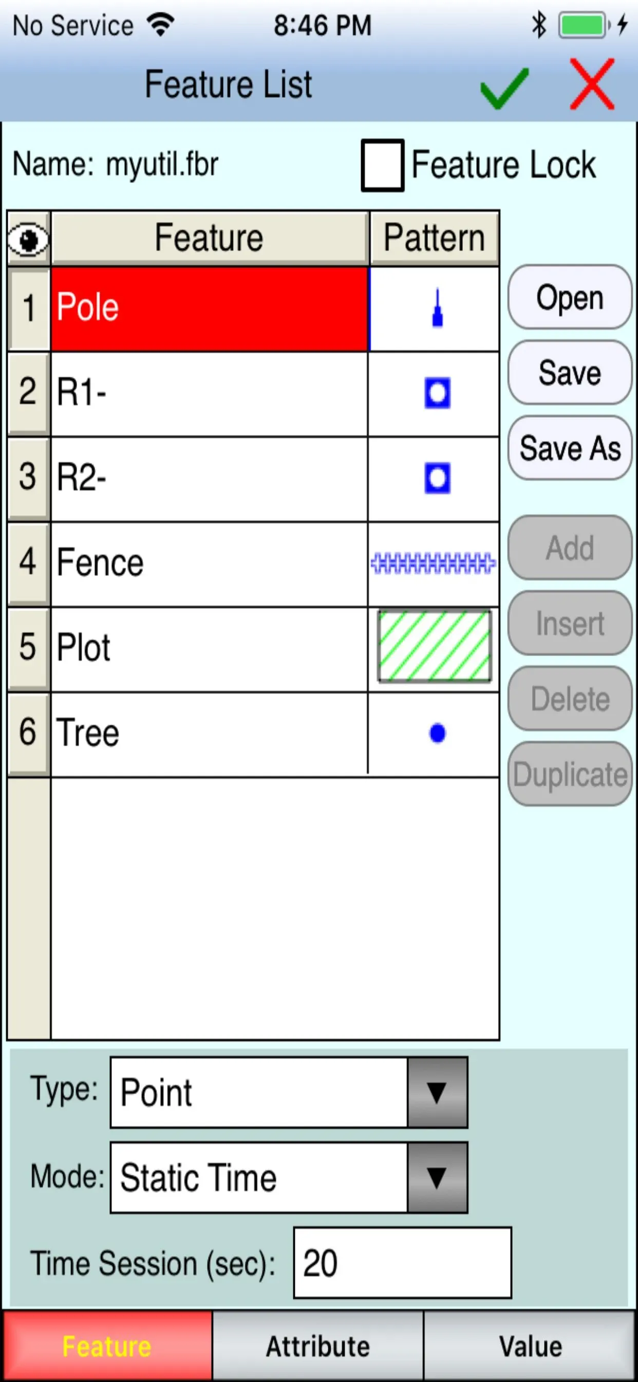
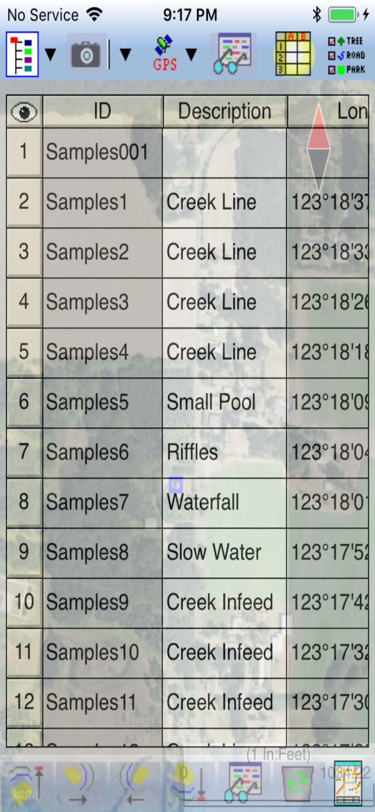
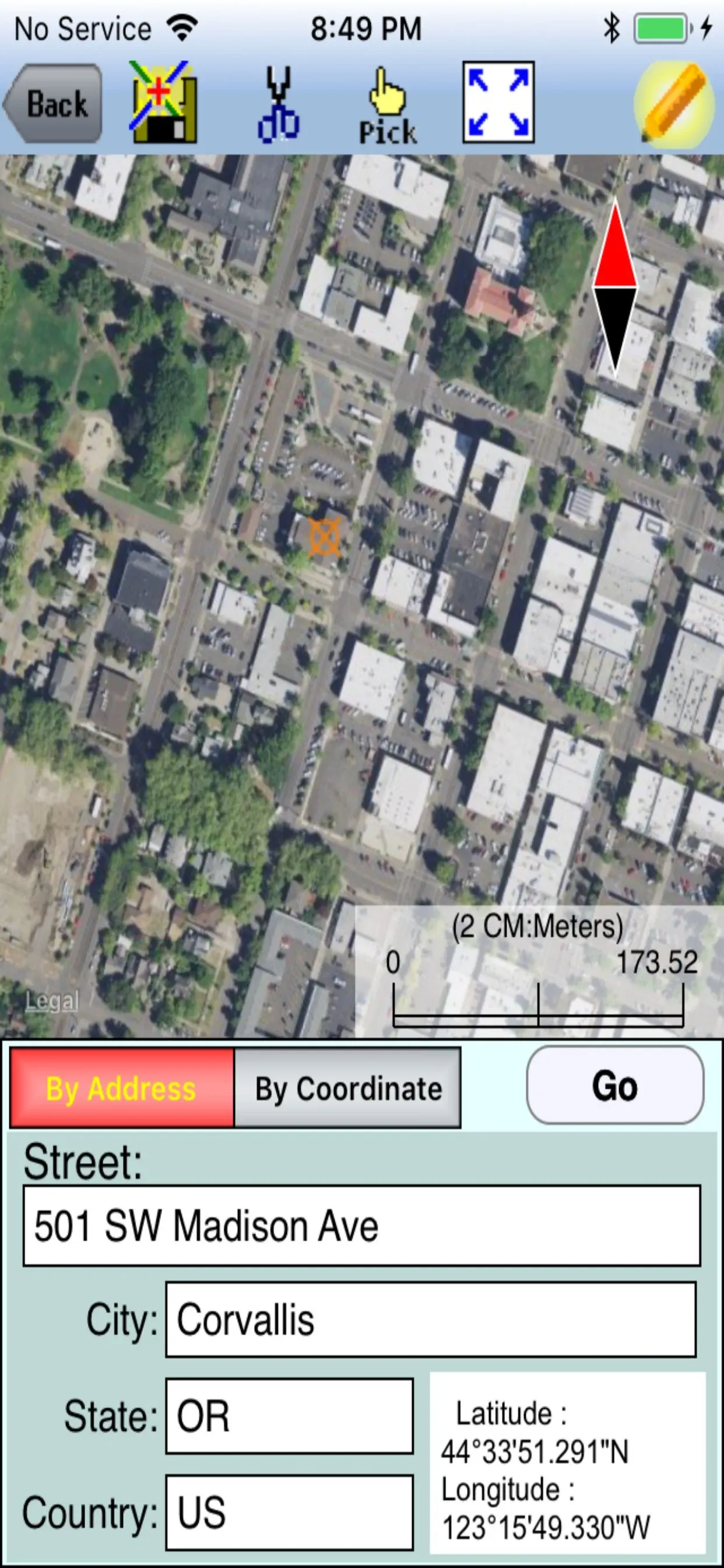
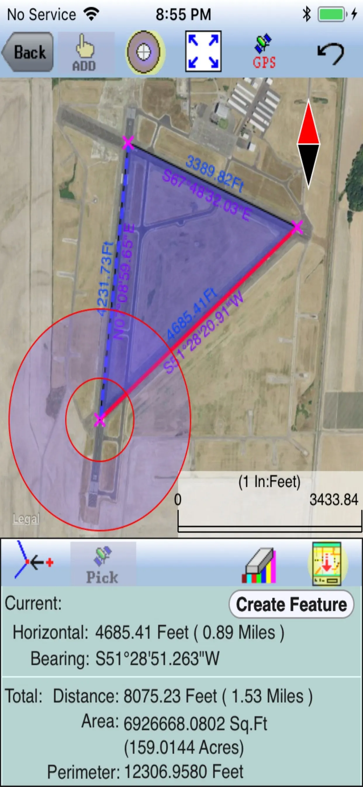
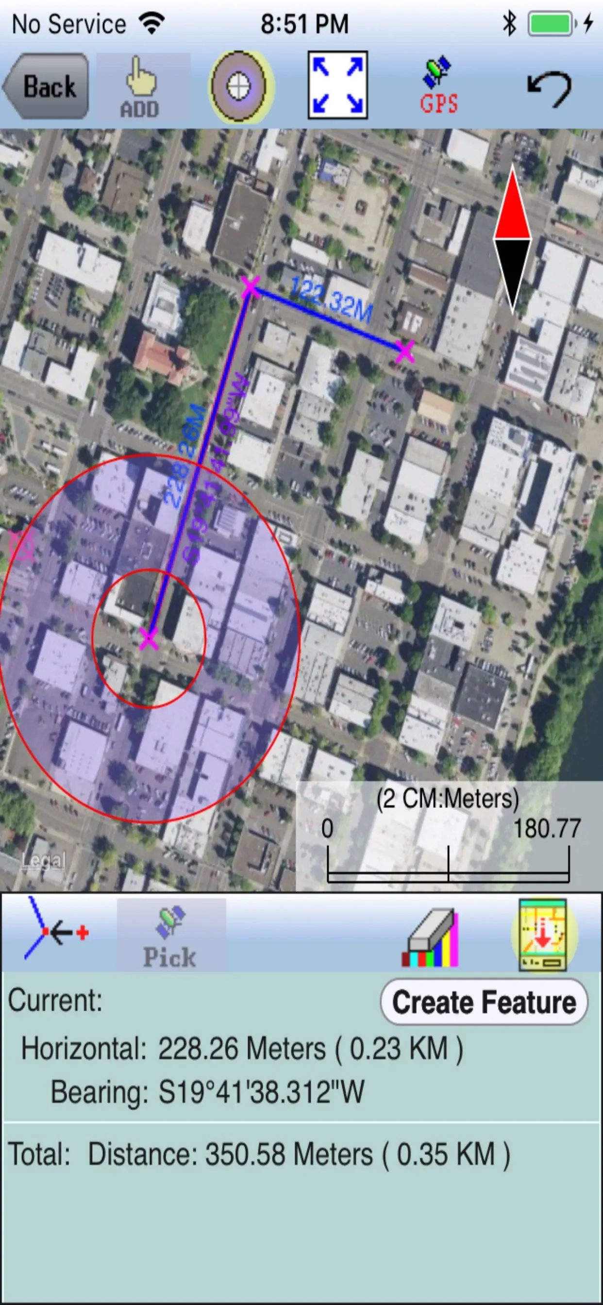
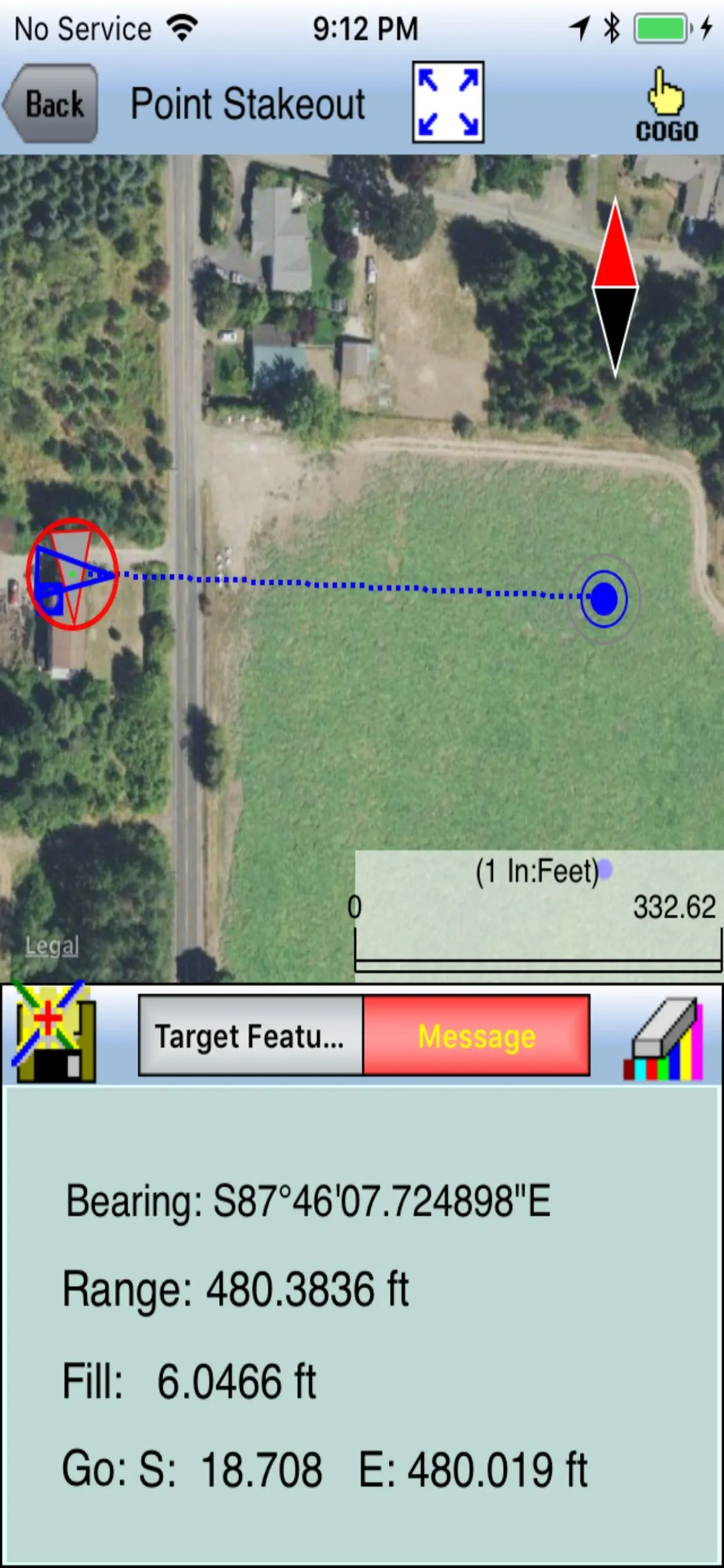
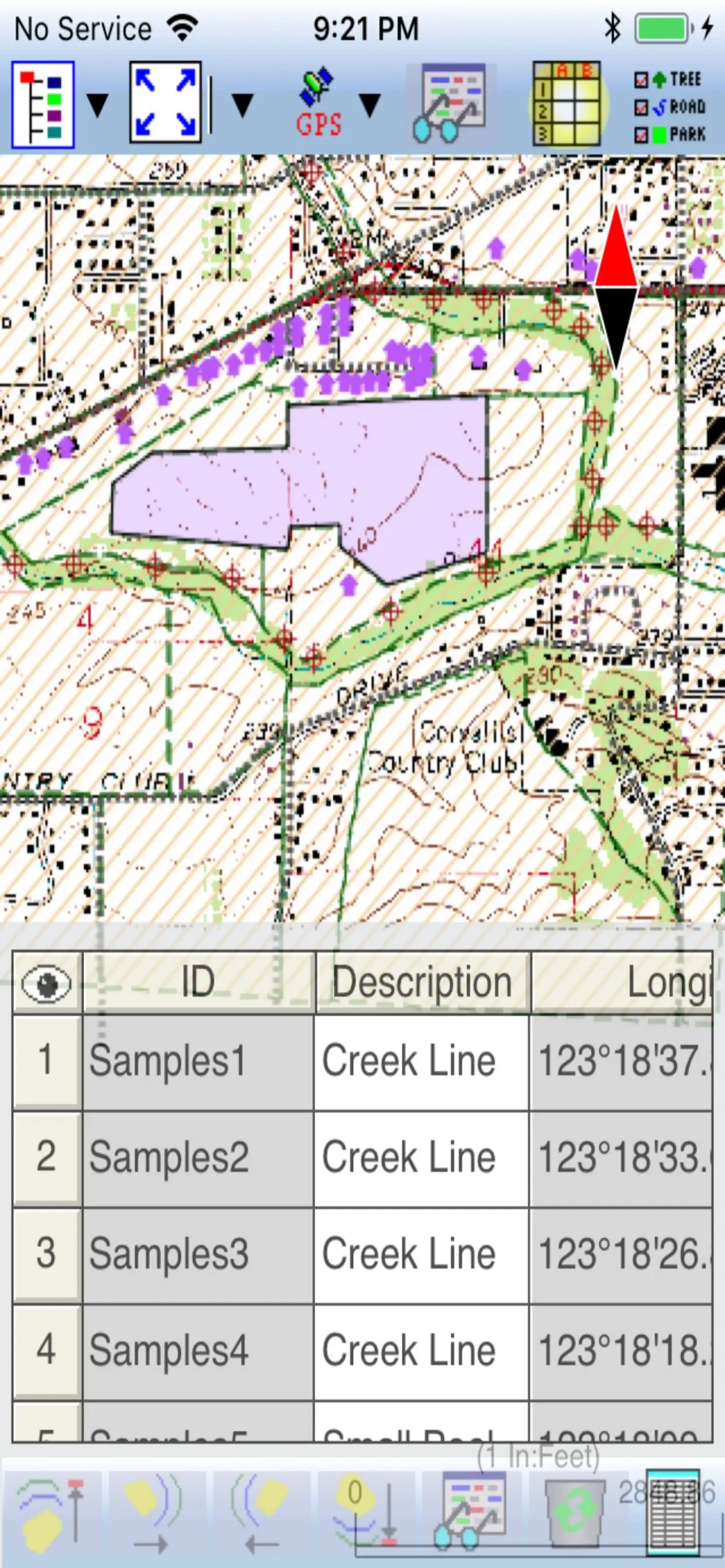
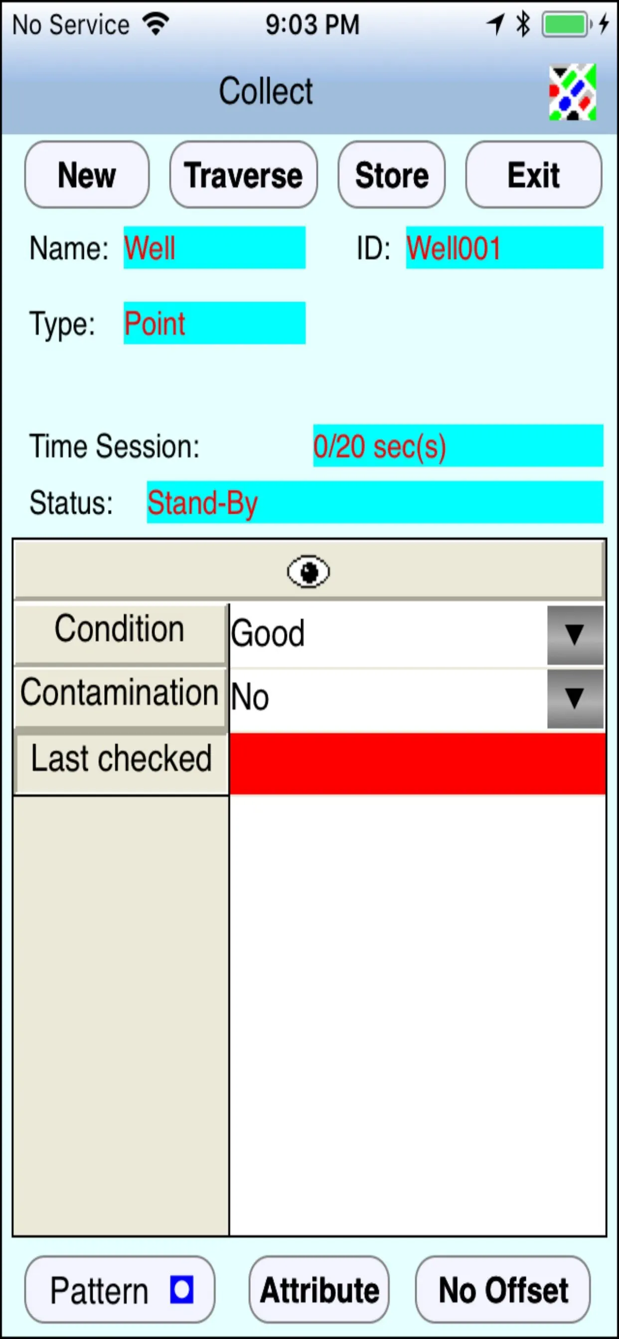
iCMTGIS III
iCMTGIS III is a professional GPS/GIS mapping app that will let you record Points, Lines and Area Features with date/time stamp and pre-defined or manually added descriptions. You could also digitize Features on top of a background map or create points by entering angles and distances. LLA, UTM, State Plane
Updated: a year ago
Released: 9 years ago


0
0 Ratings
$13.99
Navigation
Welland Canal Bridge Status
Don't get stuck waiting for a lift bridge! With this app, always know the current up-to-date bridge status.
BRIDGE STATUSES
- Available
- Raising Soon
- Raising
- Fully Raised since 7:45
- Lowering
ACTIVATE NOTIFICATIONS
When you are walking, driving or biking towards one of the bridges, the app will send you a notification of the
Updated: 4 years ago
Released: 4 years ago


4.3
648 Ratings
$8.99
Reference
FAR AIM
FAR AIM by Aviation Mobile Apps, is the finest app available for pilots who consume the US Federal Aviation Regulations and the Aeronautical Information Manual. This app is always up-to-date, synchronizes your bookmarks and highlights across all of your Apple devices and sends you an alert when regulations you care
Updated: a year ago
Released: 6 years ago


4.8
2713 Ratings
$5.99
Navigation
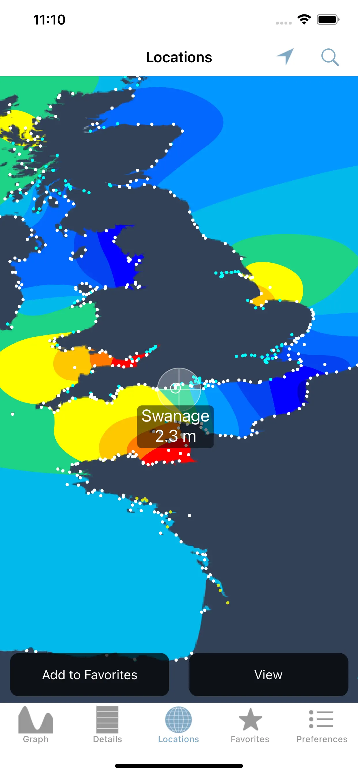
Tide Graph Pro
Tide Graph Pro universal app provides over 9000 up to date and historical US tide and water current predictions without the need for an internet connection. The scrolling design and the optimized prediction engine was developed from the ground up based on formulas and data provided by the National Oceanic
Updated: 10 months ago
Released: 11 years ago


2
4 Ratings
$5.99
Navigation
MetroView GPS Navigation
The most up to date Turn-By-Turn Navigation app for Australia and New Zealand. Comprehensive SpeedAlert with school zones that will save your license!!
Support for CarPlay.
Free regular Australia and NZ offline map updates.
Speed Alert - Licence saving national coverage for speed limits including speed, school zones and time of day.
HERE live
Updated: 8 months ago
Released: 14 years ago


5
1 Ratings
$5.99
Navigation
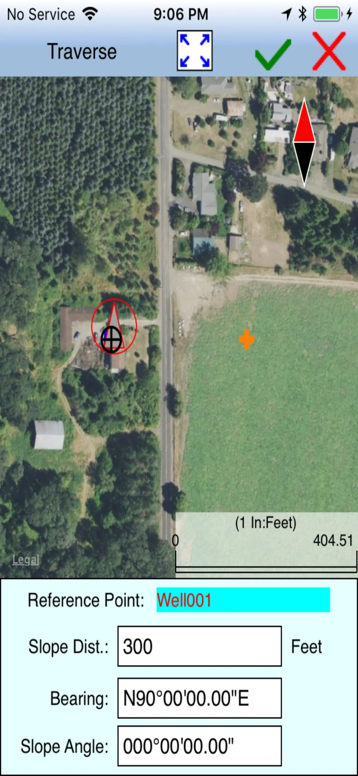
Tactical Gps. Offline Map
GPS Location Info shows your current location, date & time to the second along with a scrollable offline and online map. You can copy your coordinates & locate anything you can find on the map with accurate crosshairs.
Have a telescope that needs your coordinates & the current time? Need to
Updated: 2 years ago
Released: 4 years ago


4
1 Ratings
$5.99
Navigation
MultiEventRecorder2
【 New HUD mode!】
Add the HUD mode(Like a Head-up display) which shows driving information on fullscreen.
There is big speed meter on Center, date/time ,Battery Information , Driving Distance, Driving Time and Temprature.
You can use like HUD by keeping visible position of your device.
(This function supports iPhone5 or later)
(You cannot use
Updated: 6 years ago
Released: 9 years ago

0
0 Ratings
$5.99
Navigation
MultiEventRecorder
MultiEDR is a Event Data Recorder App that starts recording by sensing a shock and records for 1 minute both before and after a shock. It saves on speed, distance and route during driving. It is useful for checking the date and driving conditions in the event of an accident.
Updated: 4 years ago
Released: 12 years ago


0
0 Ratings
$4.99
Navigation
Lake Constance GPS Charts
MapiTech launches on the market the best official up-to-date NOAA RNC (raster) combined with S57 nautical charts (digital): marinas, wrecks, fishing spots, boat ramps, POI.
This app displays seamlessly the beauty of NOAA paper charts, a "look and feel" experience combined with S57 data.
You will be impressed how appealing the raster
Updated: 7 years ago
Released: 8 years ago

0
0 Ratings
$4.99
Navigation
Adriatic GPS Nautical Charts
MapiTech launches on the market the best official up-to-date NOAA RNC (raster) combined with S57 nautical charts (digital): marinas, wrecks, fishing spots, boat ramps, POI.
This app displays seamlessly the beauty of NOAA paper charts, a "look and feel" experience combined with S57 data.
You will be impressed how appealing the raster
Updated: 7 years ago
Released: 10 years ago

0
0 Ratings
$4.99
Navigation
Lake Geneva GPS Nautical Chart
MapiTech launches the best official up-to-date RNC rasters combined with digital S57 nautical charts: marinas, wrecks, fishing spots, boat ramps, POI.
This app displays seamlessly the beauty of paper charts, a "look and feel" experience combined with S57 data.
You will be impressed how appealing the raster charts look, how easily you
Updated: 7 years ago
Released: 9 years ago

5
1 Ratings
$4.99
Navigation
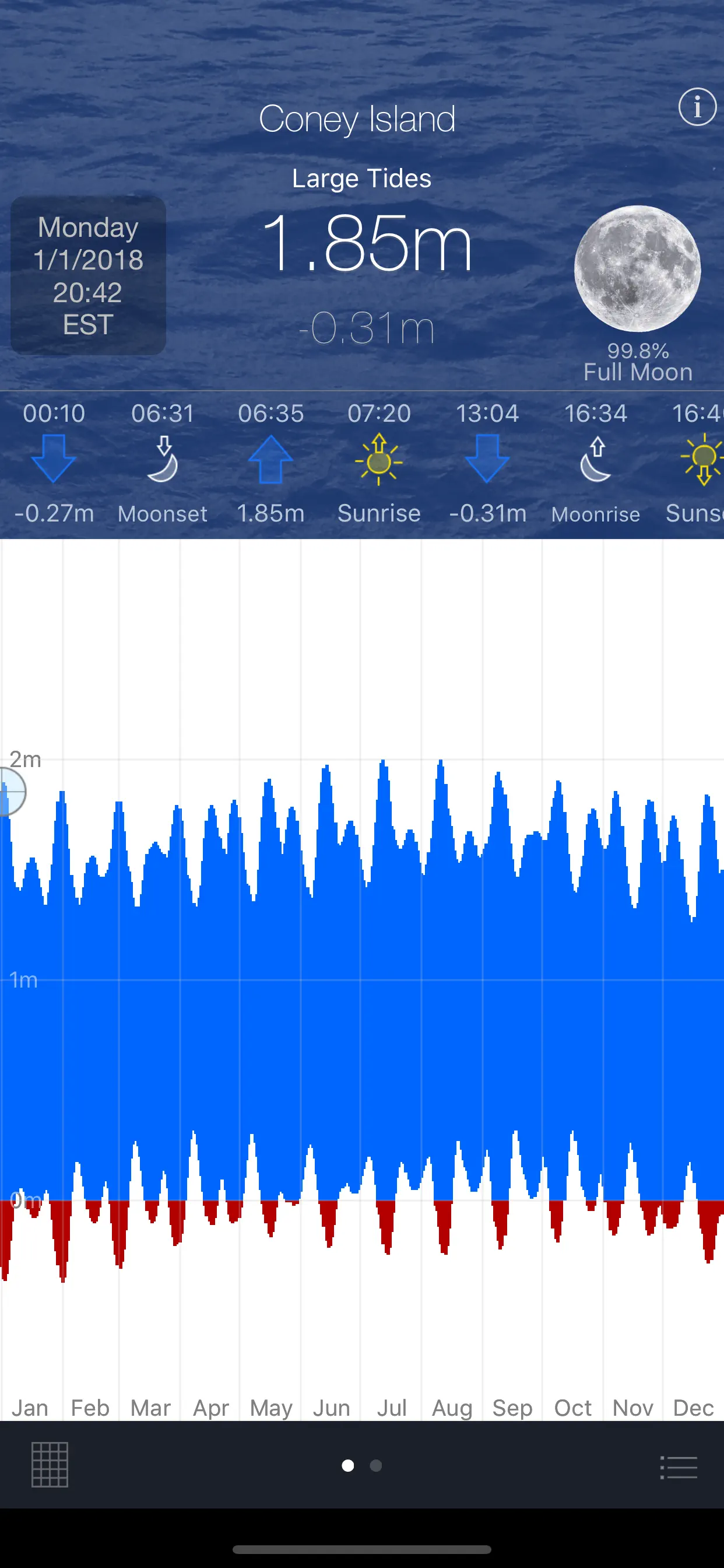
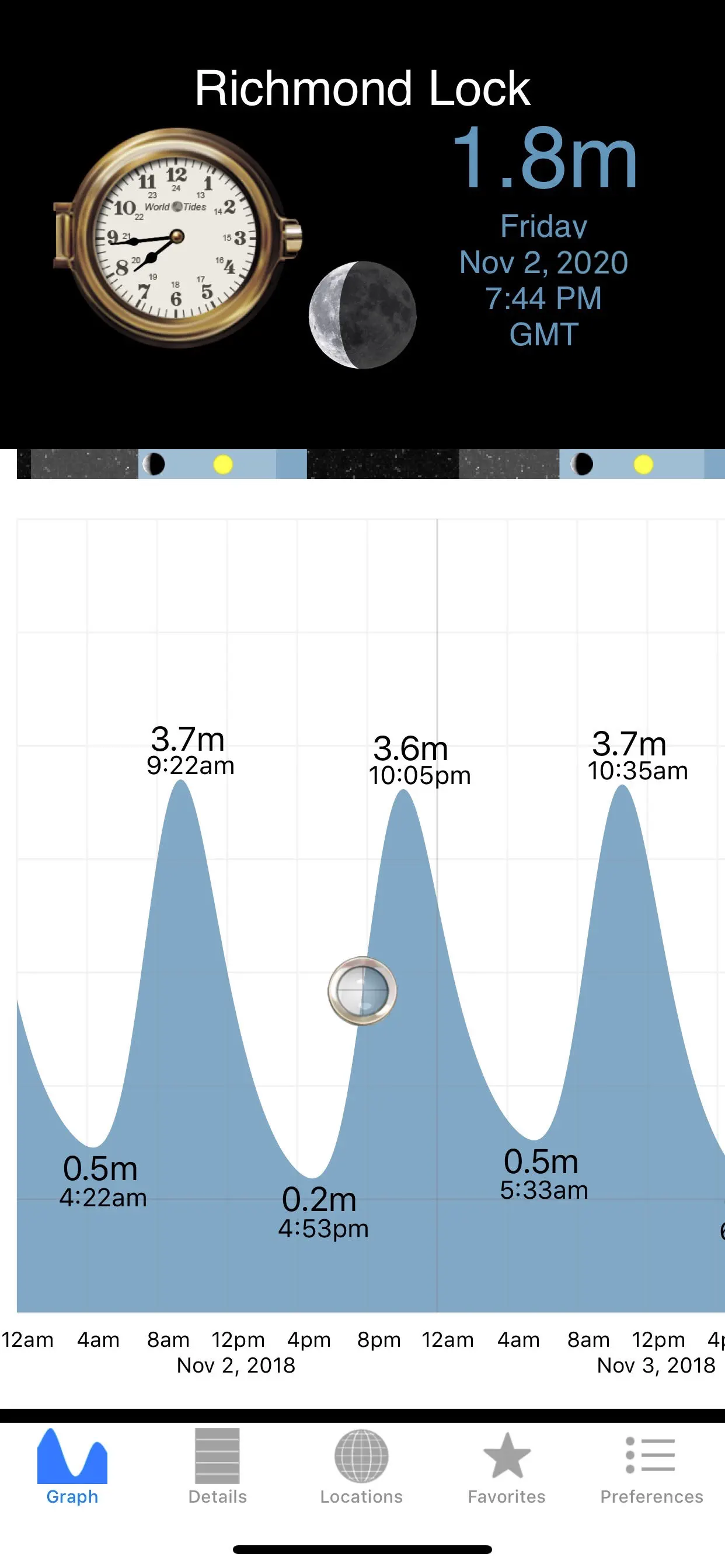
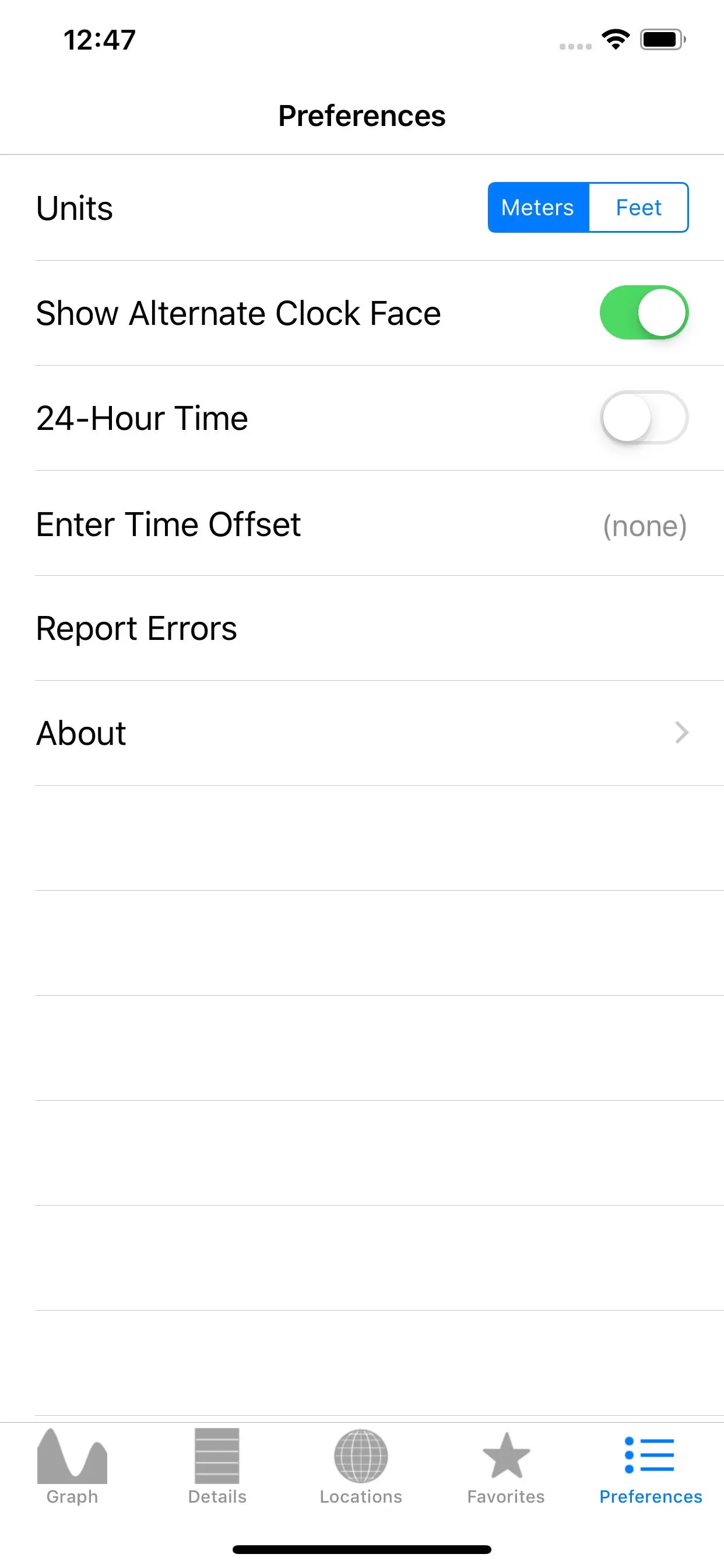
World Tides 2024
WorldTides™ for iPhone/iPad/AppleWatch delivers one year's worth of tide predictions for 8061 locations across every coastal country on the planet! You can choose any date during the year. Additionally, 867 more sites provide 7-day forecasts (today plus six more days). Furthermore, everything is built-in, including a map, so you do
Updated: 9 months ago
Released: 9 months ago


4.8
6 Ratings
$4.99
Navigation
SledNH 2024
**This purchase allows you to access up-to-date SledNH trail information for the 2023-2024 winter season. A new purchase will be required for the 2024-2025 season.**
Out exploring NH on your snowmobile? Take your own mobile trail assistant for the ride!
7,000 miles of trails in your pocket! The New Hampshire Snowmobile Association
Updated: 9 months ago
Released: a year ago


4.7
81 Ratings
$4.99
Navigation
NH SnoTraveler Trails 2023
**This purchase allows you to access up-to-date NHSA trail information for the 2022-2023 winter season. A new purchase will be required for the 2023-2024 season.**
Out exploring on your snowmobile? Take your own mobile trail assistant for the ride!
The New Hampshire Snowmobile Association (NHSA) brings an enhanced version of its web
Updated: a year ago
Released: 2 years ago


4.1
11 Ratings
$4.99
Photo & Video
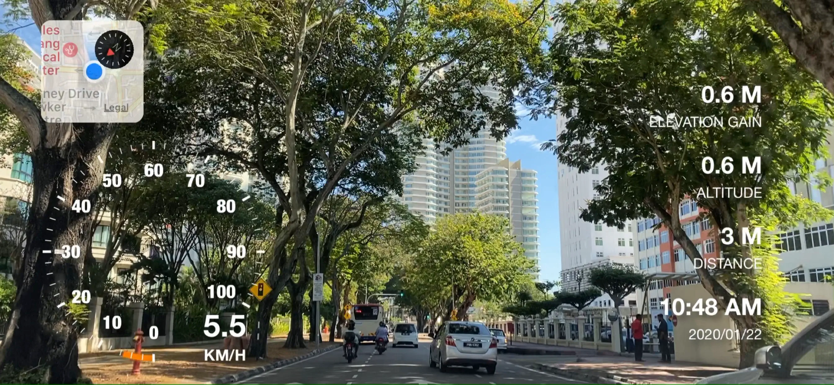
Motion Log Cam
Motion Log Cam enables you to record video with useful info embed into it. The info embeds include Location Map, Speedometer, G-Force indicator, Time, Date, Distance, Altitude and Elevation Gain.
Motion Log Cam includes Standard Camera Features:
• Pinch to Zoom.
• Rear Camera with Auto Exposure/Focus mode.
• Support both Landscape or
Updated: a year ago
Released: 5 years ago


0
0 Ratings
$4.99
Navigation
Lake Neuchatel Morat Biel Gps
MapiTech launches on the market the best official up-to-date NOAA RNC (raster) combined with S57 nautical charts (digital): marinas, wrecks, fishing spots, boat ramps, POI.
This app displays seamlessly the beauty of NOAA paper charts, a "look and feel" experience combined with S57 data.
You will be impressed how appealing the raster
Updated: 7 years ago
Released: 8 years ago

1.3
13 Ratings
$4.99
Navigation
Lake Winnipesaukee offline chart for boaters
***Seawell launches series of Lakes and Parks on to the market with up-to-date maps along with fishing spots and aerial images. For people who are looking for appealing charts, features like seamless scrolling, comprehensive coverage with good chart view management, track recording and safety feature (MOB), Seawell marine navigation
Updated: 7 years ago
Released: 7 years ago

4
3 Ratings
$4.99
Navigation
FlightService
Schedule weather notifications to pushed to you whenever you want. Just select an airpot and a delivery date/time and Flight Service will deliver via a push notification that airport’s up-to-date METAR. Amazing.
FlightService provides an easy and convenient way to look-up Airport and Navigation Aid information from around the world.
FlightService
Updated: 2 years ago
Released: 15 years ago


