Category:

4.9
53 Ratings
$399.99
Navigation
SEAiq Pilot VPP
SEAiq Pilot VPP is designed especially for use by river, channel, and harbor pilots. It includes support for displaying charts in the S-57, S-63, iENC, and BSB/KAP formats and use of external NMEA/AIS over WiFi.
IMPORTANT: you can try all the features in SEAiq Pilot VPP by downloading our other app,
Updated: 2 years ago
Released: 11 years ago


4.9
7 Ratings
$299.99
Navigation
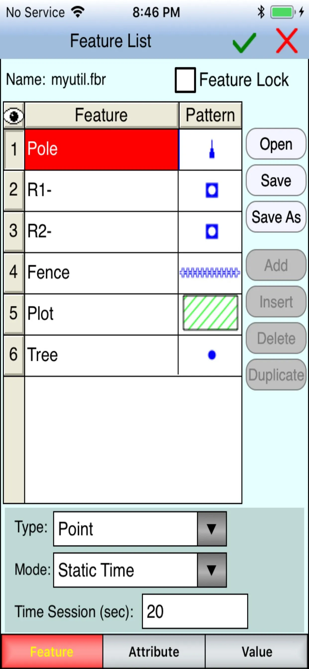
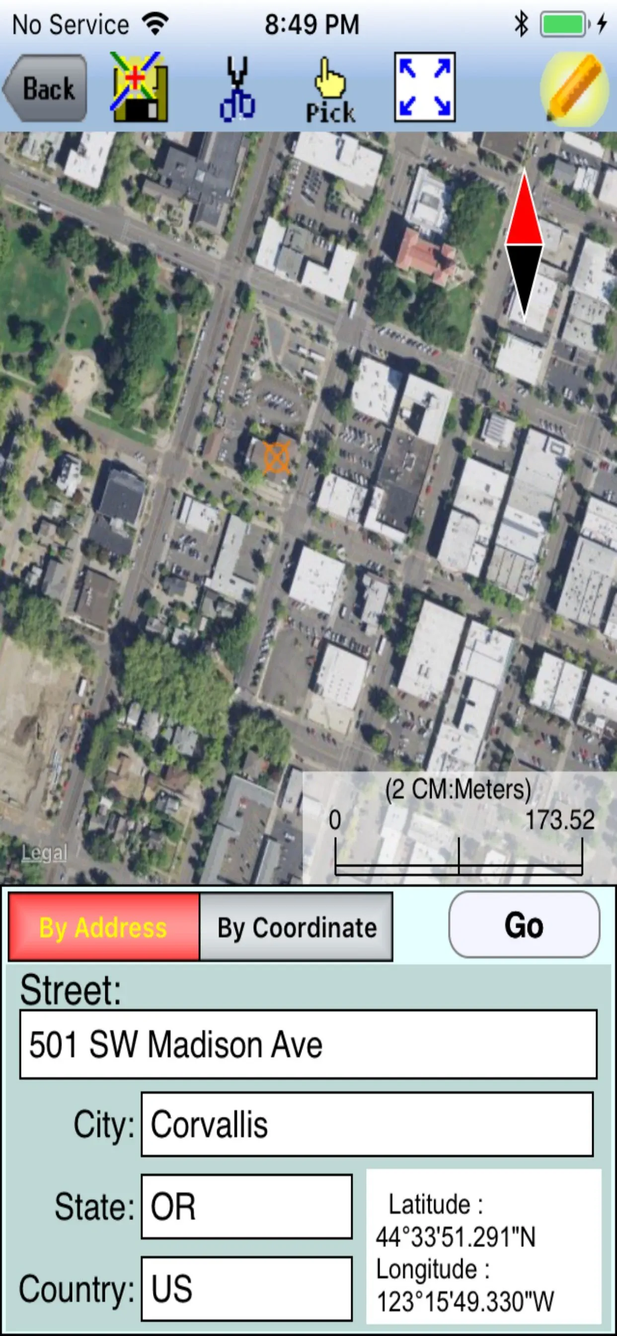
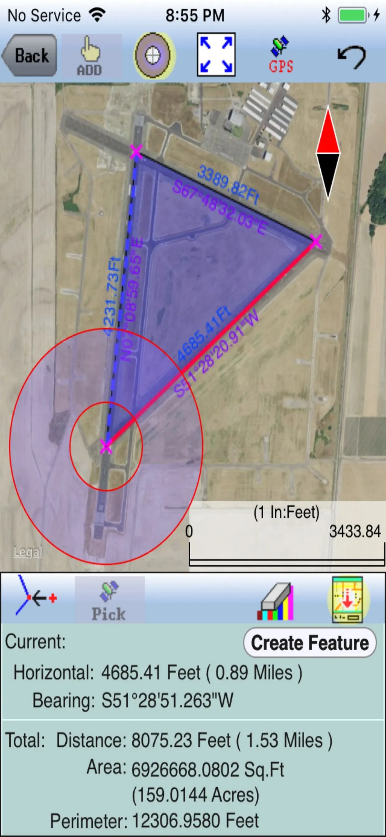
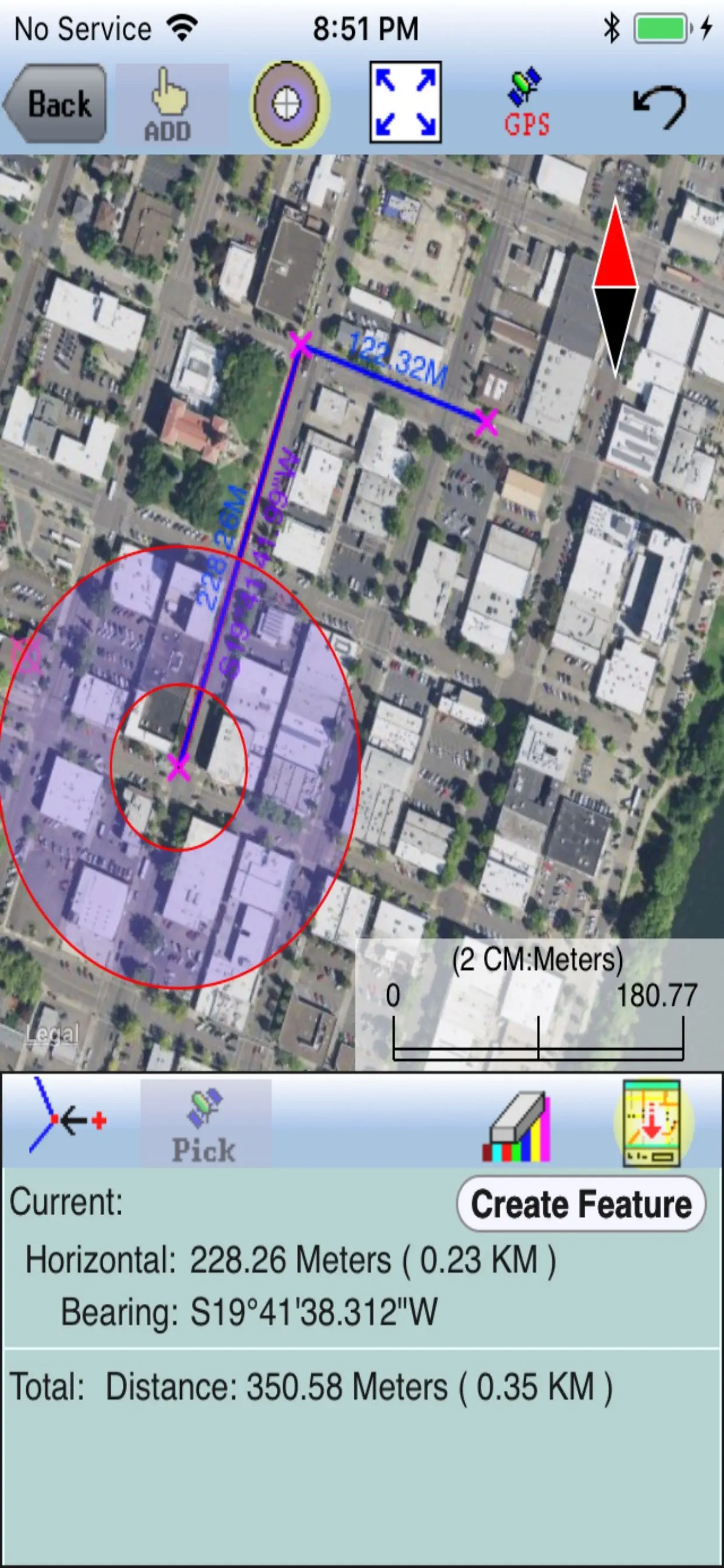
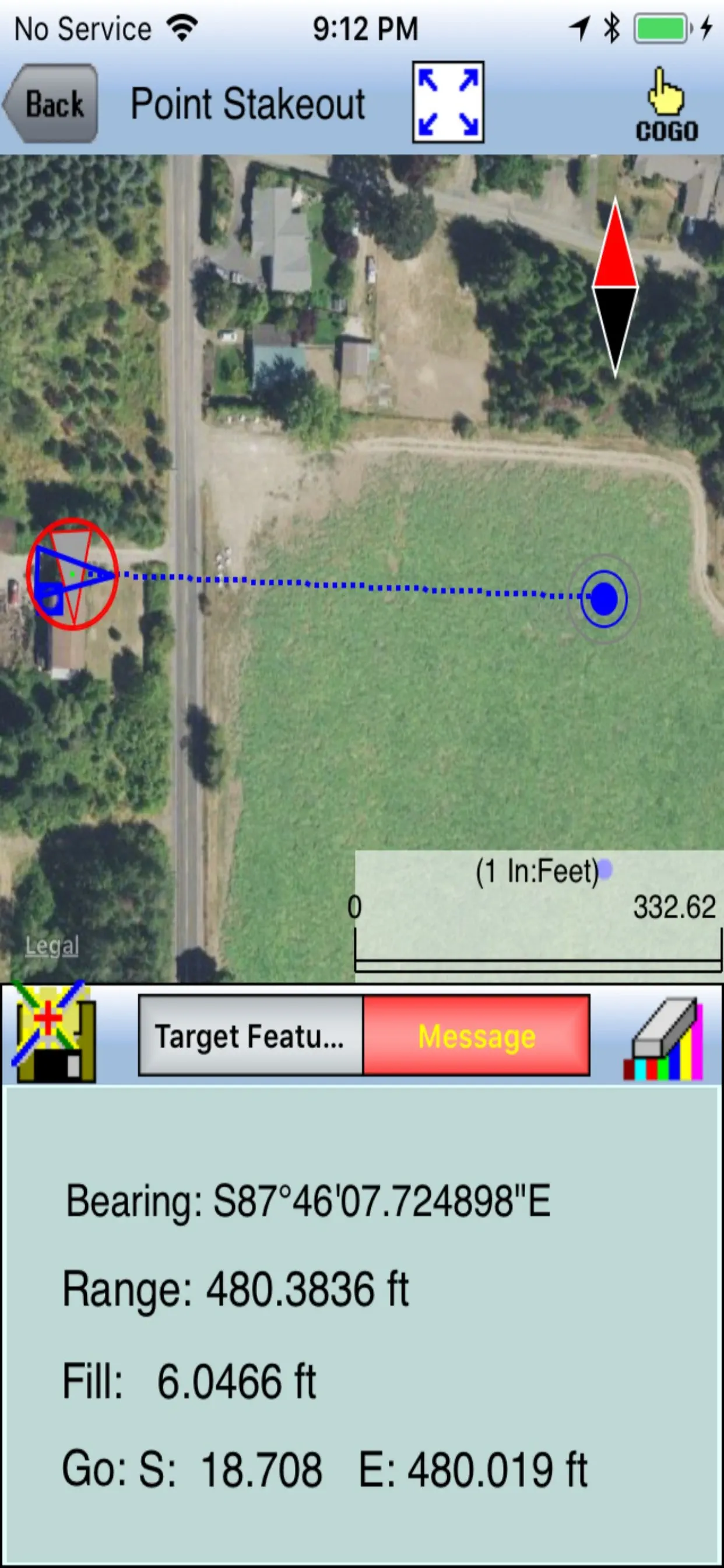
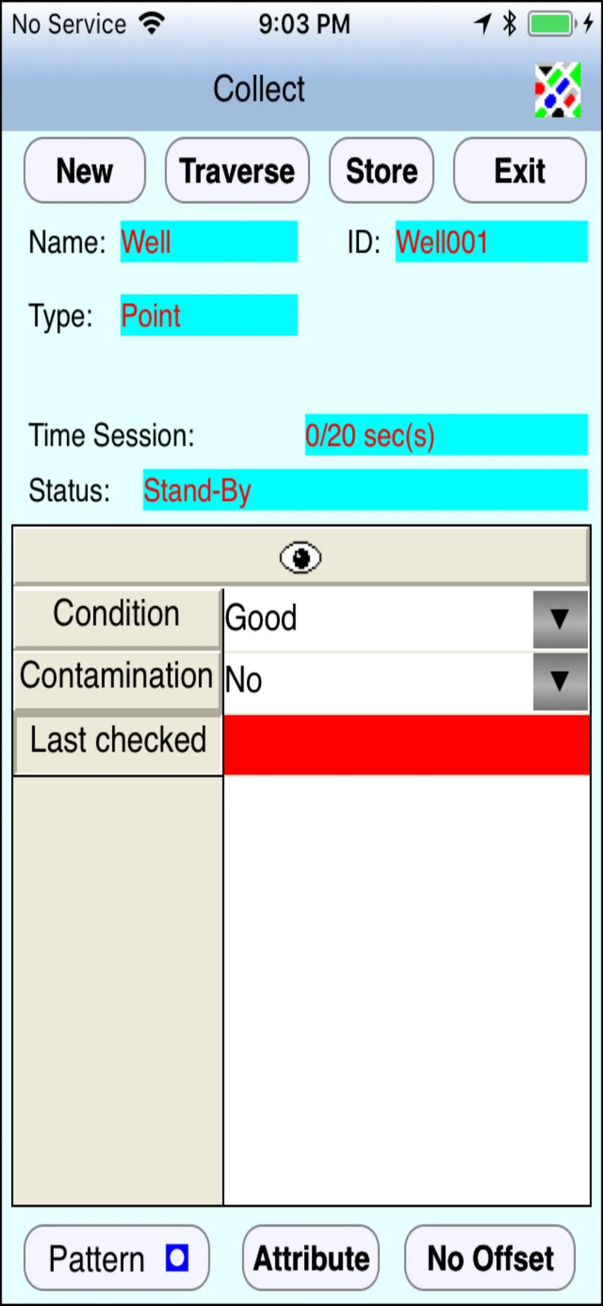
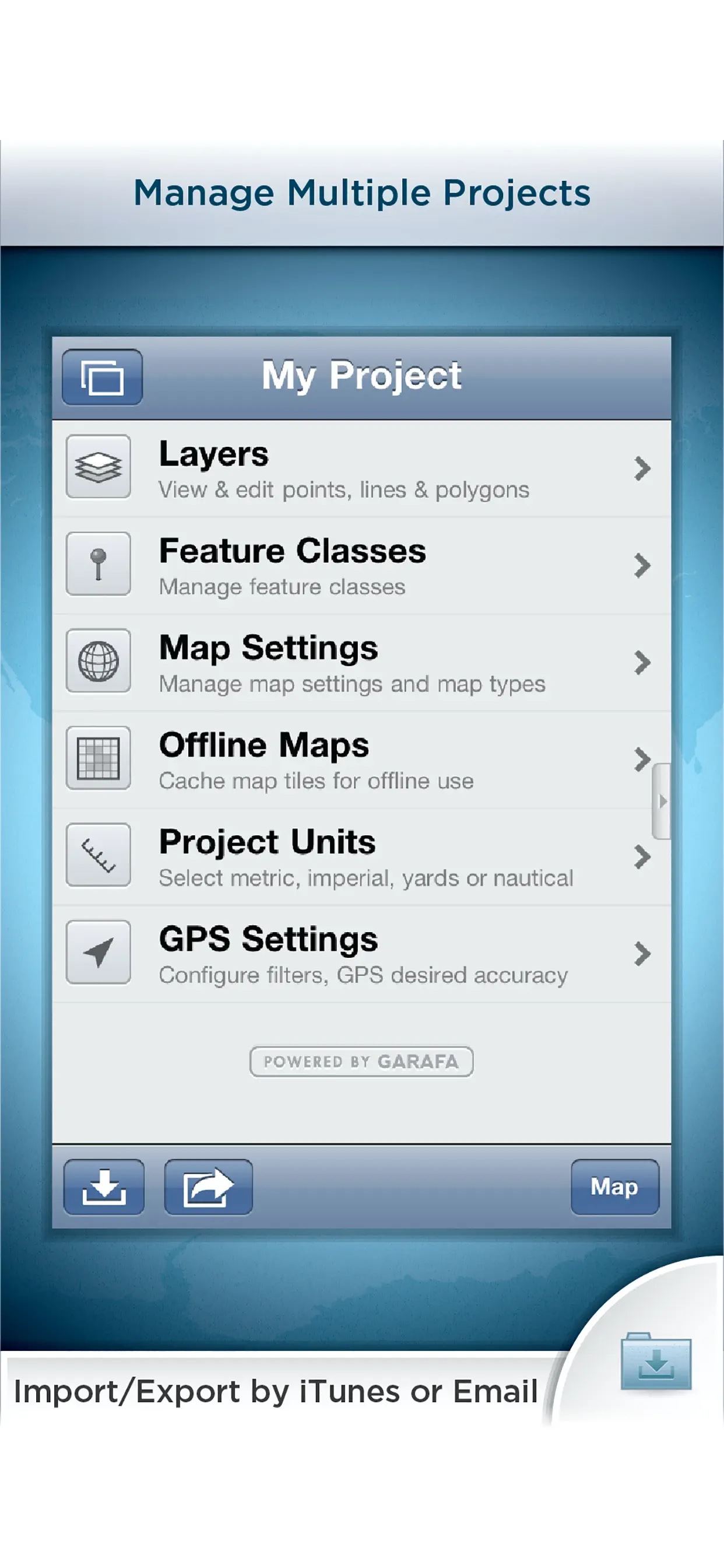
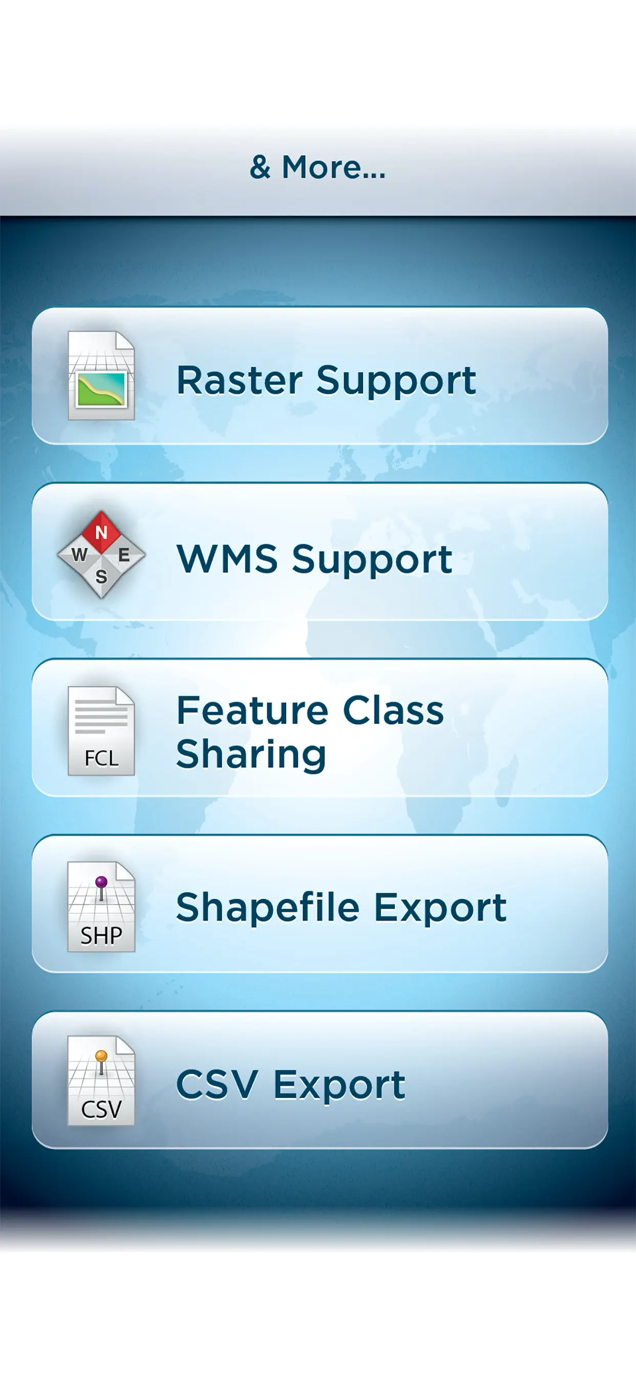
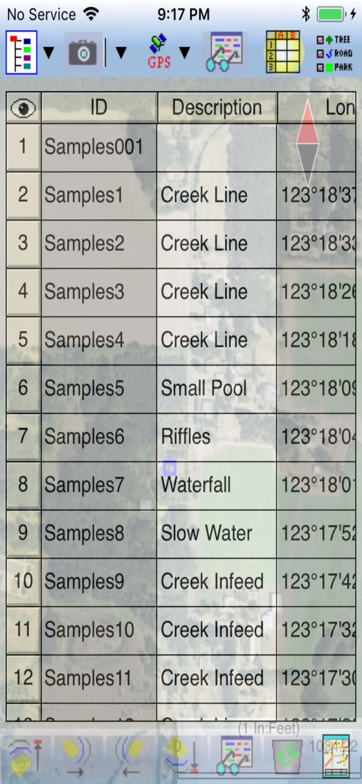
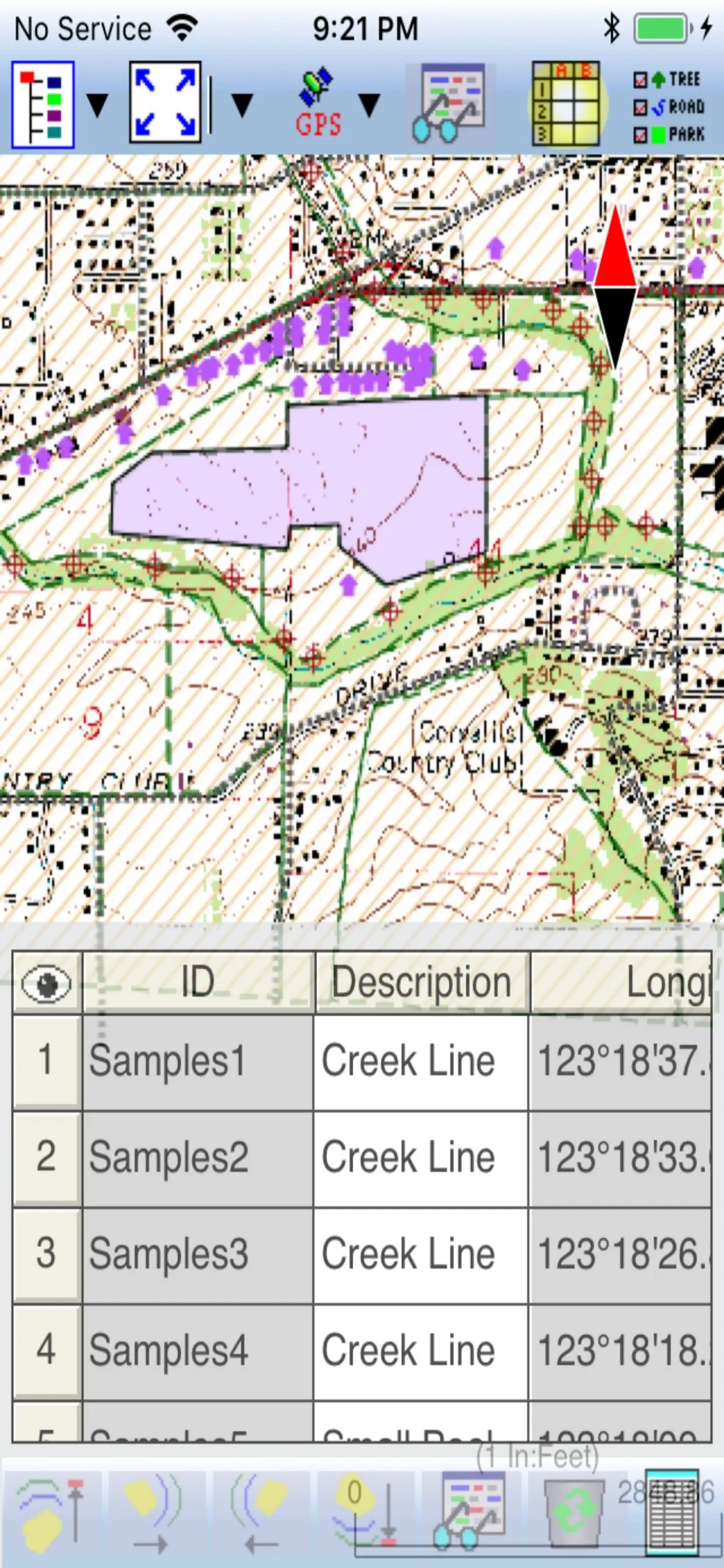
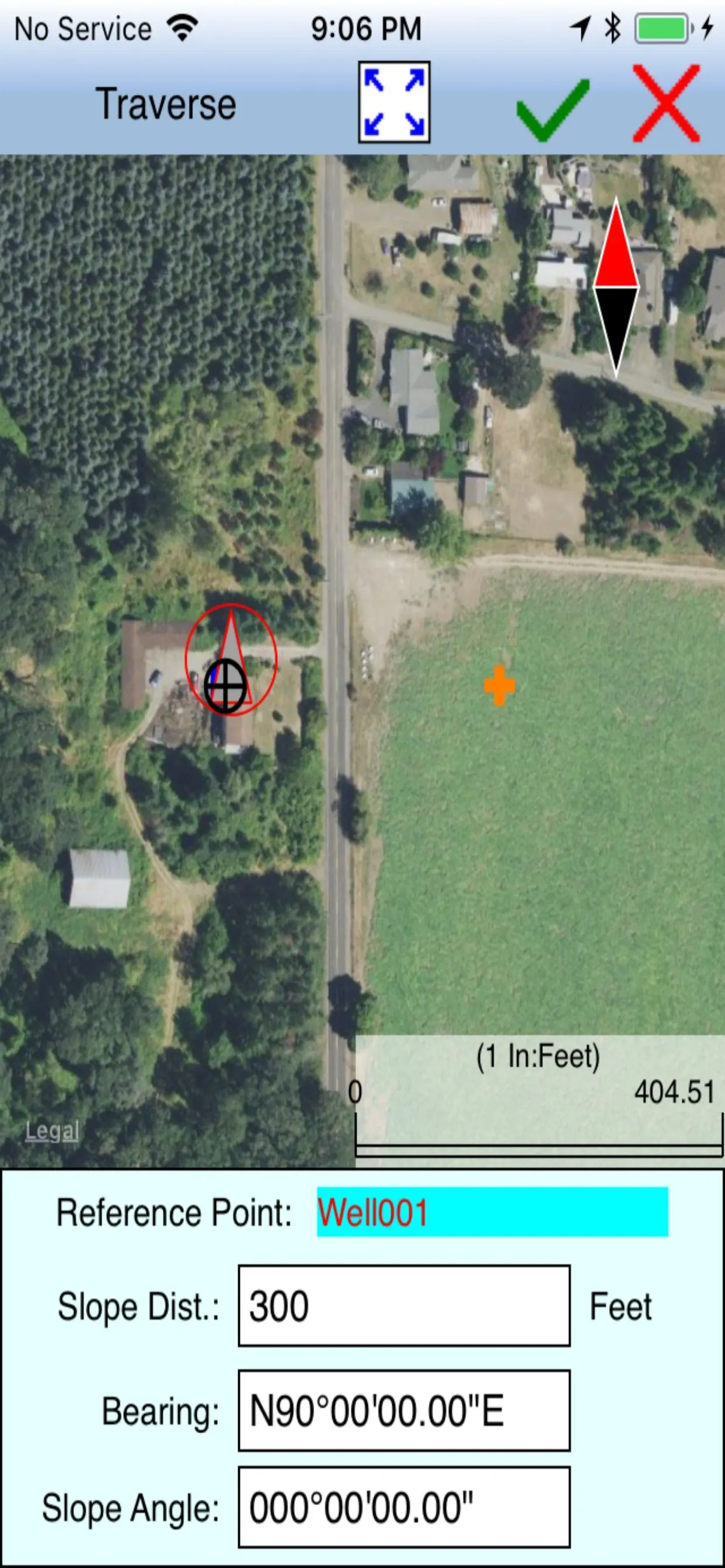
iCMTGIS PRO
iCMTGIS PRO is a professional GPS/GIS mapping, data collection and stakeout app for use on the iPad and iPhone devices. It can be used to effectively collect data and increase productivity for utilities, wildlife, natural resources, land management, surveying, soil study, archaeology, drone control points and other land-based or air-borne
Updated: a year ago
Released: 10 years ago


3.3
7 Ratings
$299.99
Navigation
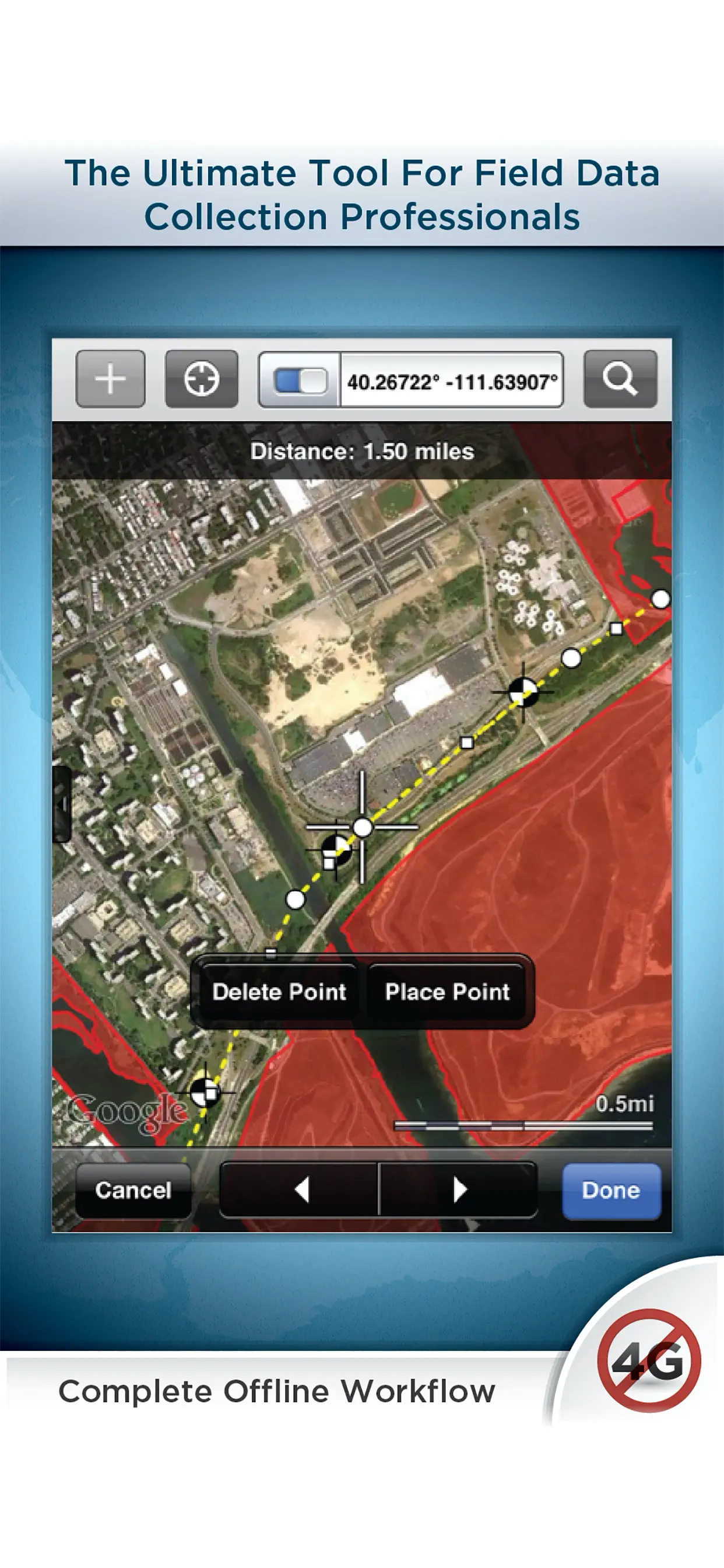
GIS Pro
Premier field collection and data viewer for iPhone and iPad.
GIS Pro is the enterprise version of a two part app suite for mobile GIS users. GIS Kit ($99) is geared toward individual users whereas GIS Pro ($299) is capable of some more advanced, collaborative features that are typical of an
Updated: 5 years ago
Released: 13 years ago
0
0 Ratings
$219.99
Navigation
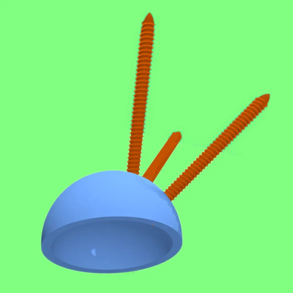
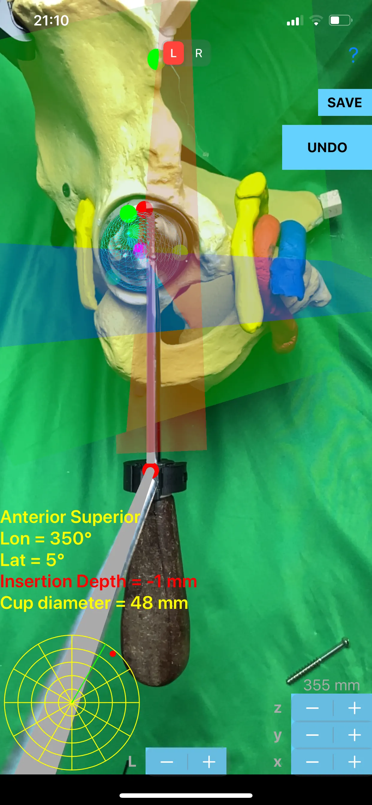
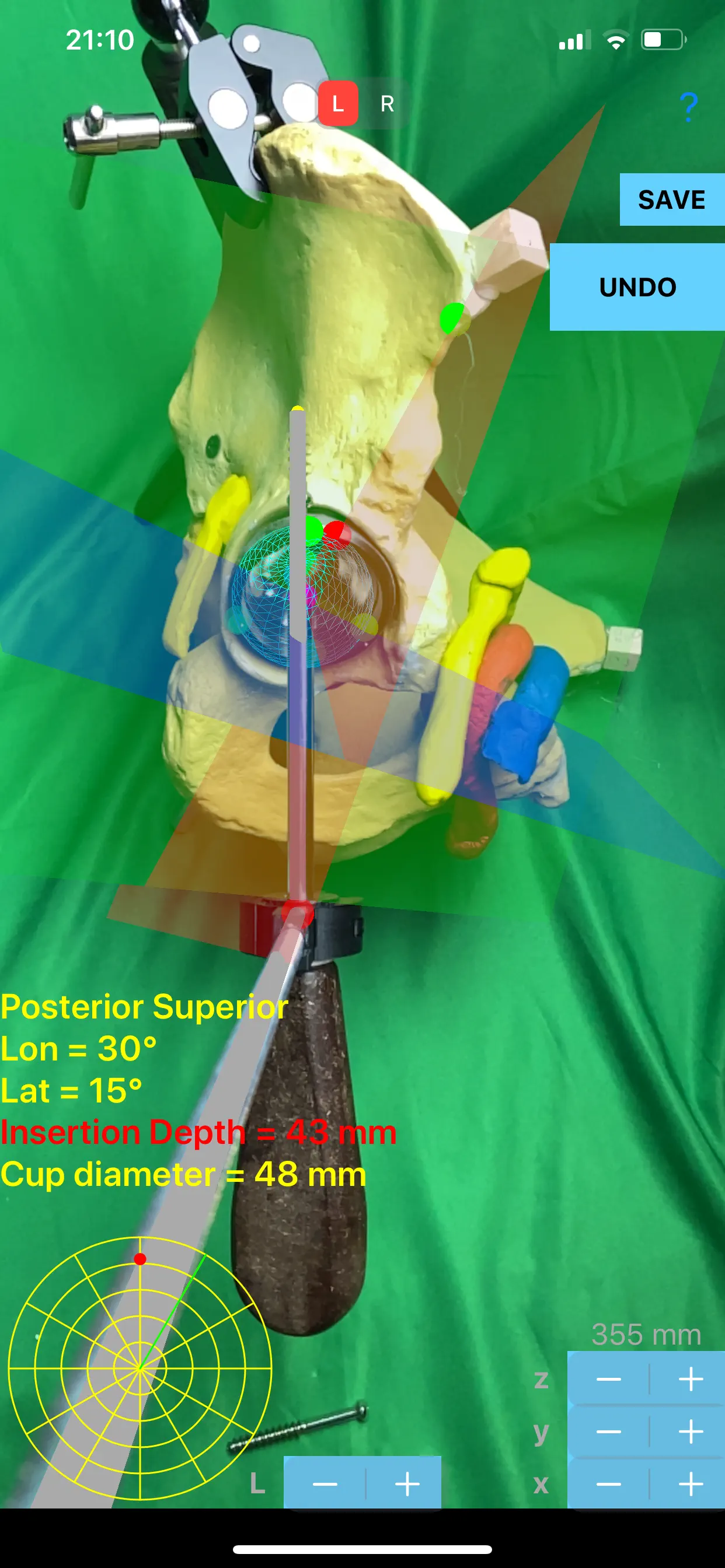
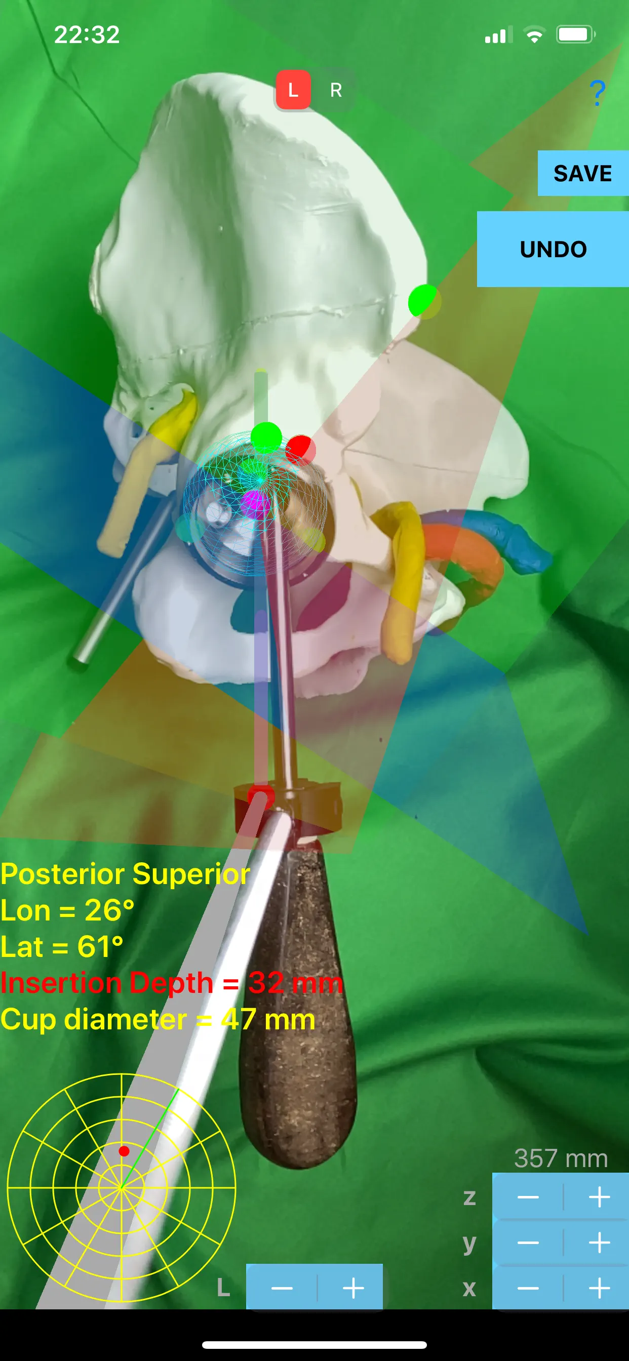
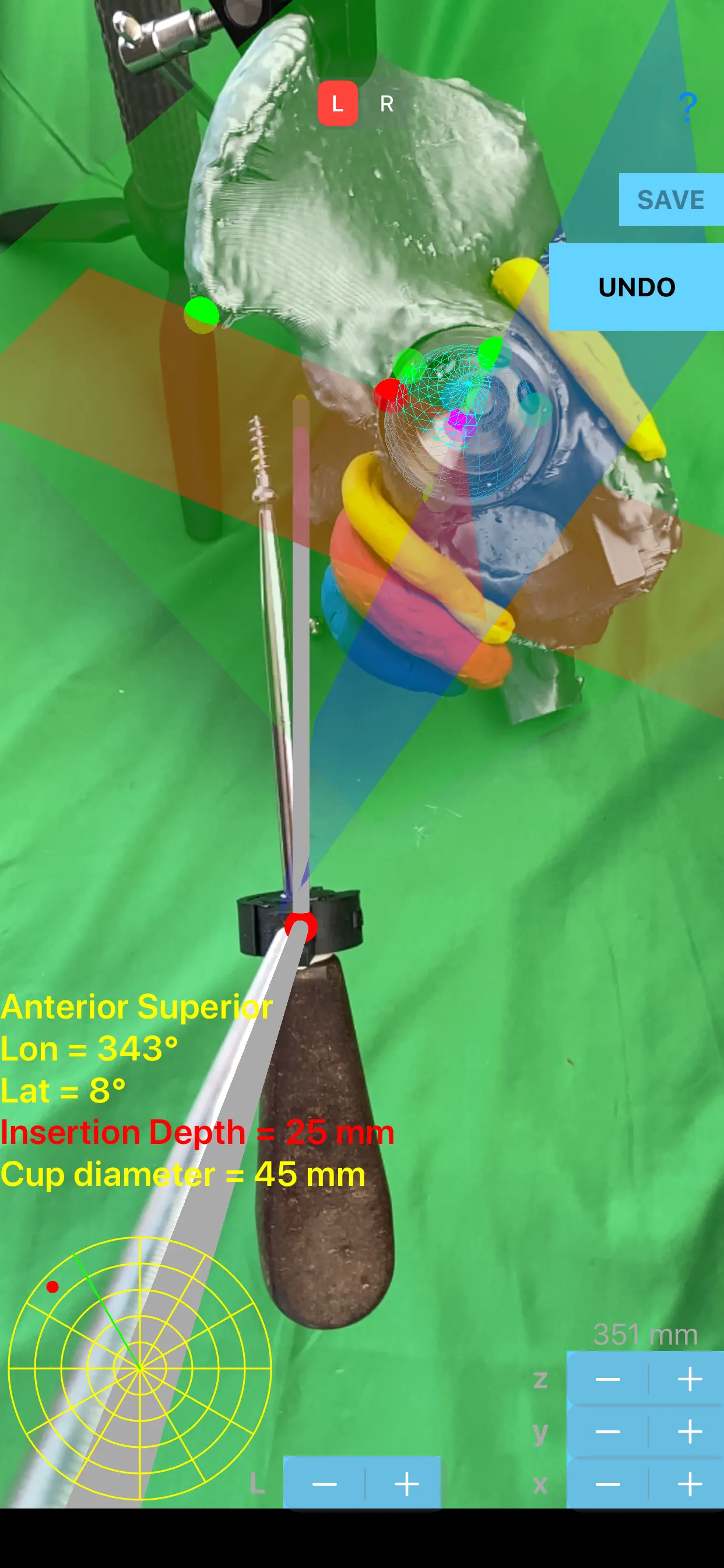
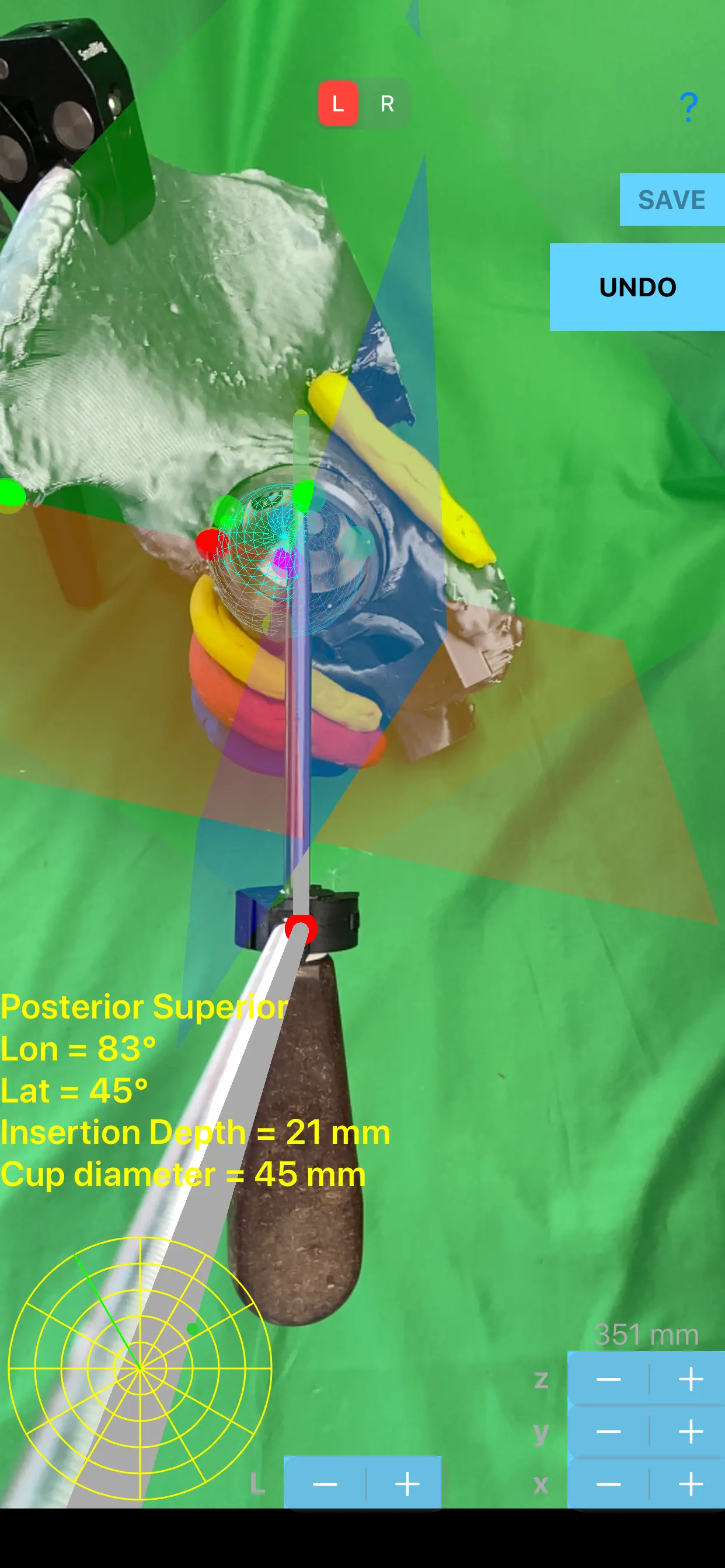
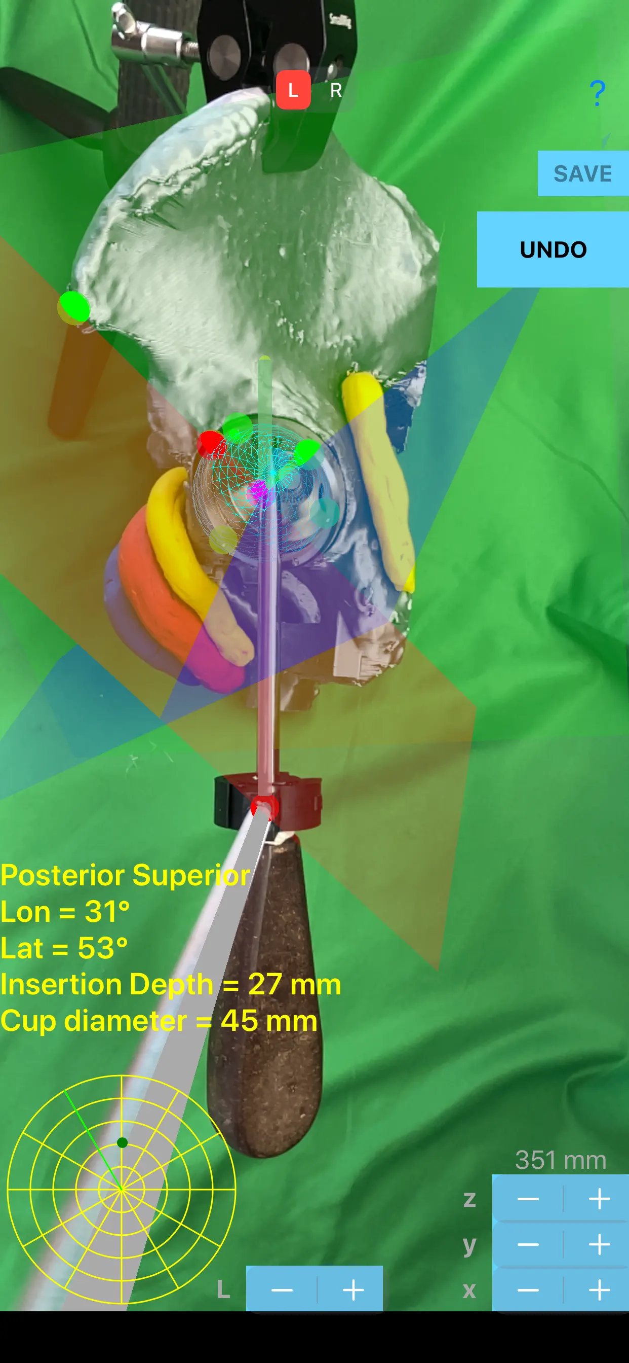
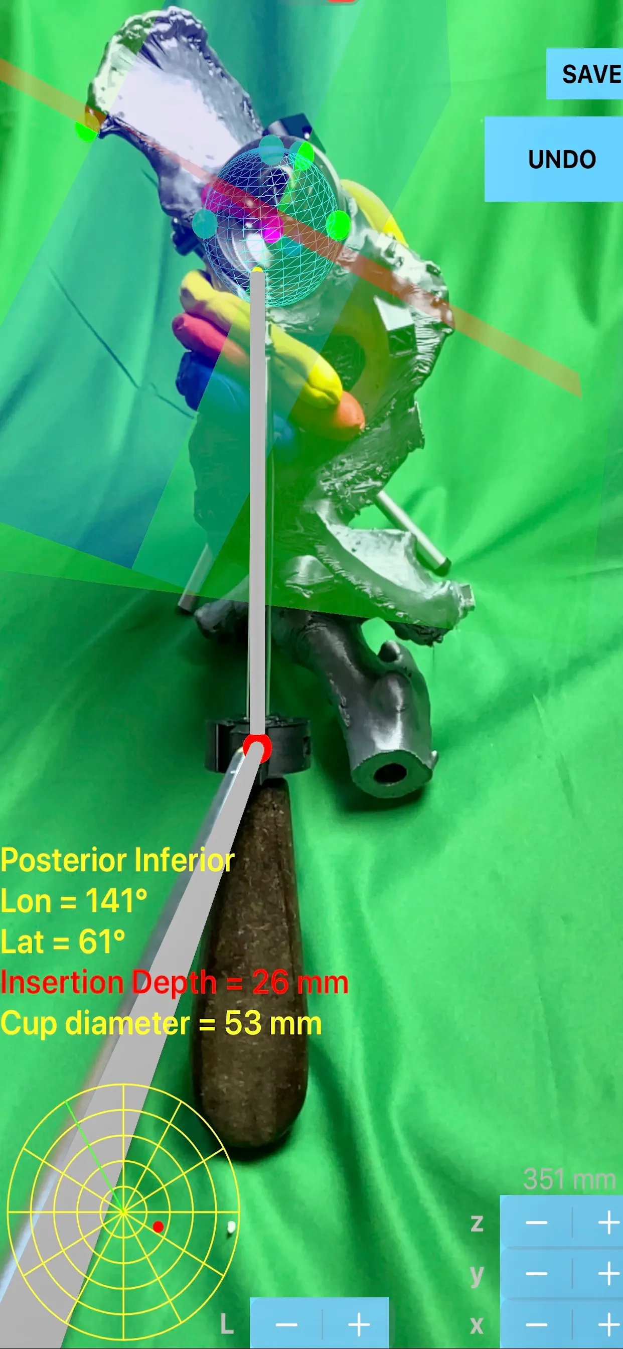
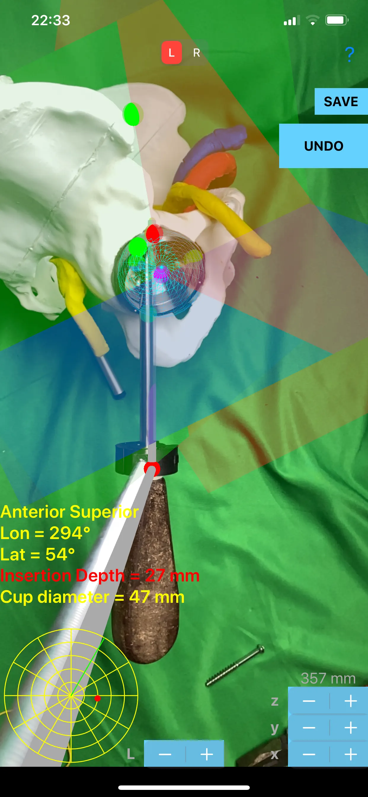
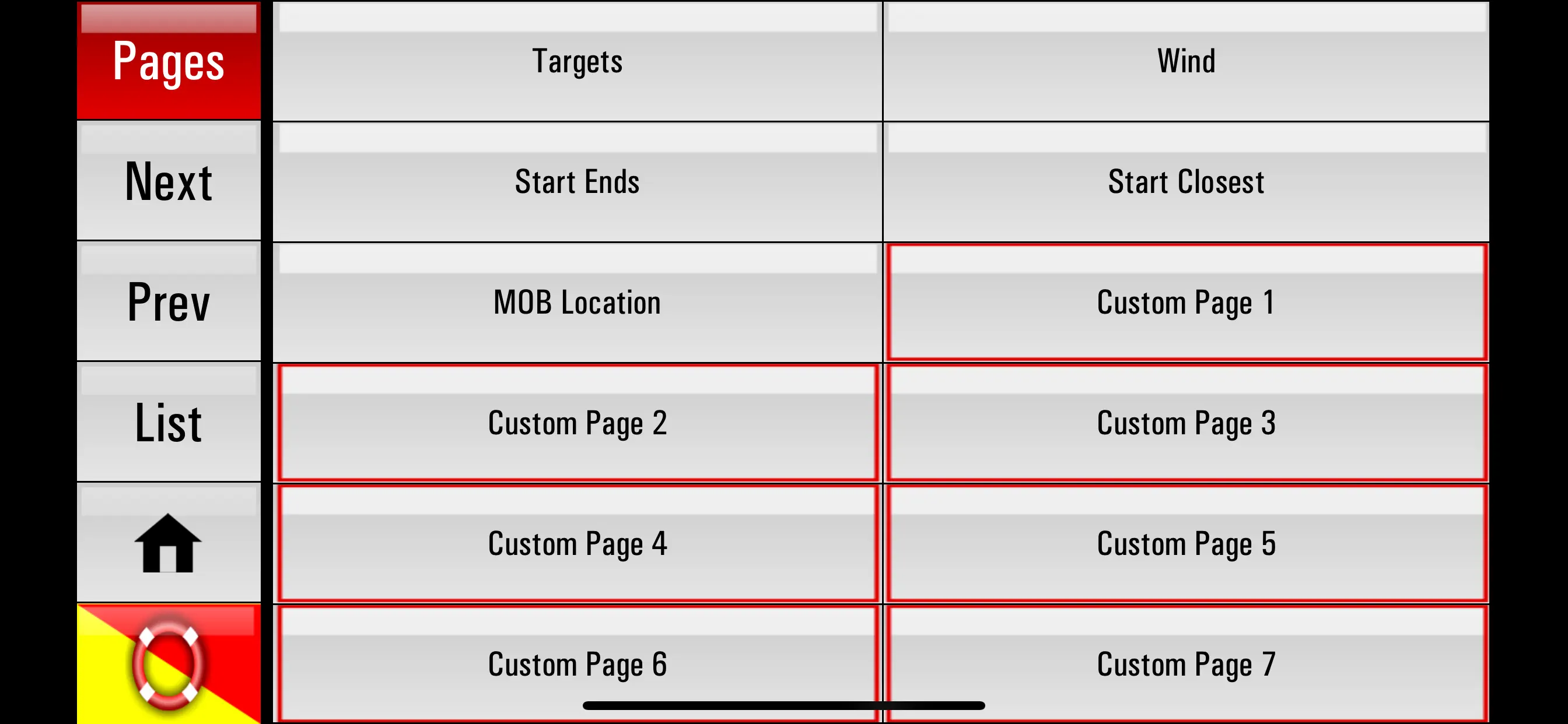
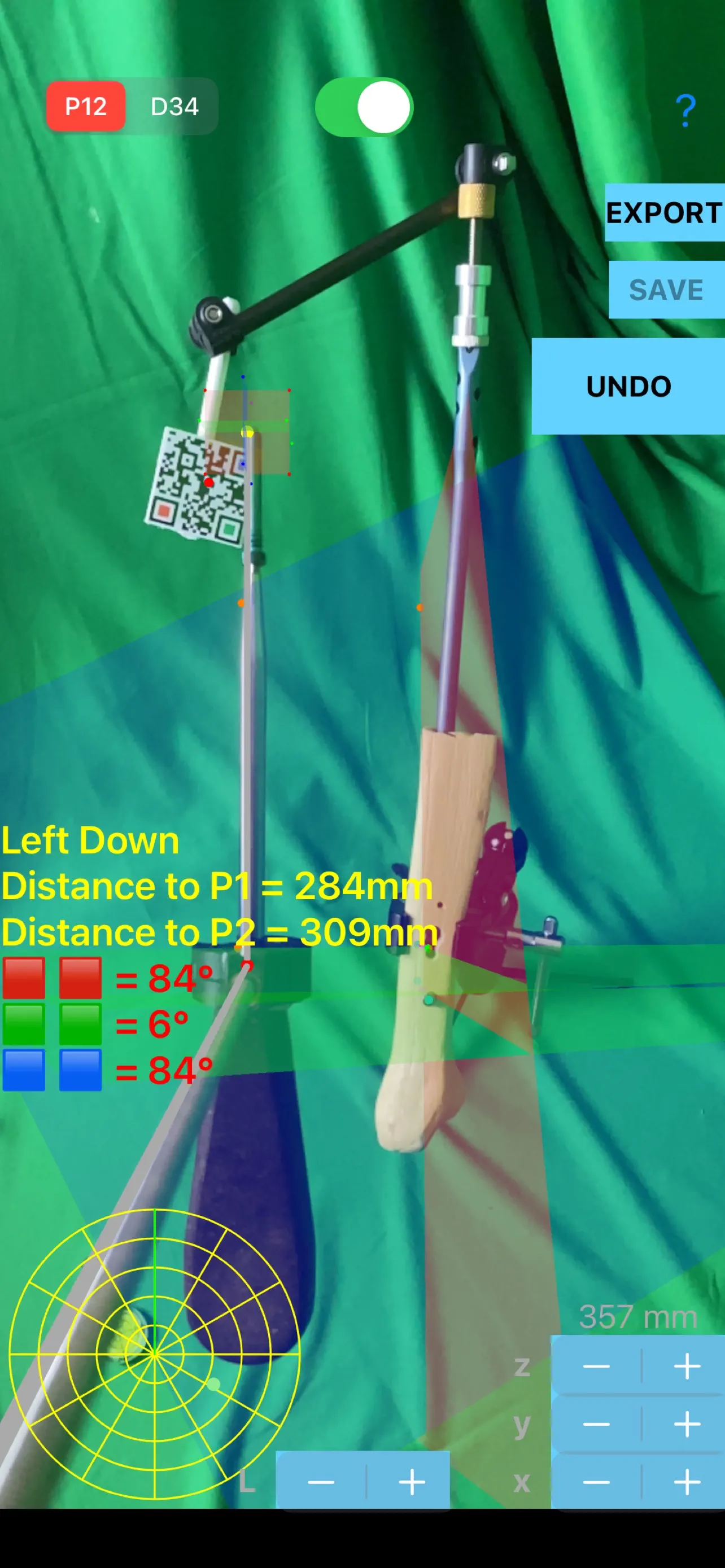
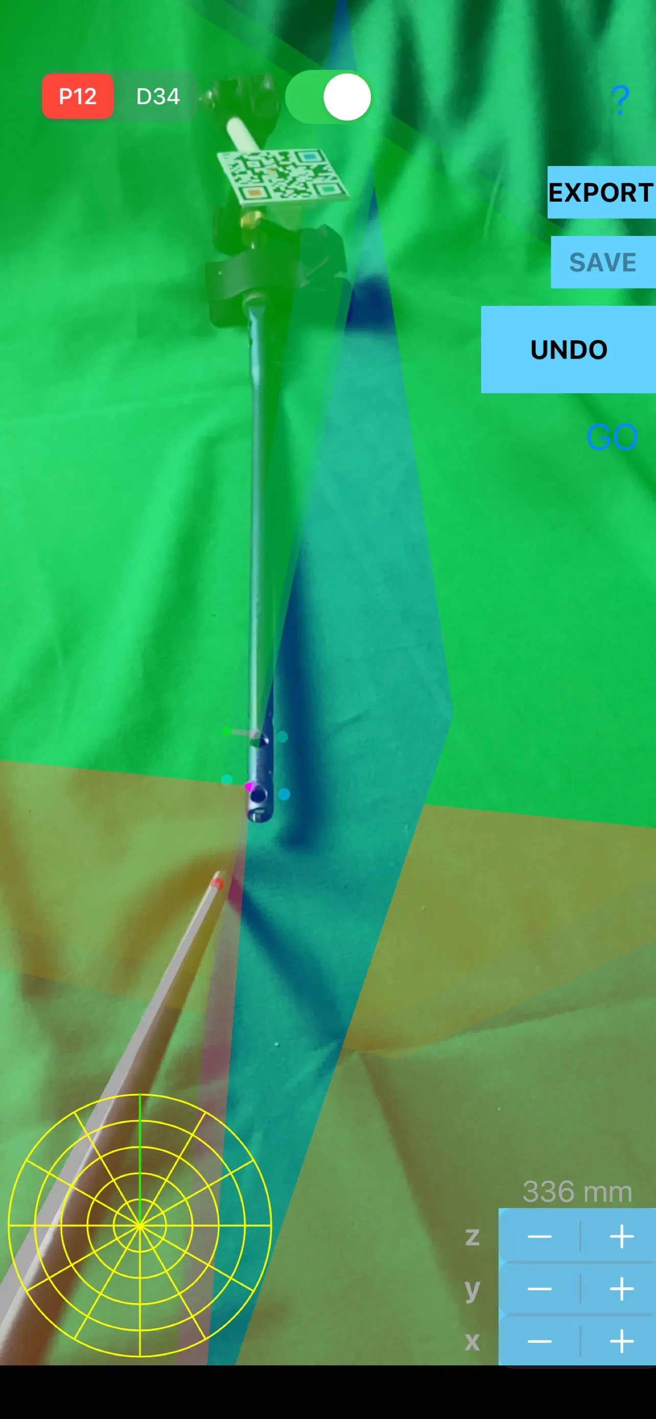
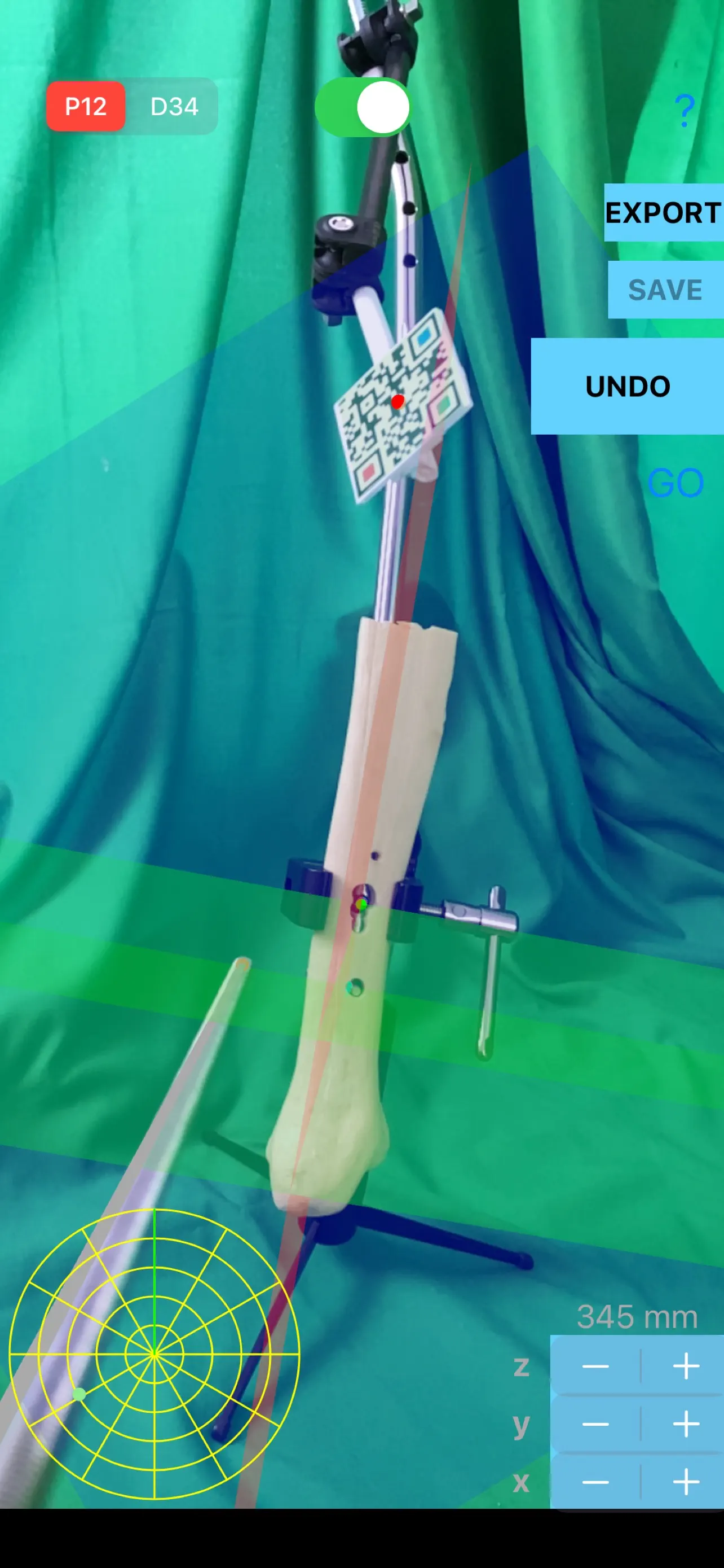
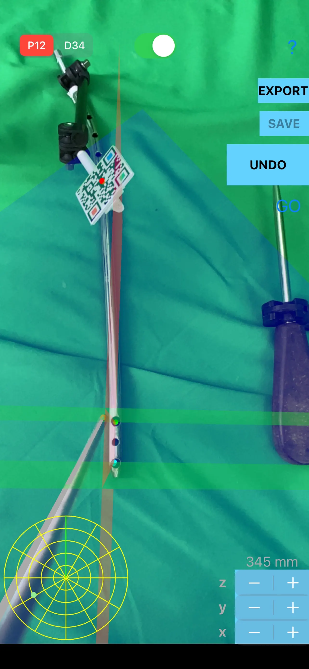
ScrewCupNaviAR
Screws are effectively used as an alternative method cup fixation in total hip arthroplasty (THA). Optimal screw hole positioning during placement of screw, strictly in periacetabular bone, avoiding injury to the near neuro-vascular structures is of paramount importance.
The app :
-depicts in augmented Reality (AR) and project the
Updated: 2 years ago
Released: 5 years ago


3.5
2 Ratings
$219.99
Navigation
iGlide Pro
NaviLogic iGlide - the Soaring Navigation app for iOS
iGlide is a soaring navigation App with advanced functionality that is amazingly easy to use. iGlide supports glider pilots during a competition, a cross-country flight, or just during short recreational flights.
iGlide comes in three editions at three price-points. Starting with "iGlide
Updated: 2 years ago
Released: 12 years ago

0
0 Ratings
$199.99
Navigation
iCMTGIS III
iCMTGIS III is a professional GPS/GIS mapping app that will let you record Points, Lines and Area Features with date/time stamp and pre-defined or manually added descriptions. You could also digitize Features on top of a background map or create points by entering angles and distances. LLA, UTM, State Plane
Updated: a year ago
Released: 10 years ago


0
0 Ratings
$199.99
Navigation
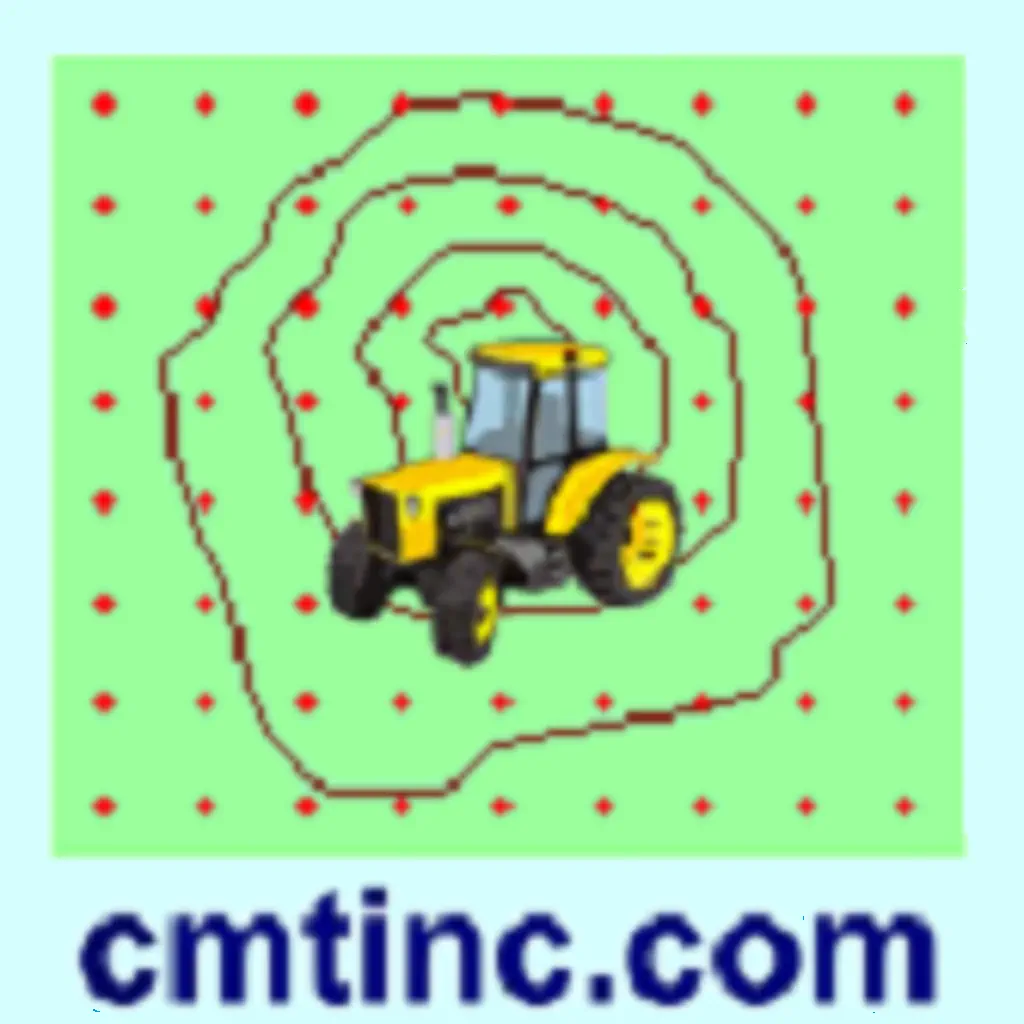
Farming GPS GIS III
“Farming GPS GIS III” provides GPS data collection and mapping functionality for use on the iPad. It will let you use a GPS receiver to map a farm tract, a timber tract or any other land parcel as well as point and line features of interest. You can also create
Updated: 4 years ago
Released: 10 years ago

0
0 Ratings
$199.99
Navigation
Forester GPS GIS III
“Forester GPS GIS III” provides tools for estimating basal area per acre for a timber stand as well as GPS data collection and mapping functions for use on the iPad. It will let you use a GPS receiver to map a timber stand or any other land parcel then create
Updated: a year ago
Released: 10 years ago

3
1 Ratings
$179
Navigation
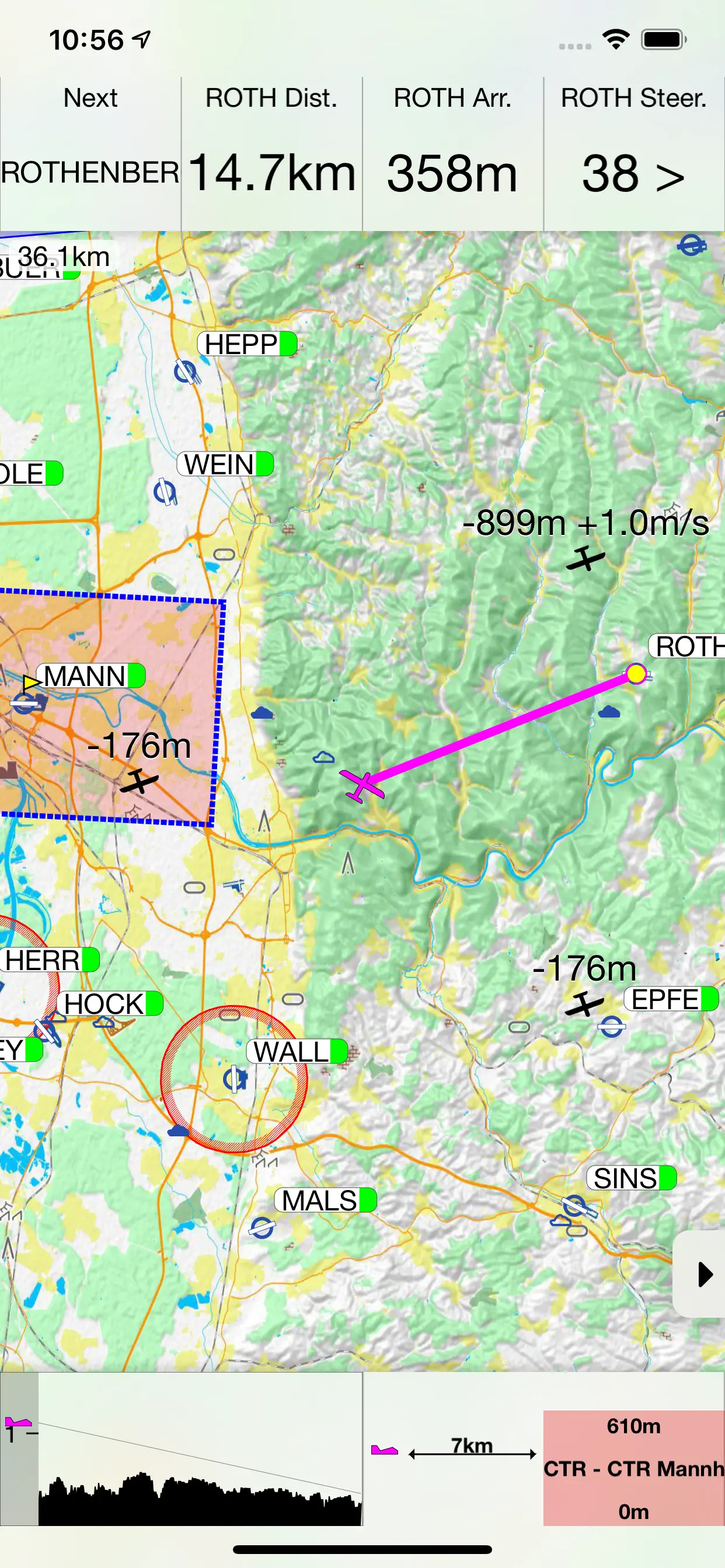
Sky-Map
Sky-Map is a Moving Map navigation and flight planning system. Like the Sky-Map Versions for other platforms it contains the following functionality:
- Moving Map: Displays the actual position on digital aviation charts, like ICAO chart from DFS (Maps not included)
- Fast move and zoom of the map
- Flightplanning: Flights can
Updated: 2 years ago
Released: 15 years ago
0
0 Ratings
$119.99
Navigation
OilTrails Unlimited
This app is the one time purchase version of OilTrails, no subscription required. All the same features, unlimited use.
This multifunctional lease locator app makes getting to work in the oilfield a breeze. Simply enter the legal land description, name, or API number to view the surface location OR drop a
Updated: a year ago
Released: 8 years ago


5
2 Ratings
$119.99
Navigation
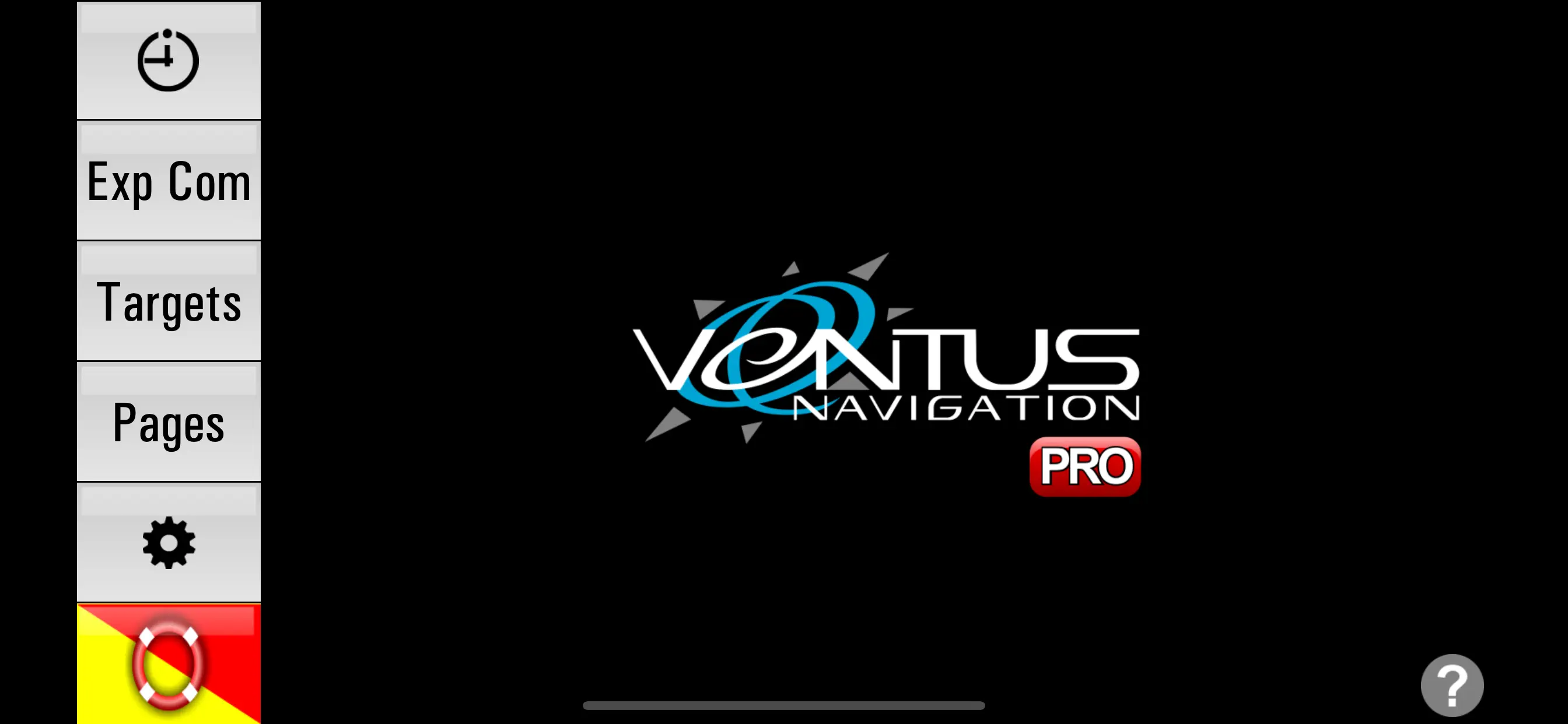
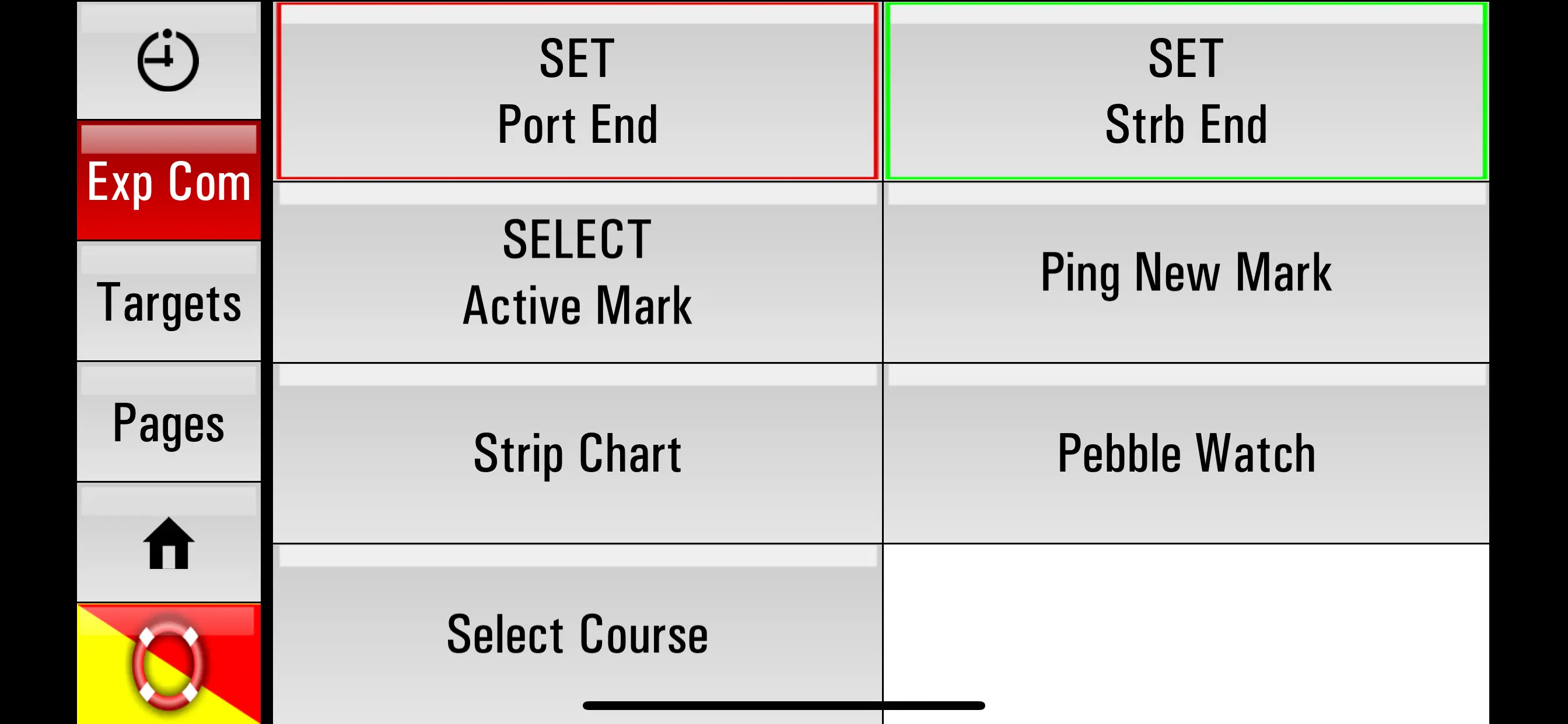
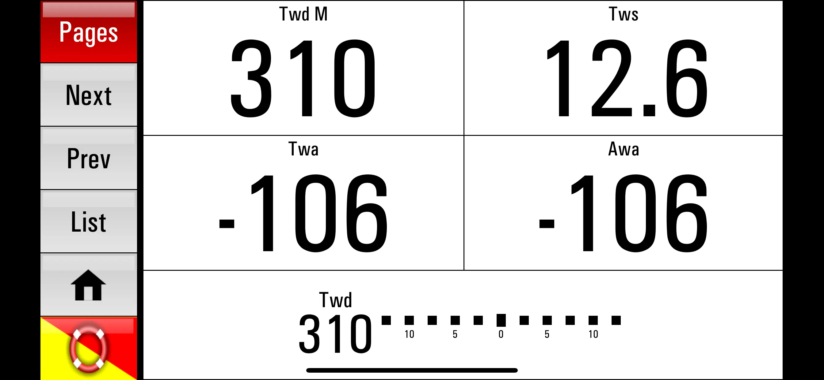
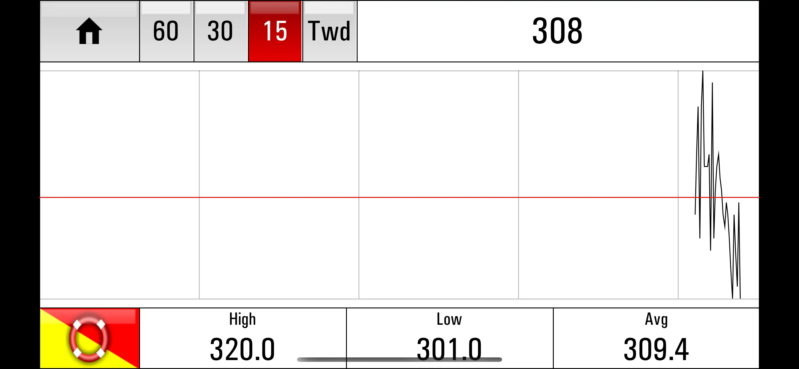
Ventus PRO
Ventus PRO, the first and only system that gives you control of key Expedition Navigation Software features from a remote device. Our new PRO version not only has all the features of the original Ventus Navigator that lets you view all the data that Expedition puts out in the palm
Updated: 2 years ago
Released: 12 years ago

0
0 Ratings
$99.99
Navigation
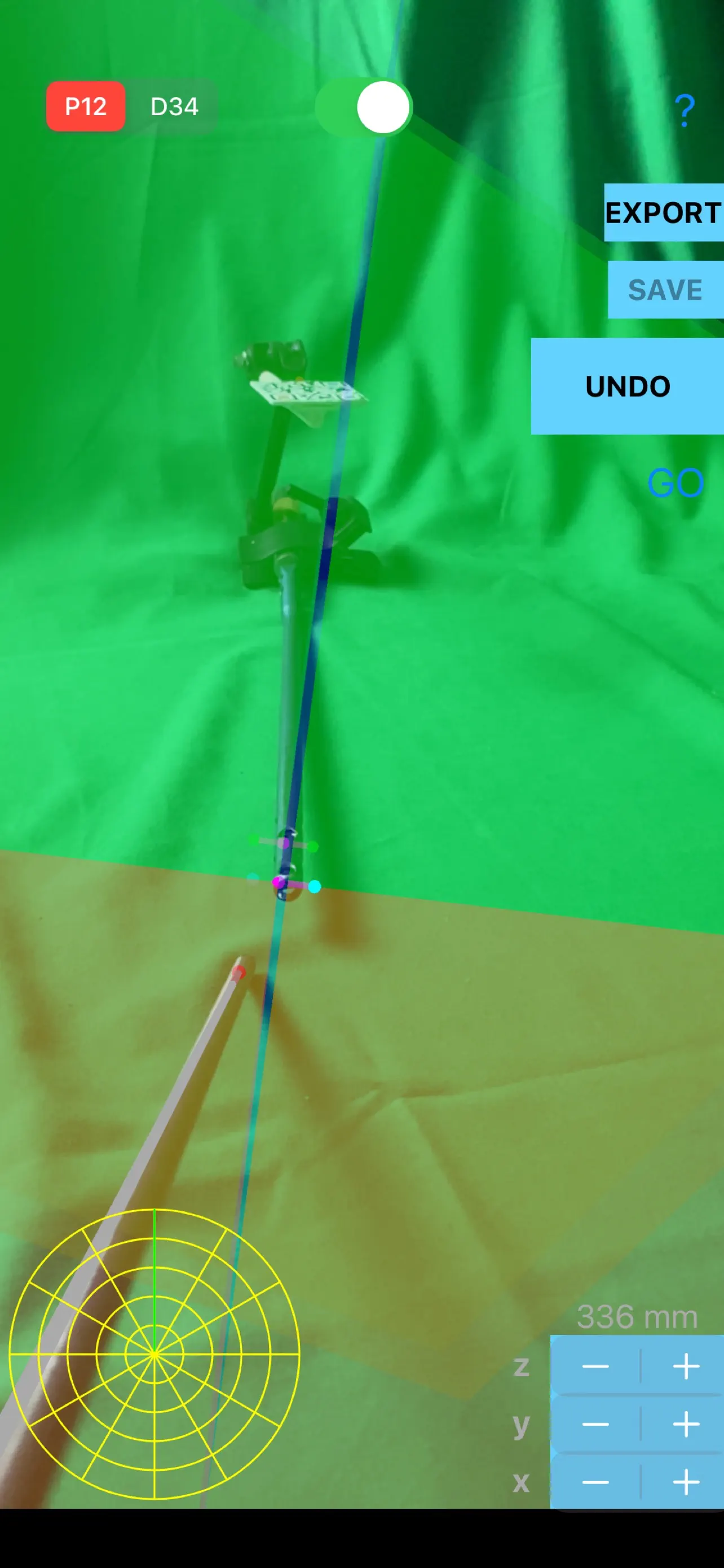
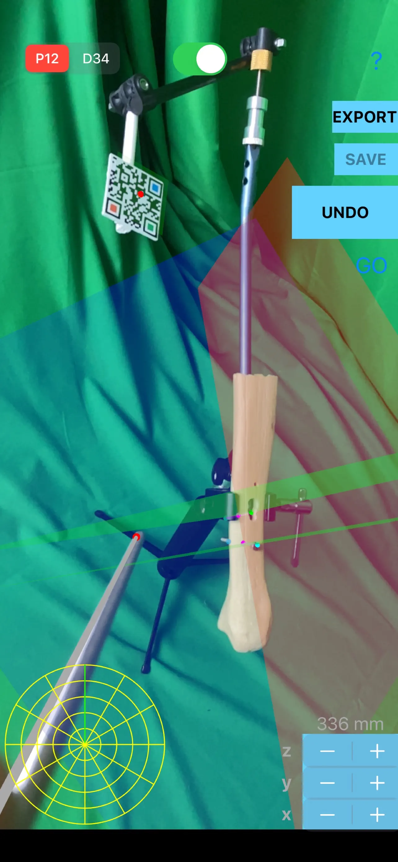
IMNailScrewAR
Intramedullary nailing (IMN) is commonly used to address diaphyseal fractures of long bones. Accurate aiming the distal interlocking holes of the nail for insertion of transfixing screws remains a challenging problem in locked intramedullary nailing requiring intraoperative fluoroscopic guidance. The ‘‘free-hand technique’’ is not sufficiently accurate, because it is conducted
Updated: 2 years ago
Released: 4 years ago

0
0 Ratings
$99.99
Navigation
Roadbook Rally
Roadbook Rally offers a new form of entertainment experience for those seeking rally-raid style adventure on two and four wheels.
This app has the ability to automatically generate a roadbook and uses an integrated rally computer to help users easily enjoy rallying.
To create a roadbook, simply specify the start and finish
Updated: a year ago
Released: 2 years ago


5
1 Ratings
$94.99
Navigation
Wetland - Stakeout
The Wetland - Stakeout app provides the capability to create a custom data collection/report form on the iPad. This app can be used for designing data collection forms for various types of applications, from a simple inventory log, price quote or job contract to a sophisticated form for collecting GIS
Updated: 2 years ago
Released: 10 years ago

0
0 Ratings
$94.99
Navigation
Farming GPS GIS II
“Farming GPS GIS II” provides GPS data collection and mapping functionality for use on the iPad. It will let you use a GPS receiver to map a farm tract, a timber tract or any other land parcel as well as point and line features of interest. You can also create
Updated: 4 years ago
Released: 10 years ago

5
1 Ratings
$94.99
Navigation
Forester GPS GIS II
“Forester GPS GIS II” provides tools for estimating basal area per acre for a timber stand as well as GPS data collection and mapping functions for use on the iPad. It will let you use a GPS receiver to map a timber stand or any other land parcel then create
Updated: 3 years ago
Released: 10 years ago

0
0 Ratings
$89.99
Navigation
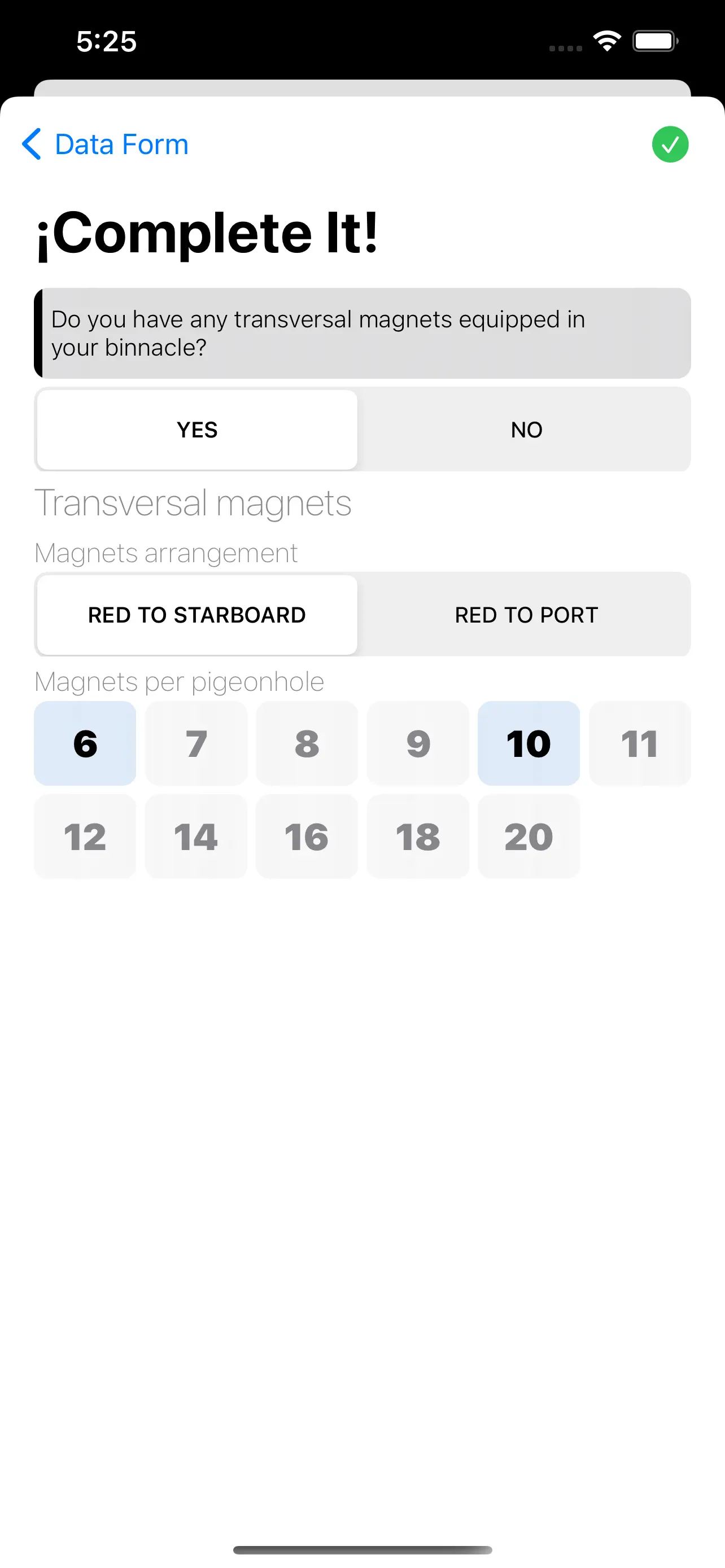
Binnacle Calibrator
The Binnacle Calibrator app allow you to perform binnacle calibration calculations in a few easy steps. Enter the required data and Binnacle Calibrator will calculate the optimal position of the magnetic correctors to reduce the magnetic deviation as much as possible. The results obtained are shown in a PDF document.
The
Updated: 3 years ago
Released: 6 years ago


0
0 Ratings
$84.99
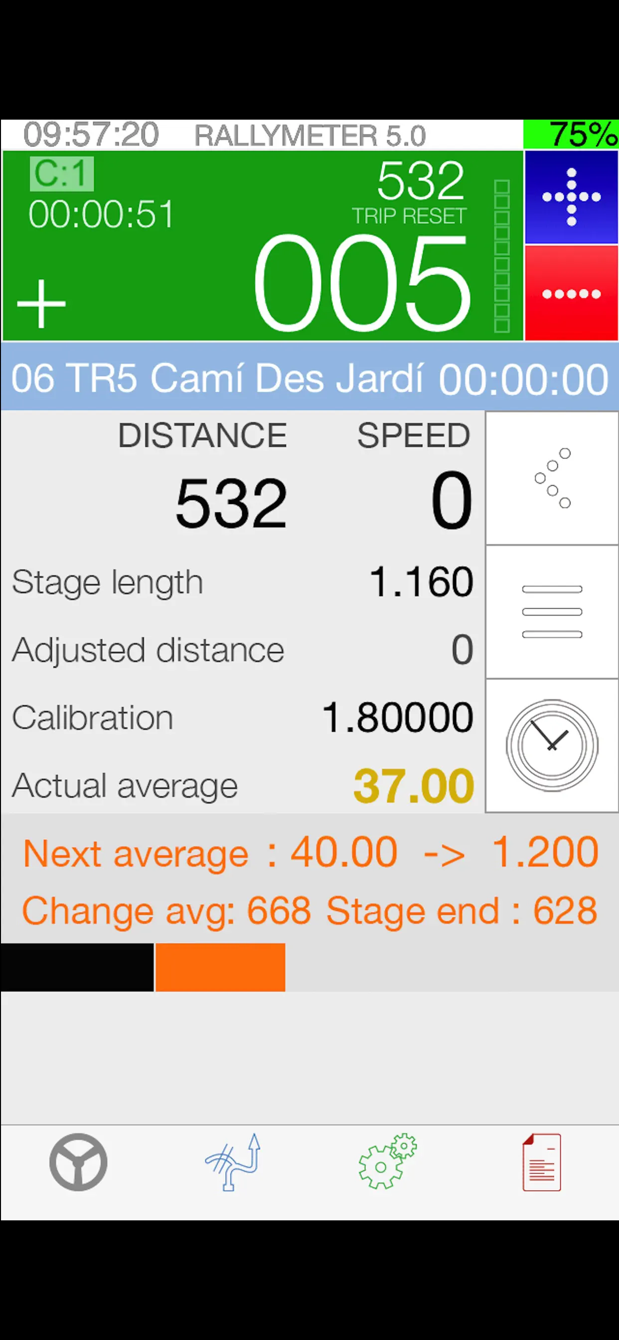
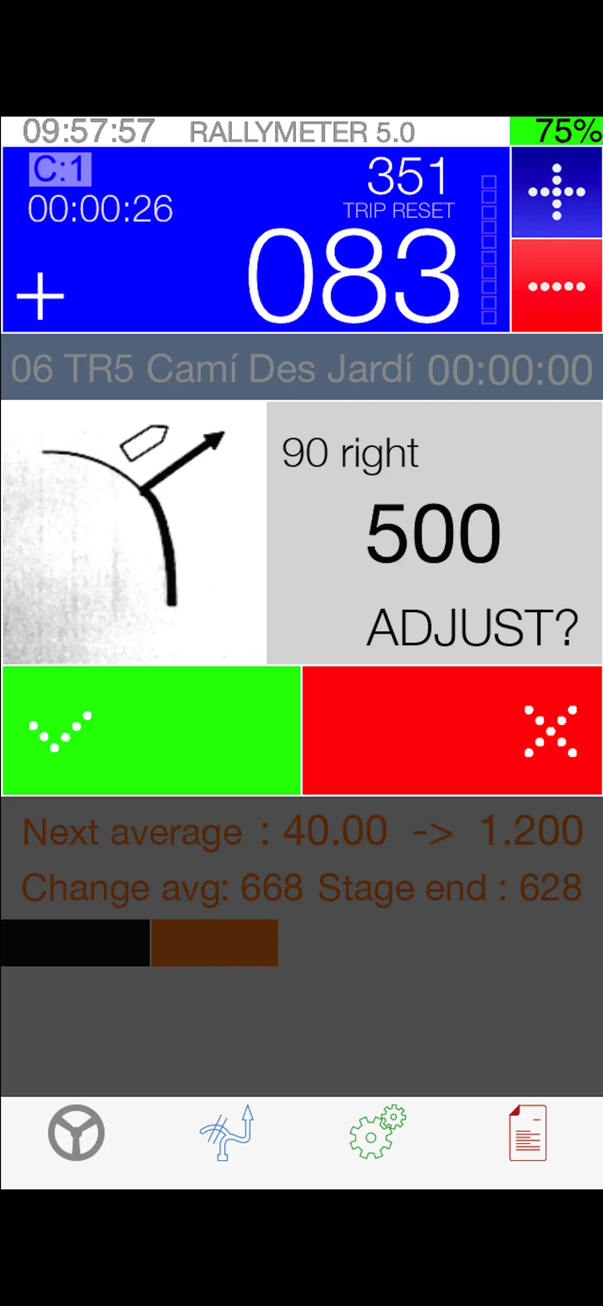
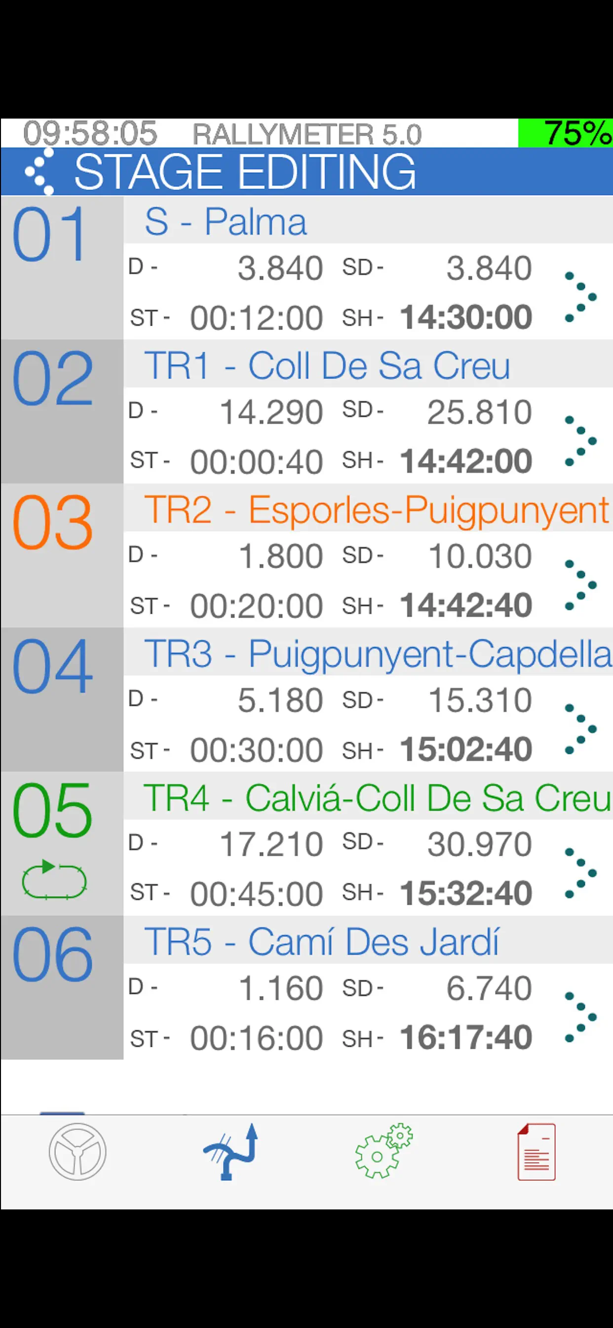
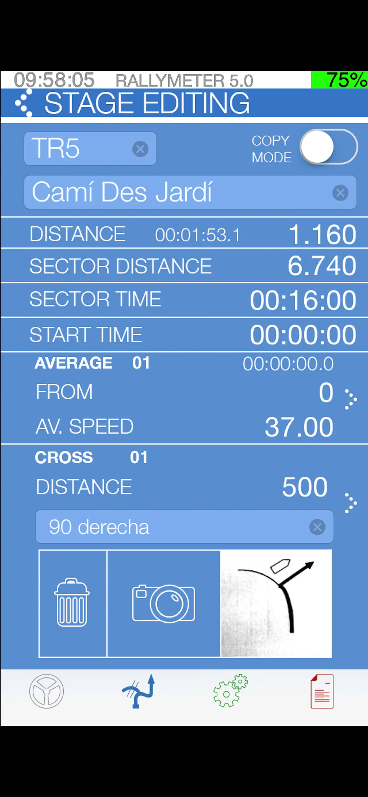
Sports
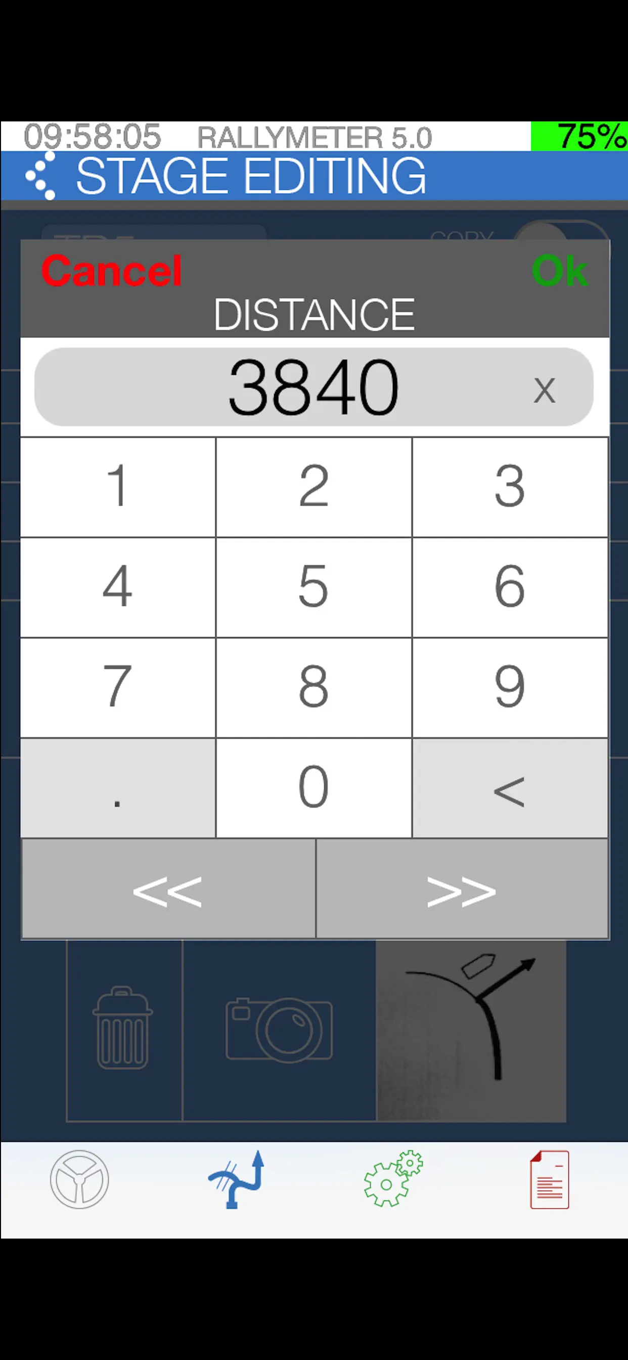
Rallymeter Pro
The definitive tool for regularity rally & raid racing.
Detailed manual and operating videos at:
http://www.rallymeter.com
http://www.facebook.com/rallymeter
https://www.youtube.com/user/rallymeter
All the control in your iPhone, iPod or iPad. There's simply not a better system.
Use it as an advanced speed table with your odometer or as an independent precision system with the separately available precision sensor.
Main
Updated: 2 years ago
Released: 14 years ago