Category:

3.7
3 Ratings
$4.99
Navigation
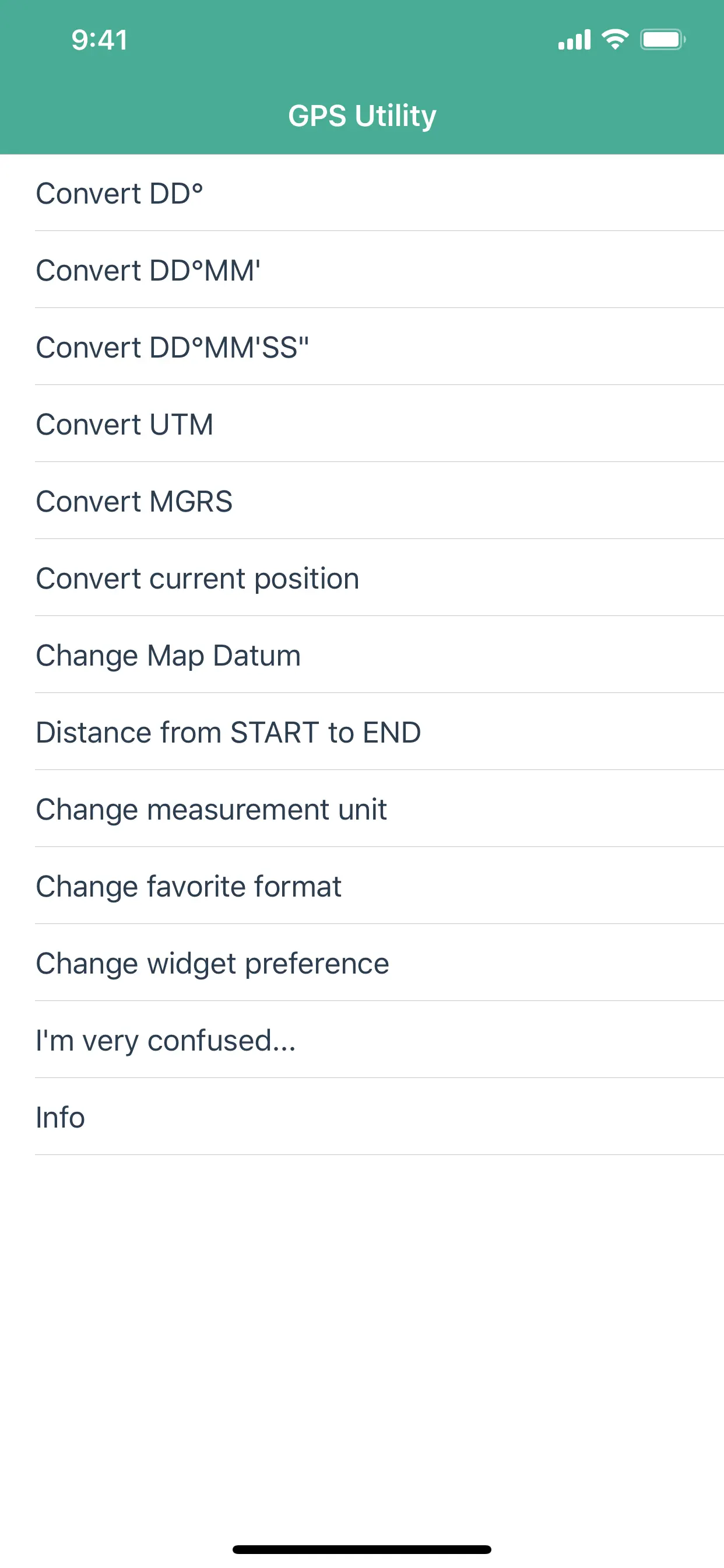
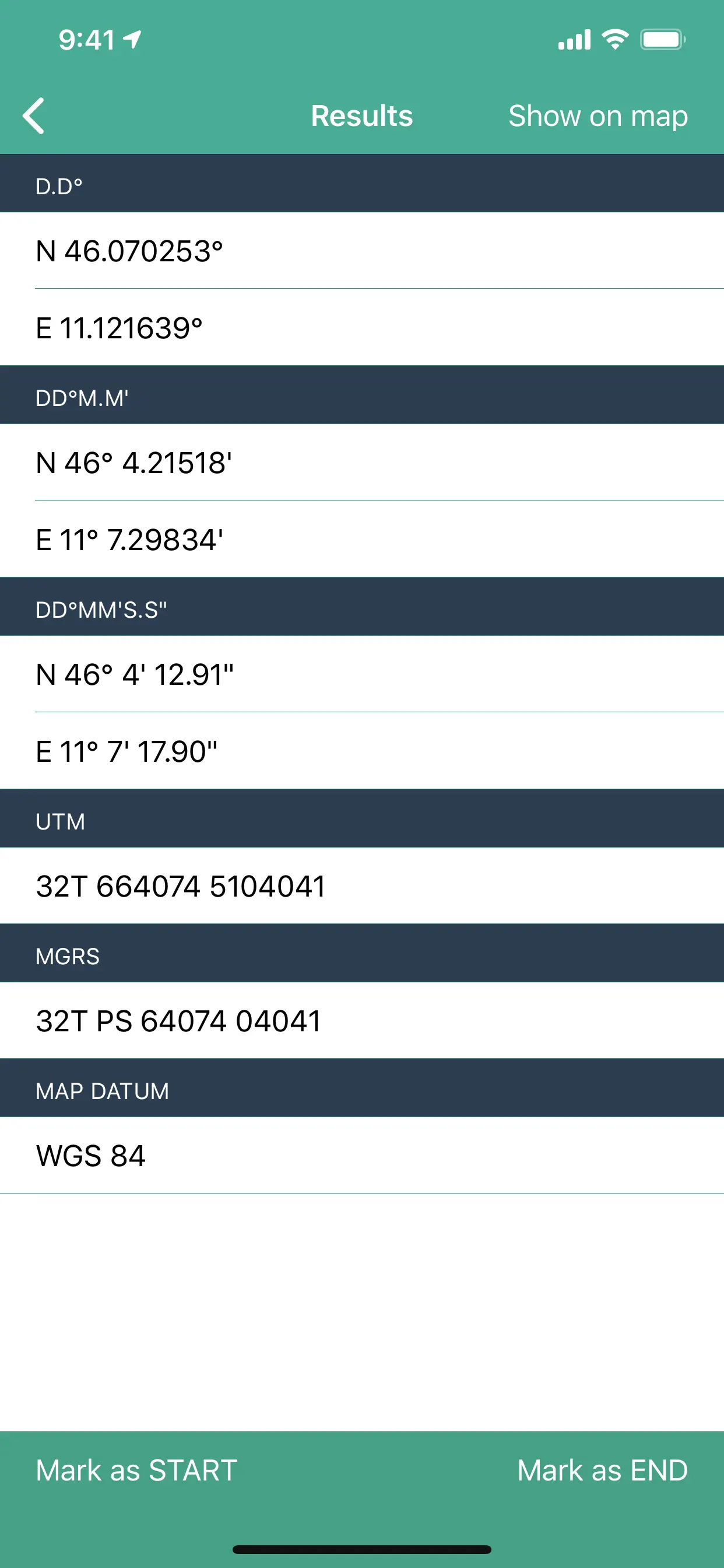
GPS Utility
GPS Utility helps you converts between all major geographical coordinate systems.
Helpful for excursionists, navigators users (TomTom, garmin, etc.), GeoCaching lovers, and google maps enthusiasts.
You can convert from and to:
- DMS coordinates (Degrees Minutes Second)
- DM coordinates (Degrees decimal Minutes)
- DD coordinates (decimal Degrees)
- UTM coordinates (Universal Transverse
Updated: 5 years ago
Released: 16 years ago

4
1 Ratings
$0
Navigation
深圳香港地铁指南 Shenzhen Hong Kong Metro Guide
Free app! Latest Hong Kong and Shen Zhen Metro Map. Your 5-star review will keep the updates coming!
Thanks!
Search for "Faraway Inc" for all our nice apps! Some are free to try!
It shows the metro map of Shen Zhen and Hong Kong, in Chinese and also in English (pinyin).
Shenzhen is
Updated: 8 years ago
Released: 16 years ago

4
19 Ratings
$0
Travel
Beijing Subway Map 北京地铁线路图
Beijing Subway App
--Latest Beijing Subway Route Map.
--First train/last train schedule info for every station.
All the station names are both in Chinese and in English .
Beijing, the capital city, is the political, educational and cultural center of China.
Great companion for traveling in Beijing, China ! Enjoy it !
***No network support
Updated: 4 years ago
Released: 16 years ago


4.3
3 Ratings
$0
Travel
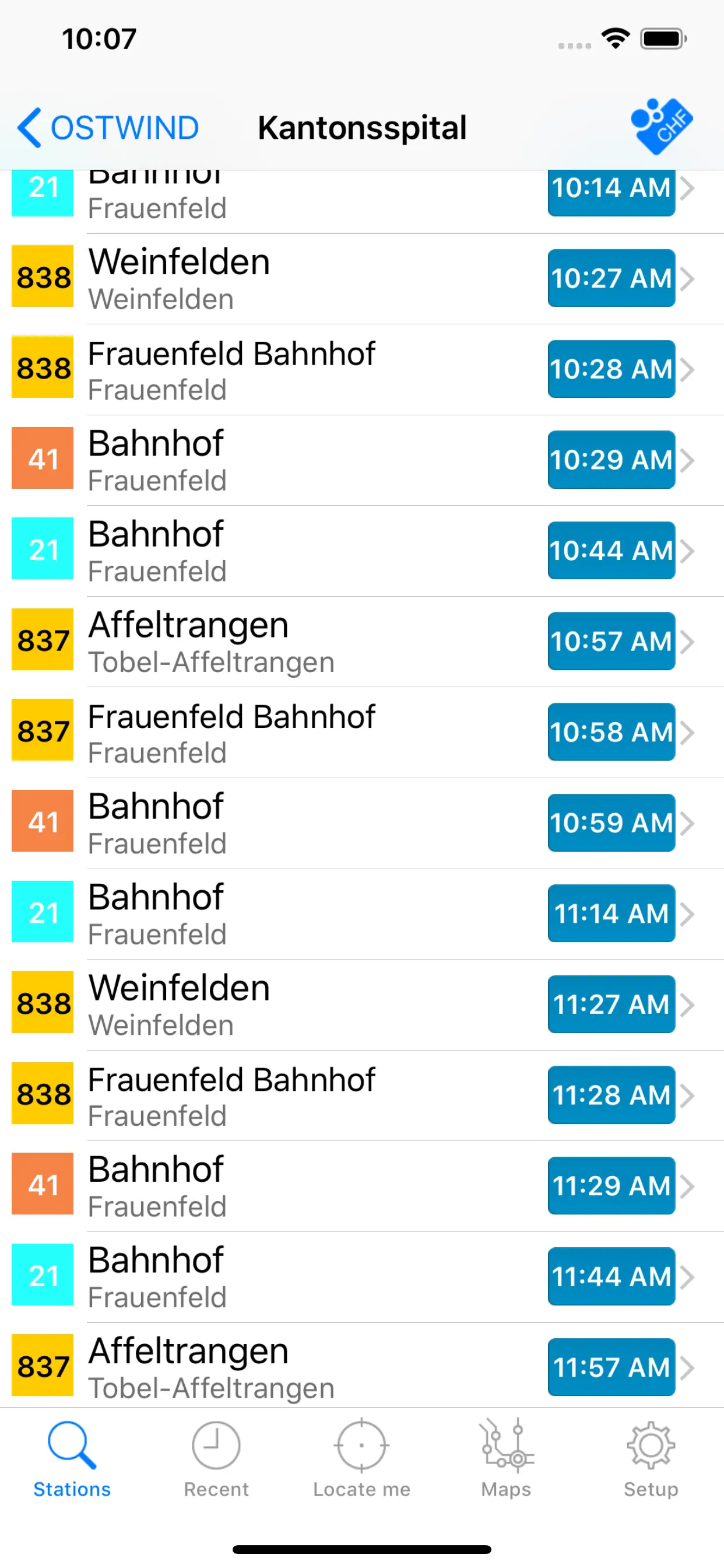
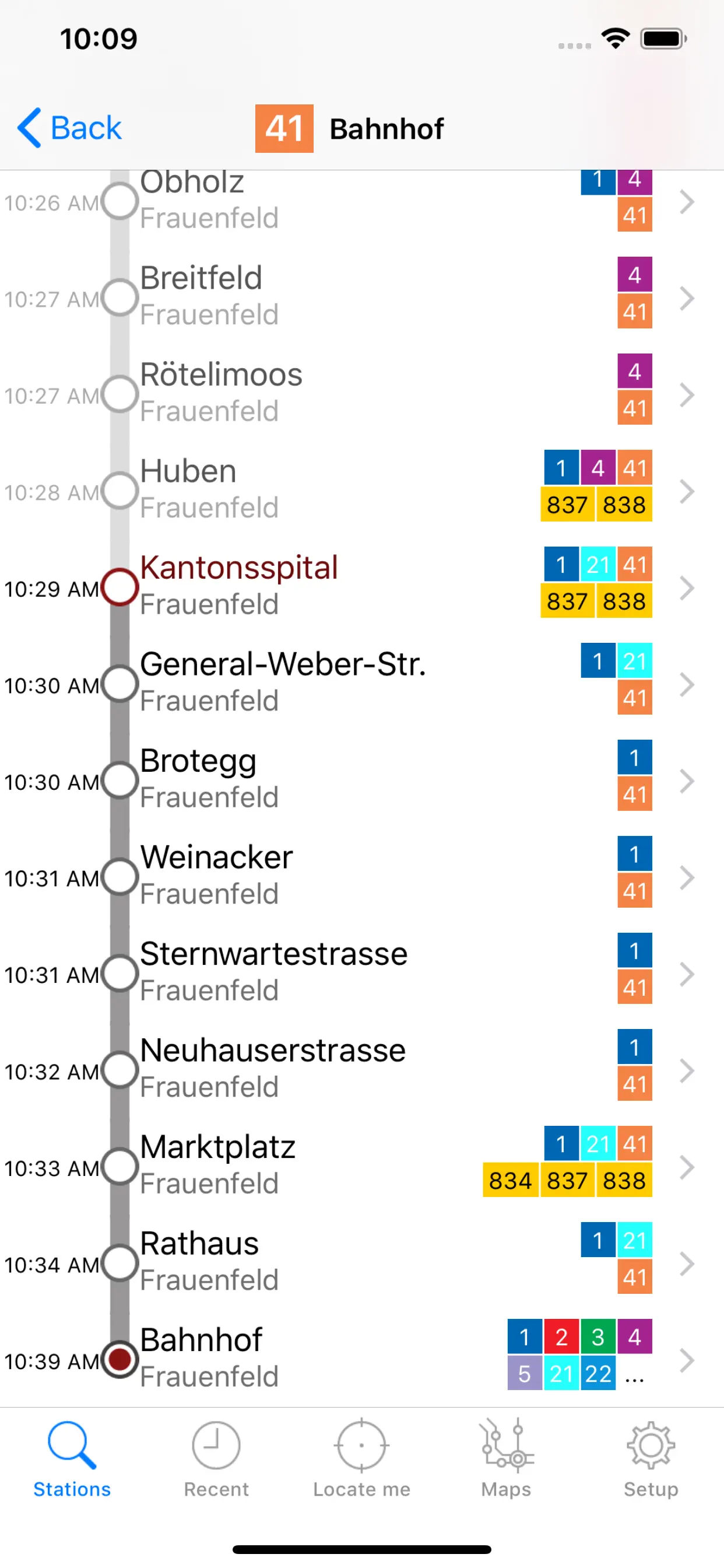
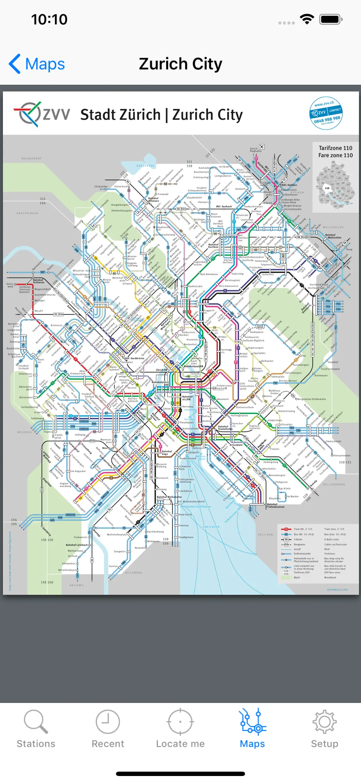
Wemlin
Traveling without haste in Switzerland’s public transport, with schedules from OSTWIND, BLT, Liechtenstein mobil and ZVV.
With a single tap Wemlin displays the departures of any public means of transport for:
- Zurich's Transport Network (Zürcher Verkehrsverbund - ZVV) incl. Winterthur and Schaffhausen
- in the OSTWIND area
- for BLT (Baselland Transport)
-
Updated: 4 years ago
Released: 16 years ago
4.1
35550 Ratings
$0
Travel
Google Earth
Explore the whole world from above with satellite imagery, 3D terrain of the entire globe, and 3D buildings in hundreds of cities around the world.
Zoom to your house or anywhere else then dive in for a 360° perspective with Street View. See the world from a new point of view
Updated: a year ago
Released: 16 years ago


2
2 Ratings
$0
Navigation
Hong Kong Metro Map 香港深圳地铁线路图
香港深圳地铁线路图 Free Hong Kong Shen Zhen Metro Map !
"I love the minimalism -- it's just what I want"
from app reviewer Don Ellis
HK MTR map now comes with free Shenzhen Metro map!
Simple is the best!
Hong Kong is connected to city of Shenzhen in mainland China in the northern border.
This is Hong
Updated: 8 years ago
Released: 16 years ago

4.7
406 Ratings
$0
Travel
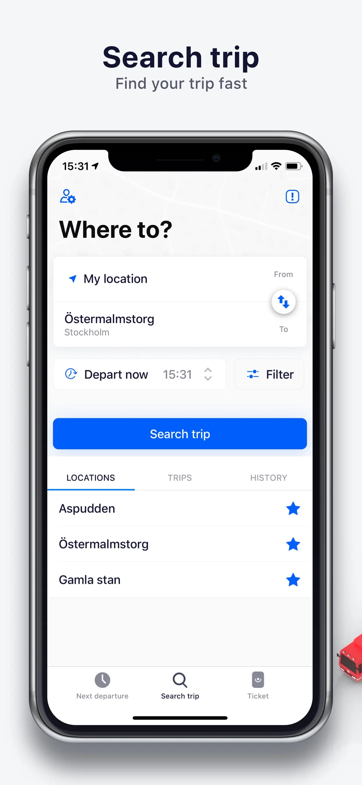
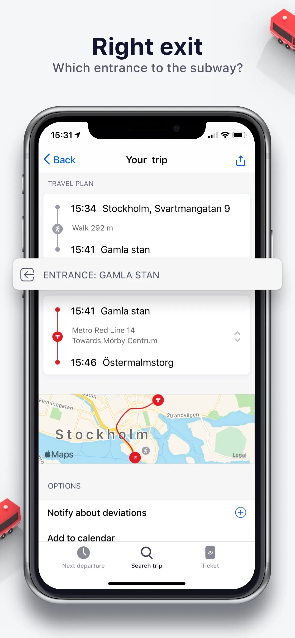
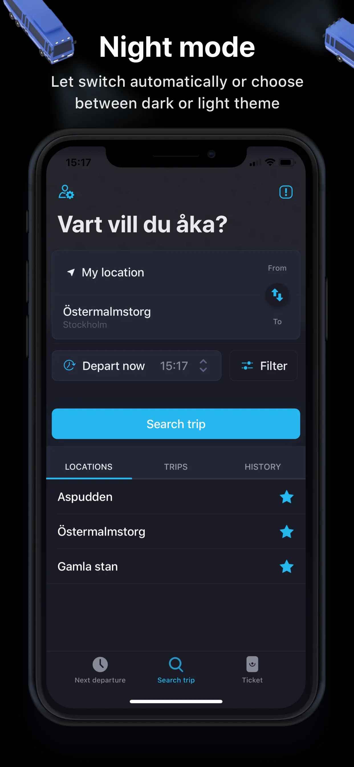
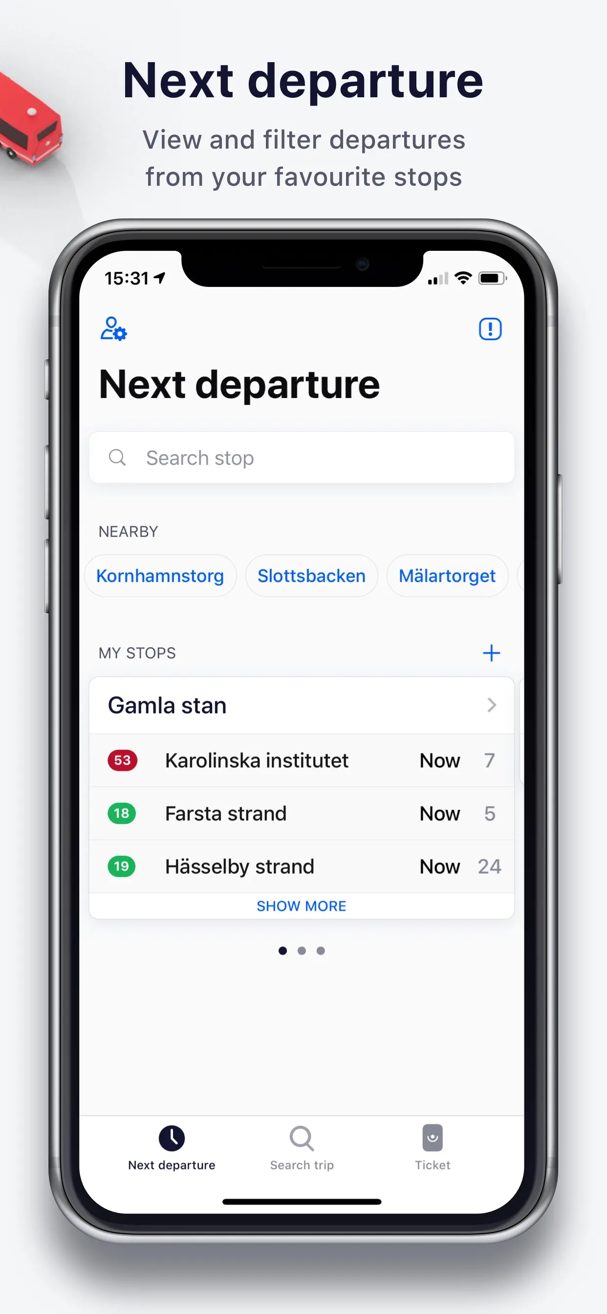
Res i STHLM:SL journey planner
Simplify your traveling in Stockholm using Res i STHLM, a free journey planner for SL, the Stockholm region's public transport authority. Either you're traveling by bus or commuter train, metro or light rail, the app helps you plan you whole journey easily.
Functions:
Search trip - Specify where you
Updated: 2 years ago
Released: 16 years ago


4
4 Ratings
$0.99
Utilities
DC Metro
Quickly access train arrivals for any metro stop in the Washington DC area.
You can also add and organize your most frequently used metro stops, or browse a subway map to find stations.
Updated: 4 years ago
Released: 16 years ago


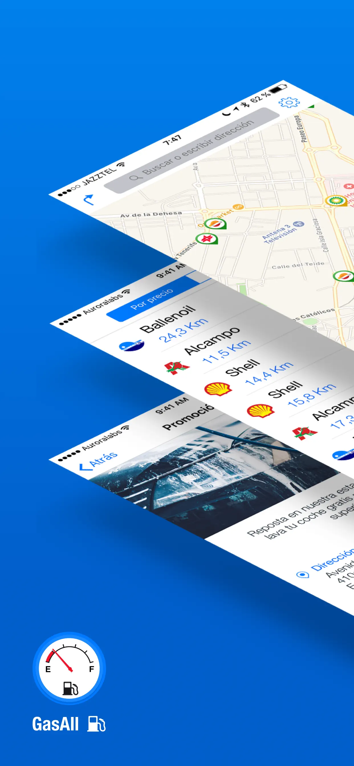
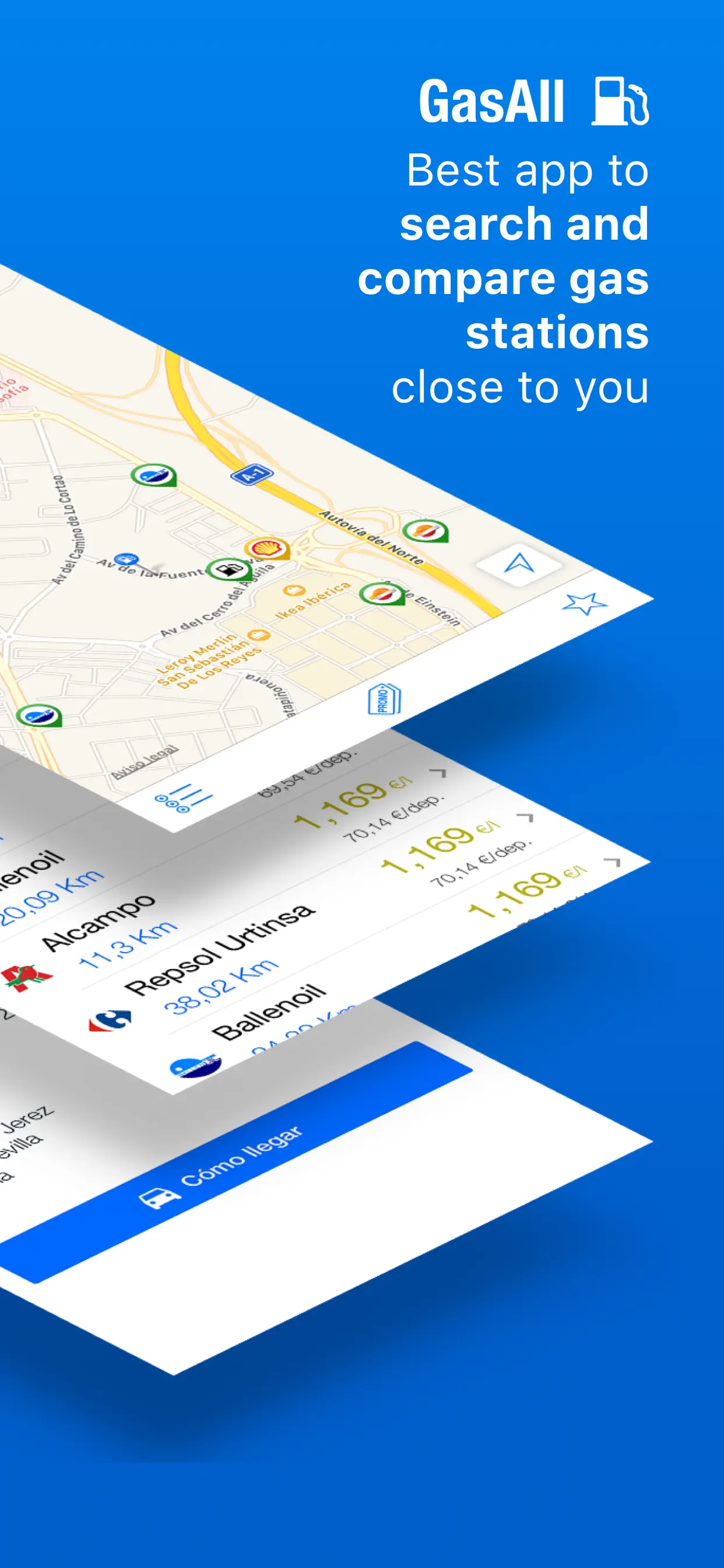
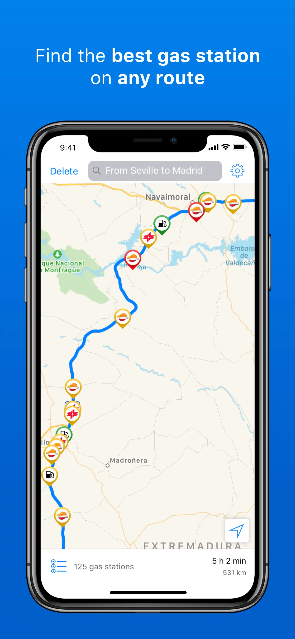
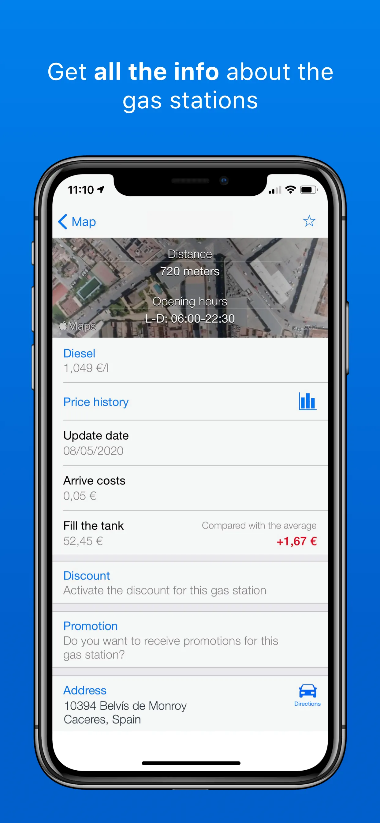
4.6
21 Ratings
$0
Navigation
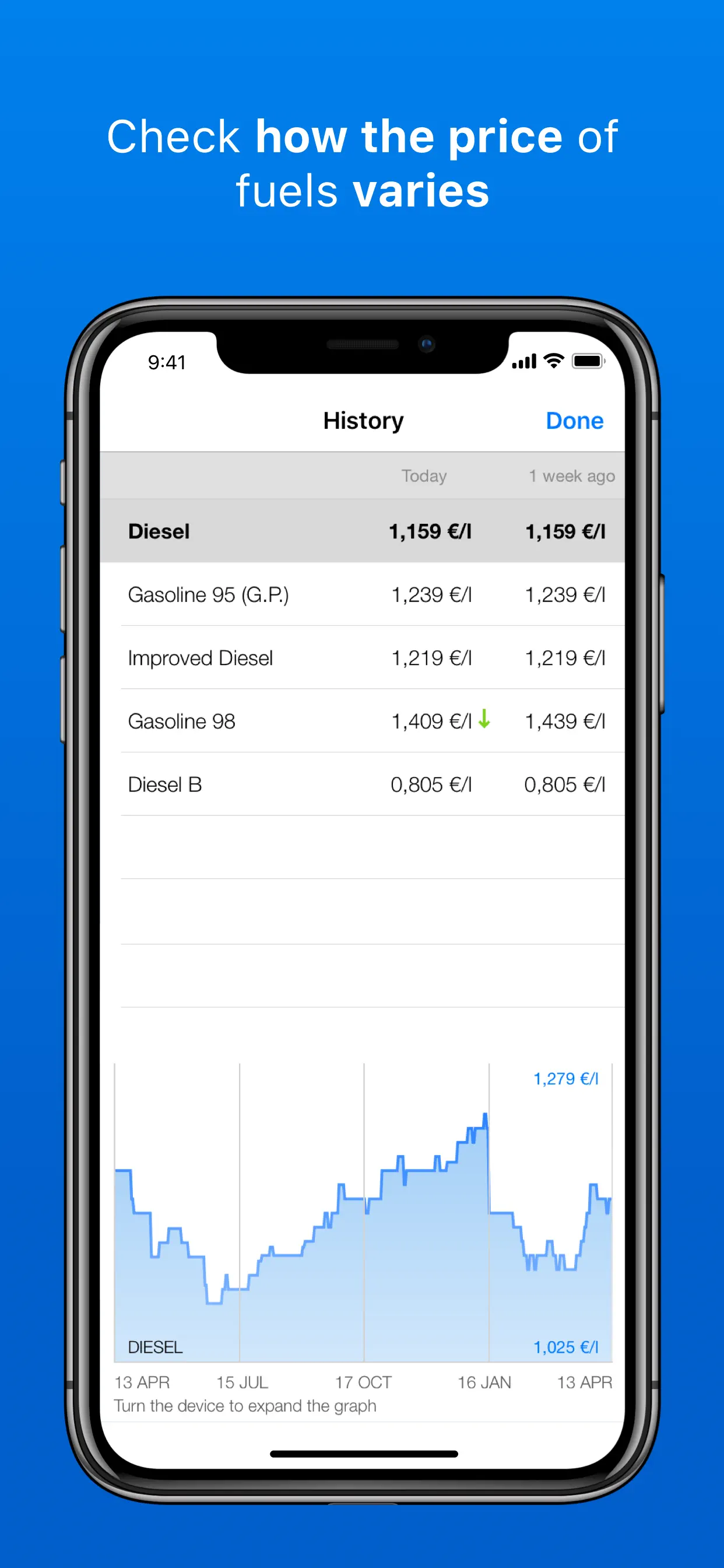
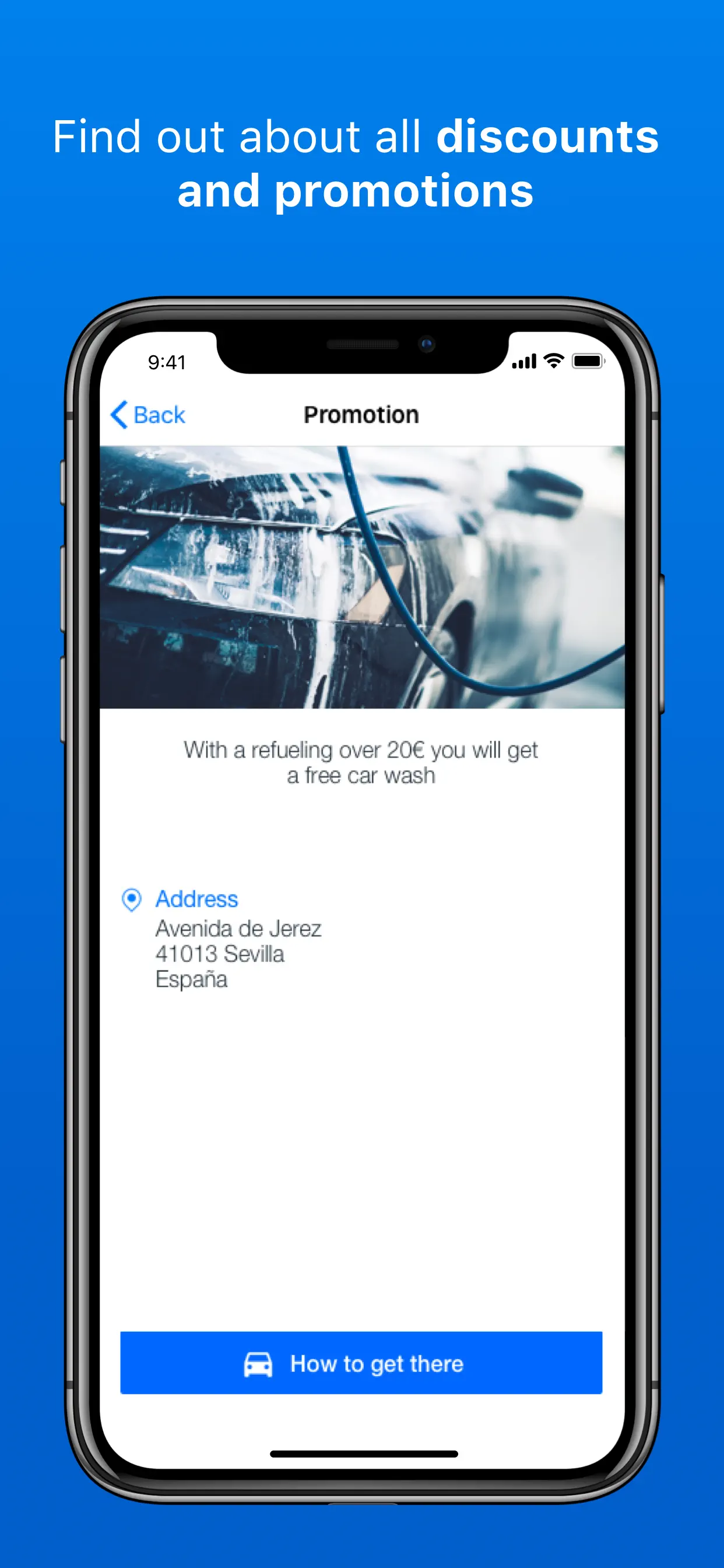
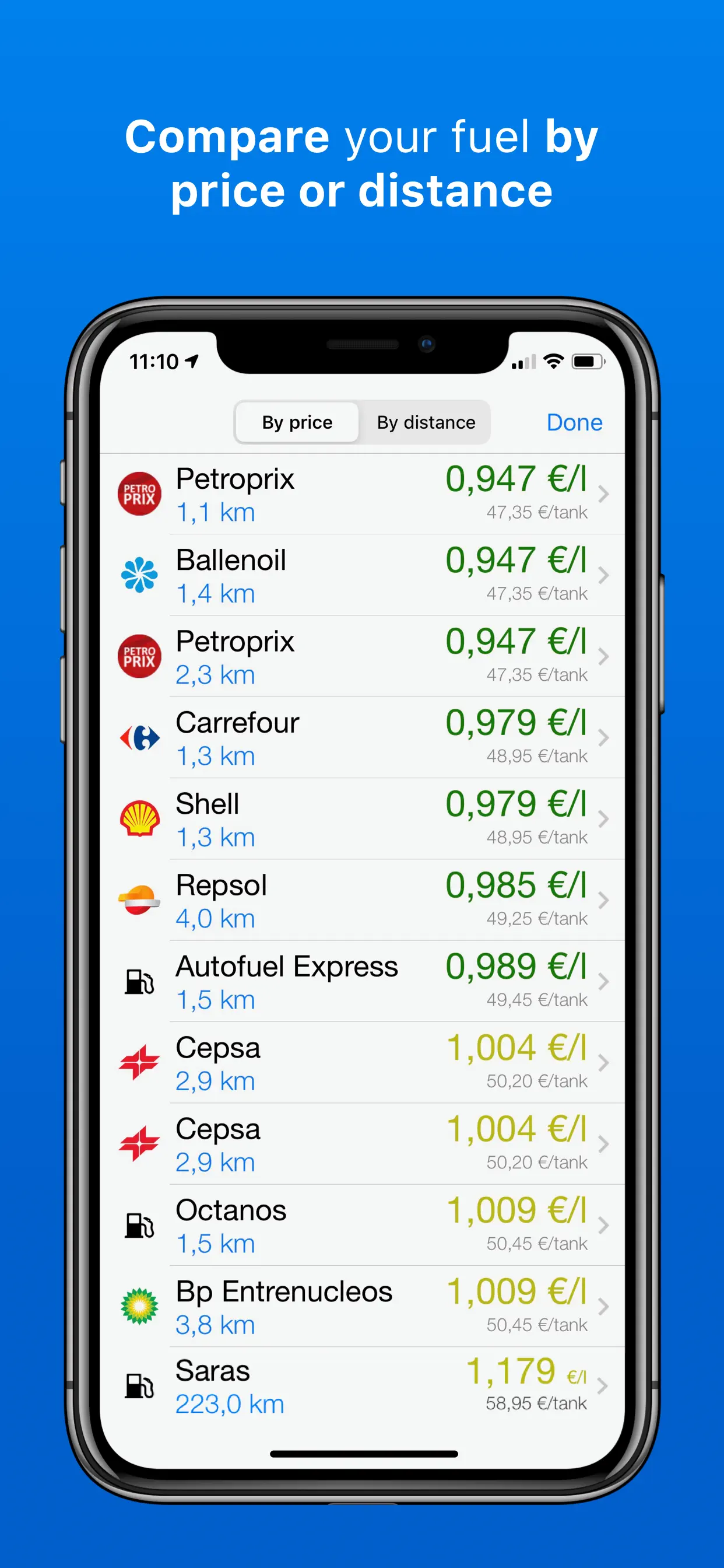
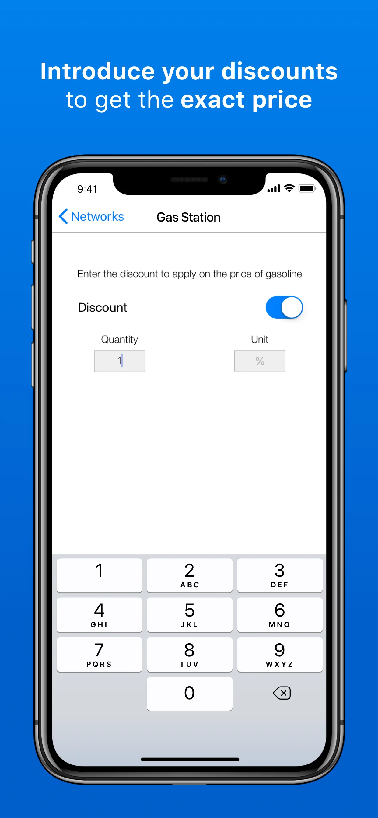
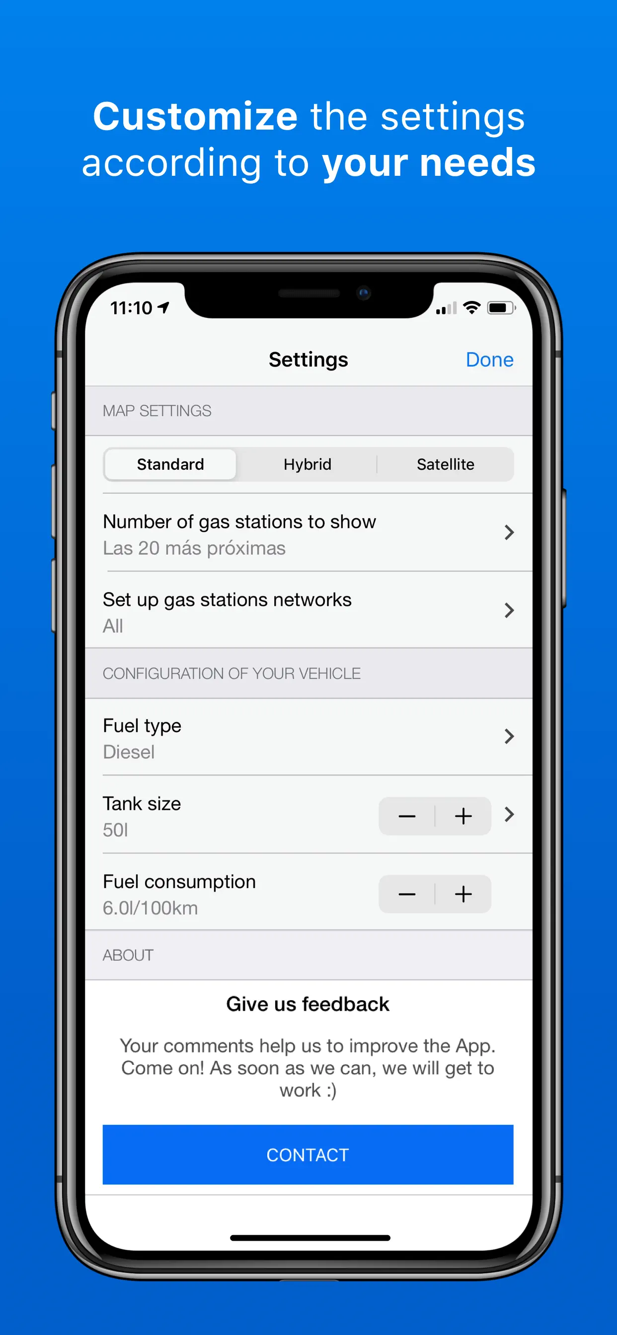
GasAll: Gas stations in Spain
GasAll is the best app to find the gas station that fits you better in every moment: by price, by distance, by fuel or with a nice promotion or discount. Since 2008 we have been pioneers showing all the relevant information about the gas stations in Spain.
We know that the
Updated: a year ago
Released: 16 years ago


4.7
260 Ratings
$2.99
Travel
Metro Paris Subway
Metro Paris Subway is the original and No. 1 selling application for getting around Paris, France.
◉ Metro Paris Subway is recommended by the Financial Times and the Los Angeles Times. Featured by Apple.
************************************************************
DESCRIPTION
************************************************************
Metro Paris Subway for iPhone is a comprehensive guide to traveling through Paris, France. It includes official subway
Updated: 2 years ago
Released: 16 years ago

3.3
3 Ratings
$6.99
Navigation
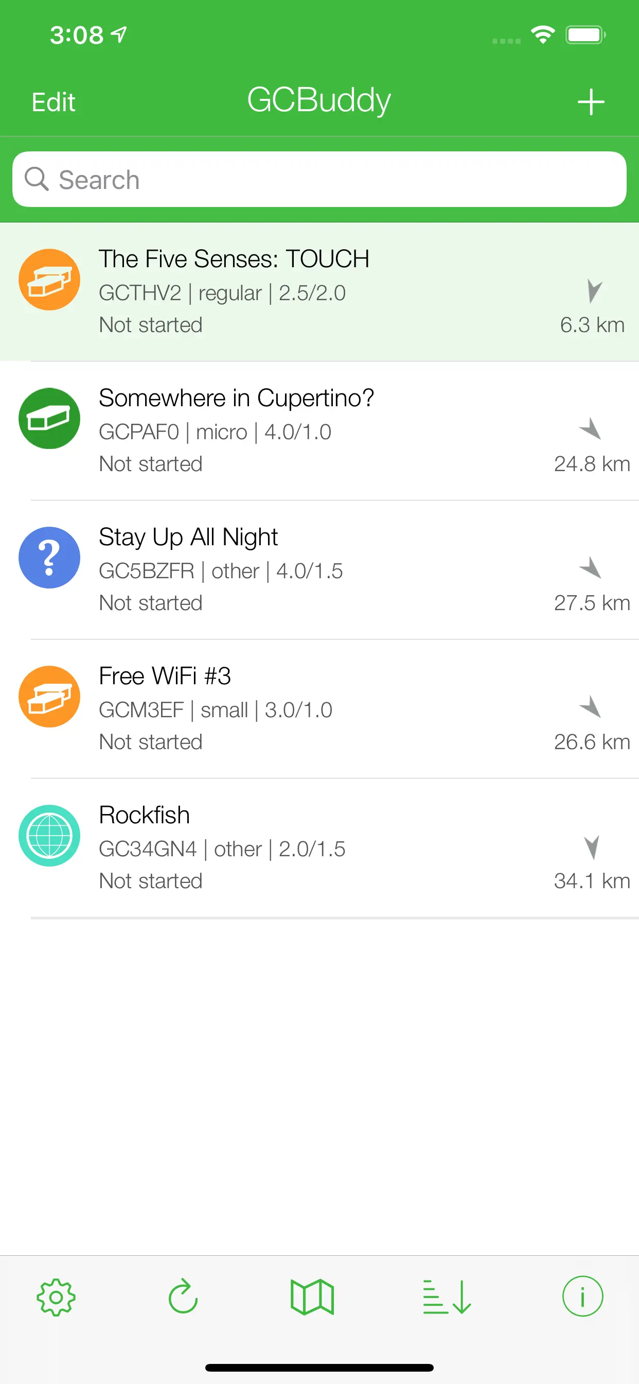
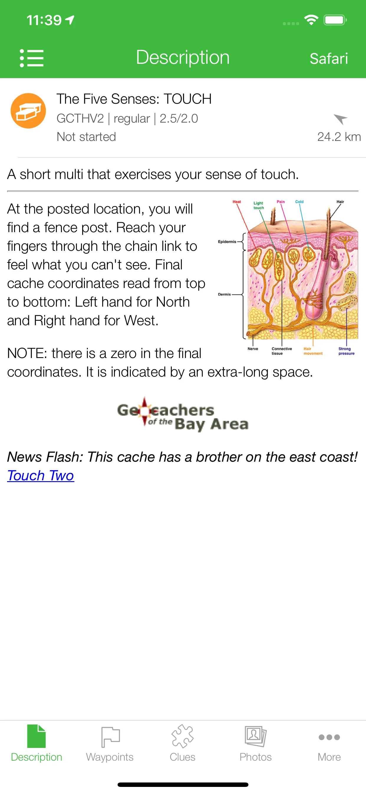
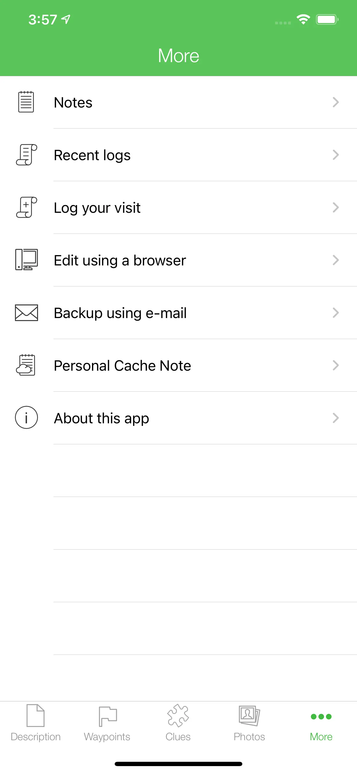
GCBuddy - geocaching
GCBuddy is the perfect tool for the serious geocacher when solving multi-caches. With this application you can record all found values for A...Z and use them to automatically calculate new waypoint coordinates. The final cache coordinates are also calculated as soon as all required puzzles have been solved and entered.
Updated: 2 years ago
Released: 16 years ago


2.4
7 Ratings
$0.99
Navigation
GPS
"GPS" gives you access to your iPhone's GPS functionality and more.
The simple display shows your current:
- Heading (where a compass is available).
- Course
- Speed or Speed Average
- Coordinates
- Altitude
Street and Topographic maps are available along with aerial or satellite photos. Once viewed maps will also
Updated: 3 years ago
Released: 16 years ago


3
2 Ratings
$0
Navigation
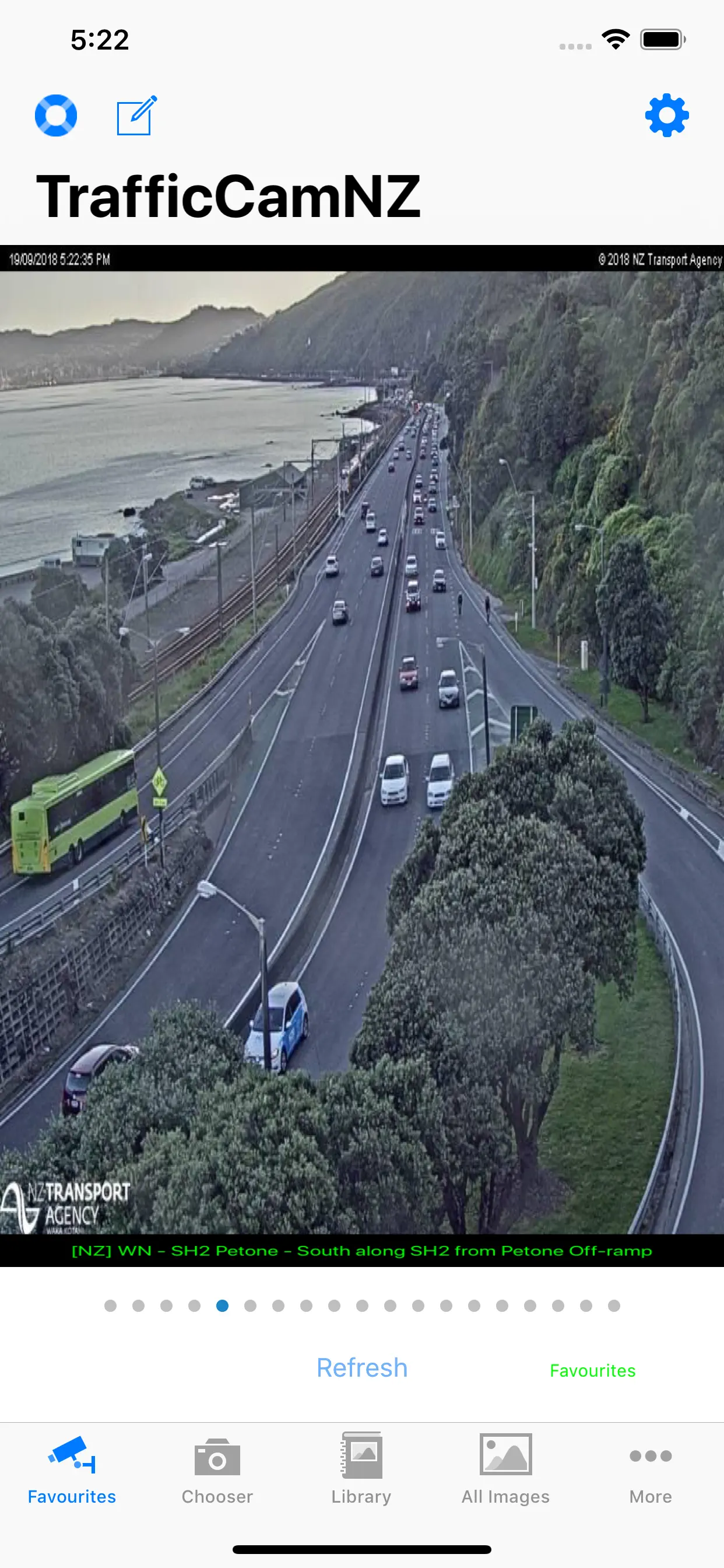
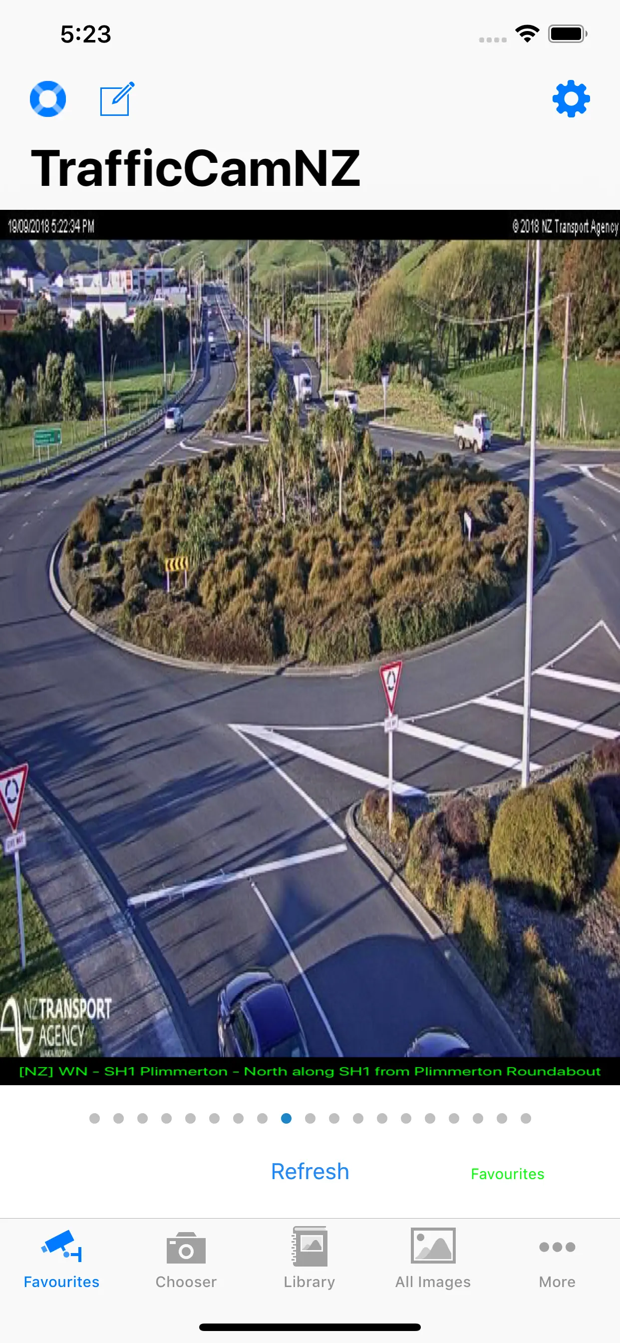
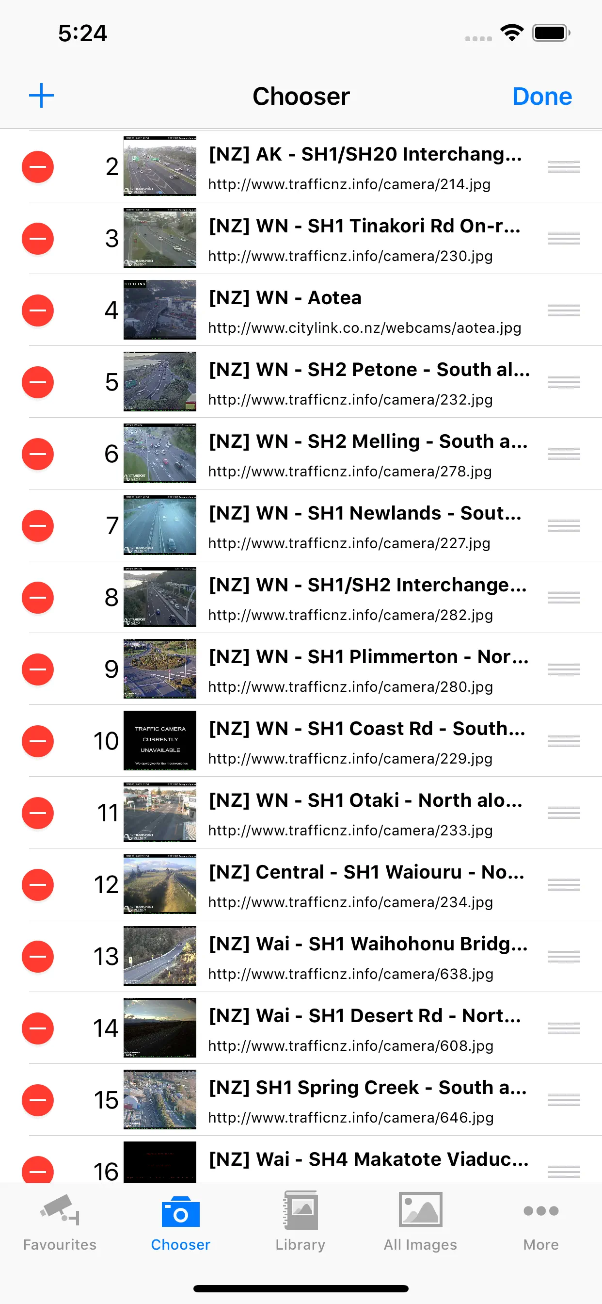
TrafficCamNZ Lite
TrafficCamNZ Lite gives you the power to load any Internet web camera that you want to look at. A default list of more than 50 cameras is provided, you can then find and add your own.
TrafficCamNZ L:ite is limited to displaying 4 images (6 on iPad) - this can be
Updated: 8 years ago
Released: 16 years ago

0
0 Ratings
$0.99
Navigation
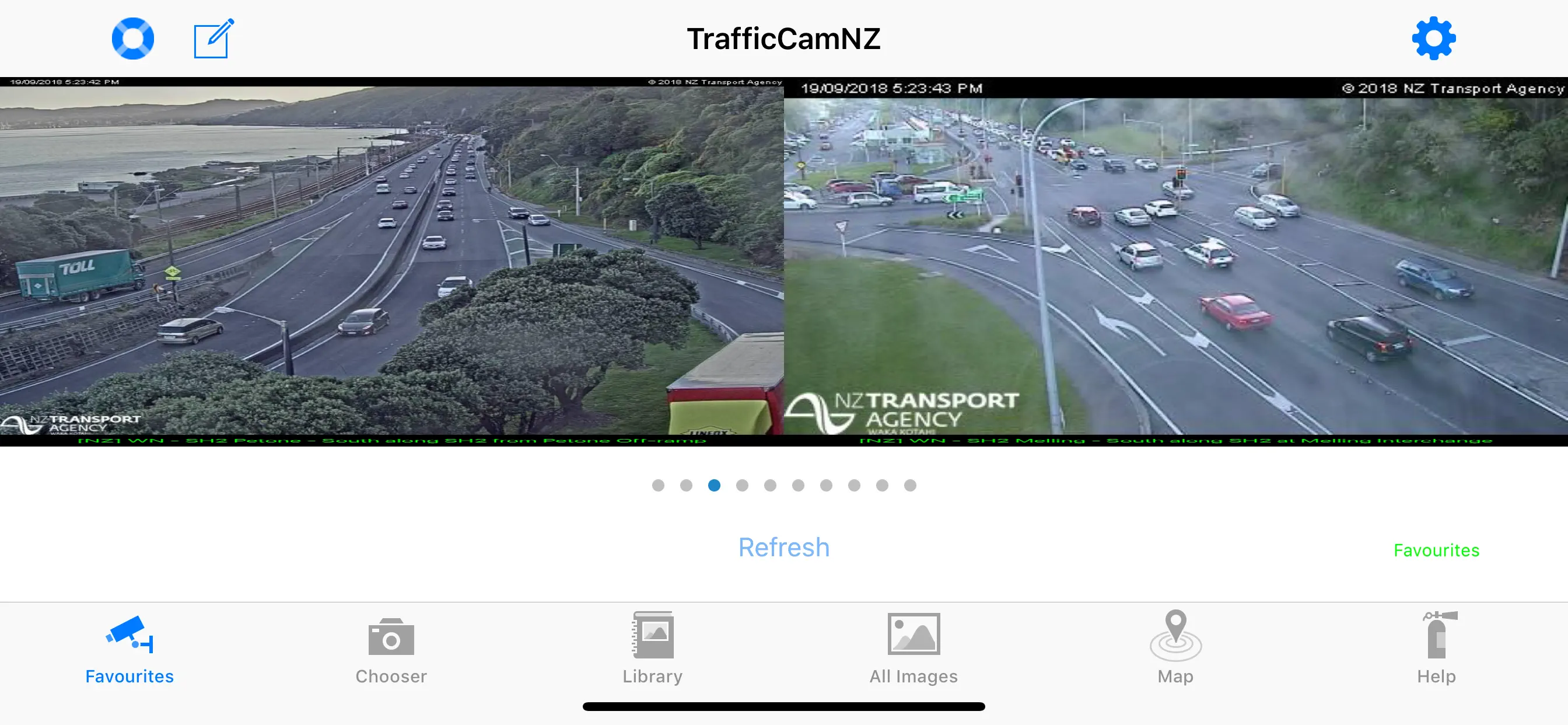
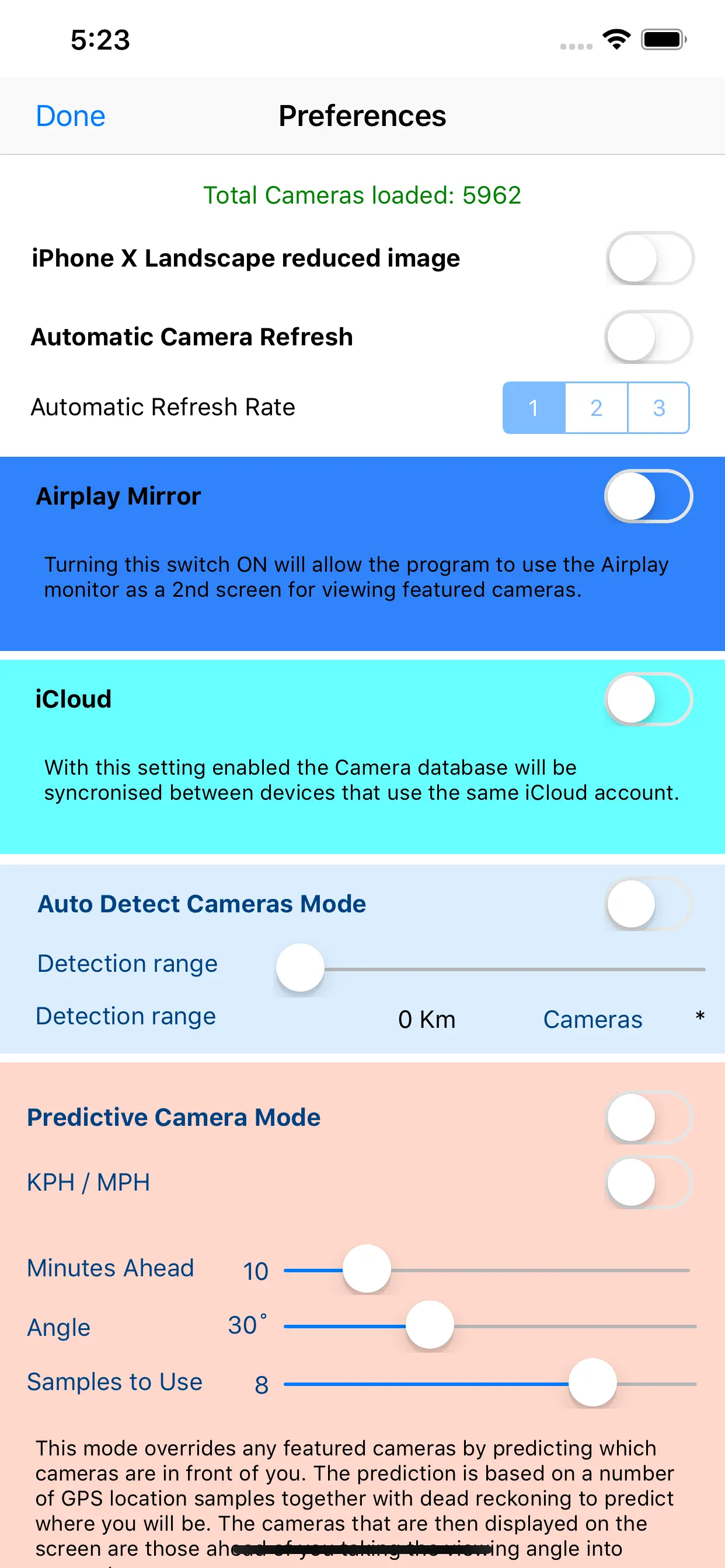
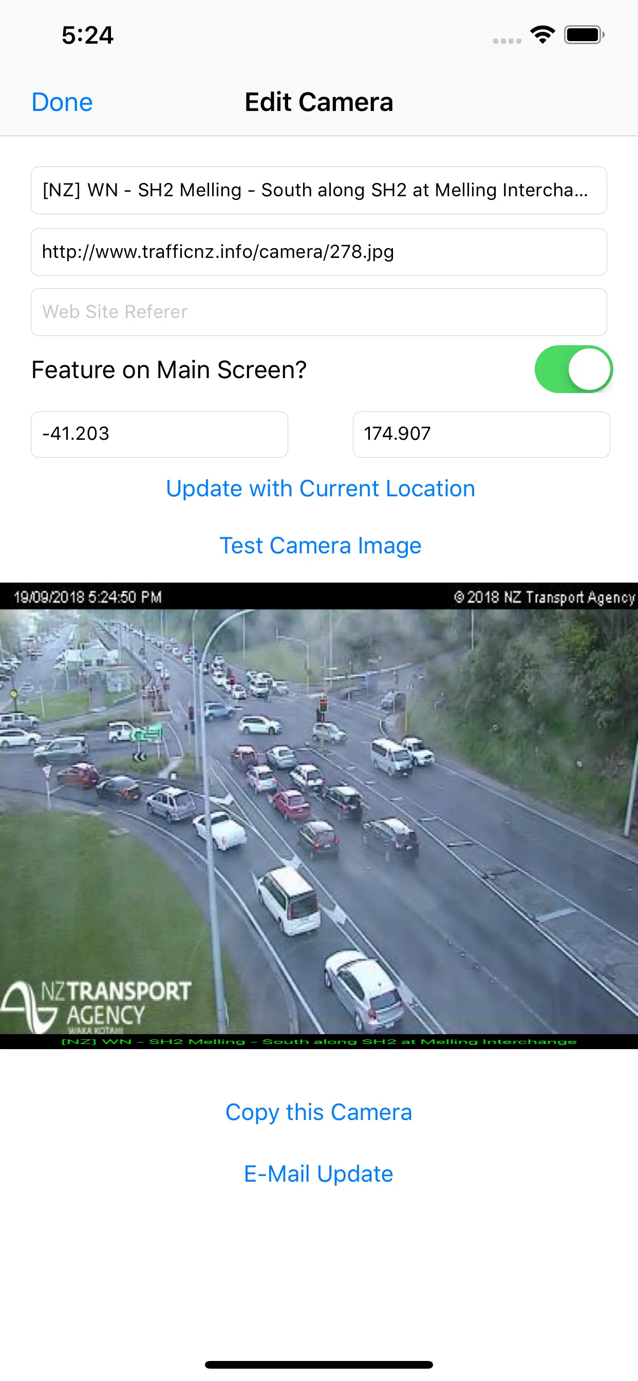
TrafficCamNZ
TrafficCamNZ displays internet accessible pictures of Traffic Cameras all over the world. Use it for any image with a fixed URL (web address).
Images you choose as "Featured" are downloaded and setup side by side so that you can swipe across the screen to view multiple images quickly.
TrafficCamNZ works over the
Updated: 3 years ago
Released: 16 years ago


1
1 Ratings
$0
Travel
TraffiCam SG
"Trafficam SG" is a no fuss application that provides updated access to webcams in all the key traffic hotspots in Singapore. Data is sourced directly from LTA.
Key images are now updated every minute!
This is an essential (and free) app for all Singaporean drivers. Drive smart.
* Apple Watch Support
You can now
Updated: 10 years ago
Released: 16 years ago

4.8
1247 Ratings
$0
Navigation
Japan Transit Planner
Japan Transit Planner-Norikae Annai is a multilingual version of the navigation application "Norikae Annai", the most downloaded in Japan.
It will show you the route or how to transfer by railways or airplanes in Japan.
It can check the route, the fare, and the required time easily as long as
Updated: a year ago
Released: 16 years ago


3.9
40 Ratings
$9.99
Reference
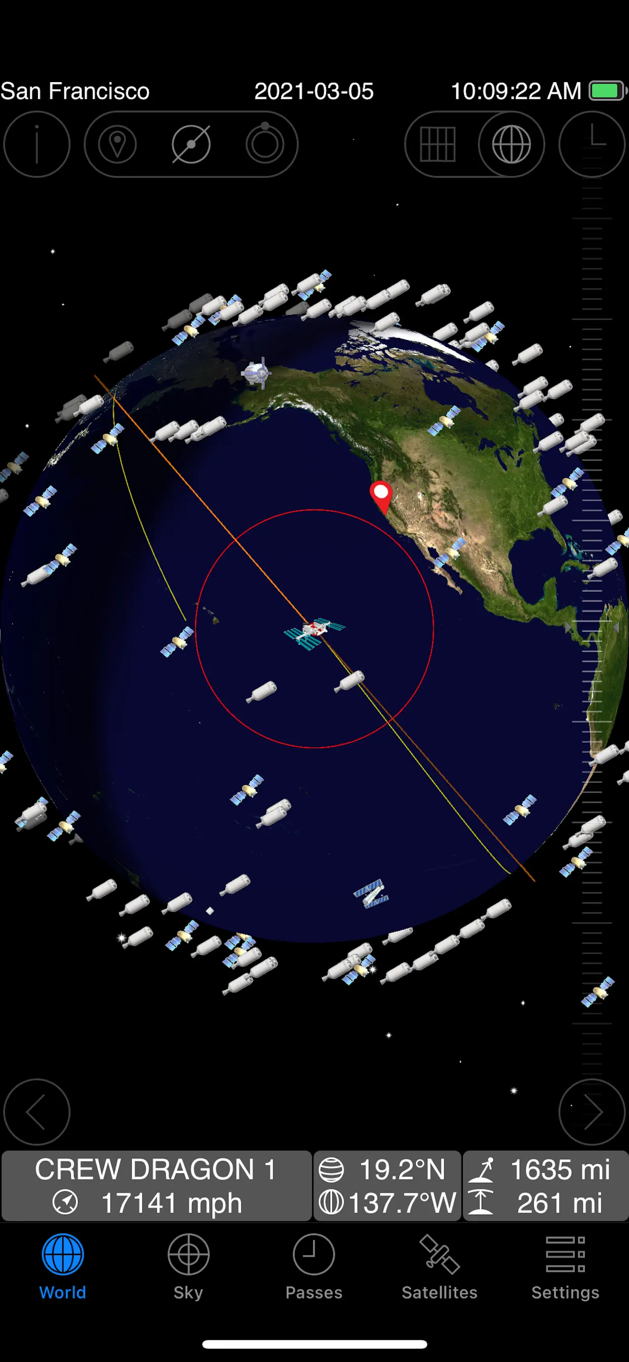
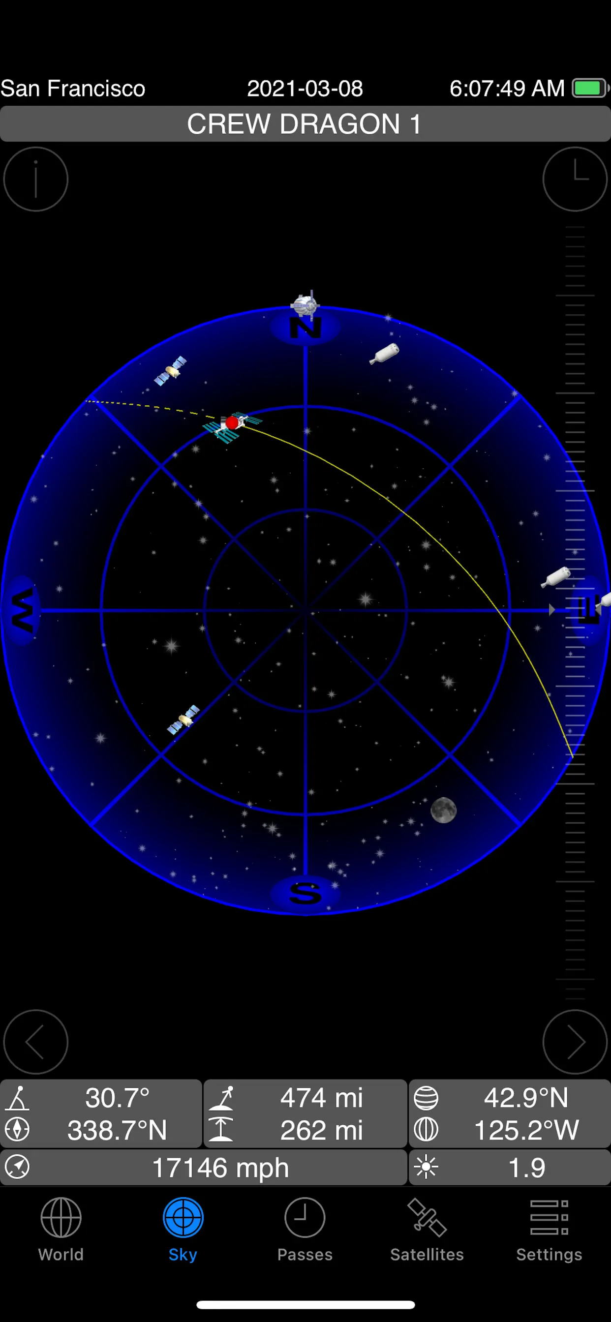
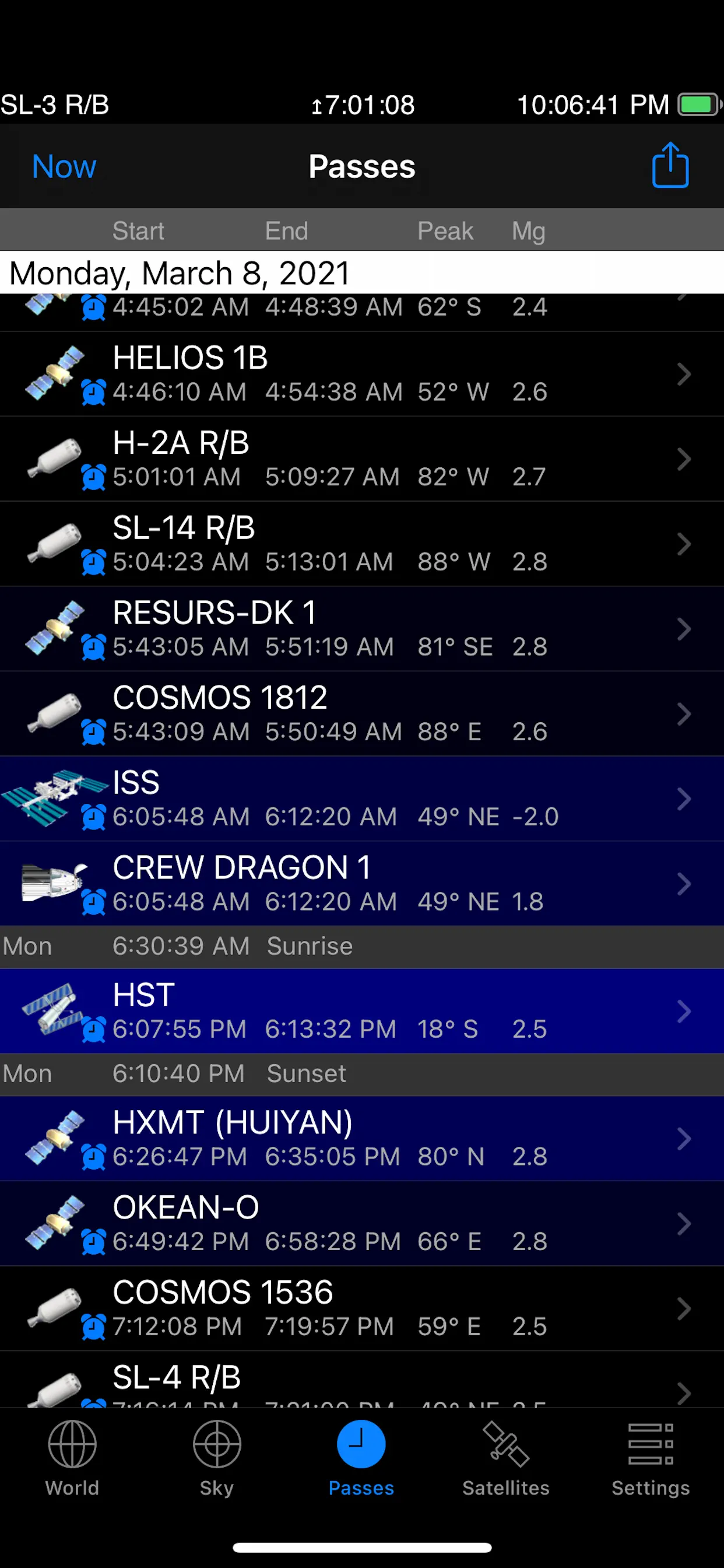
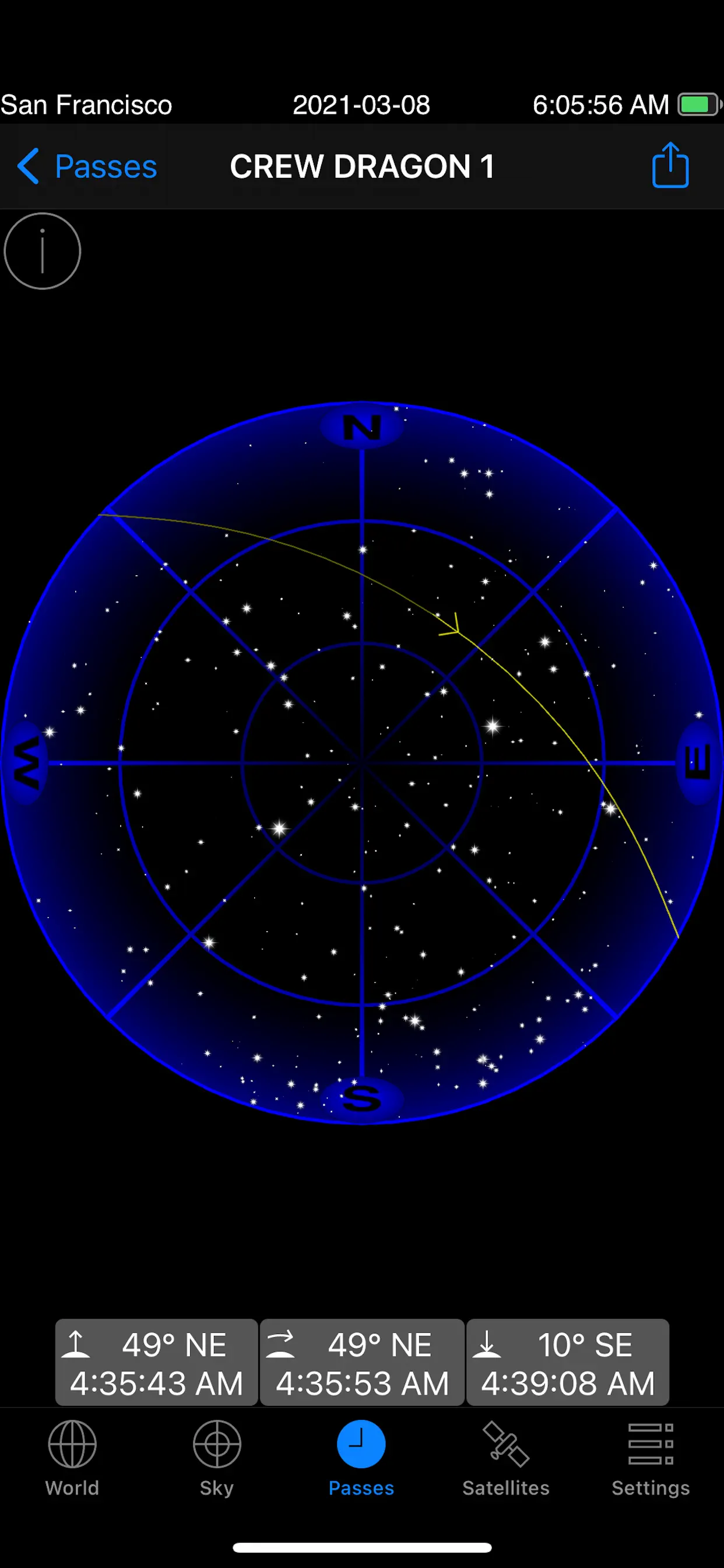
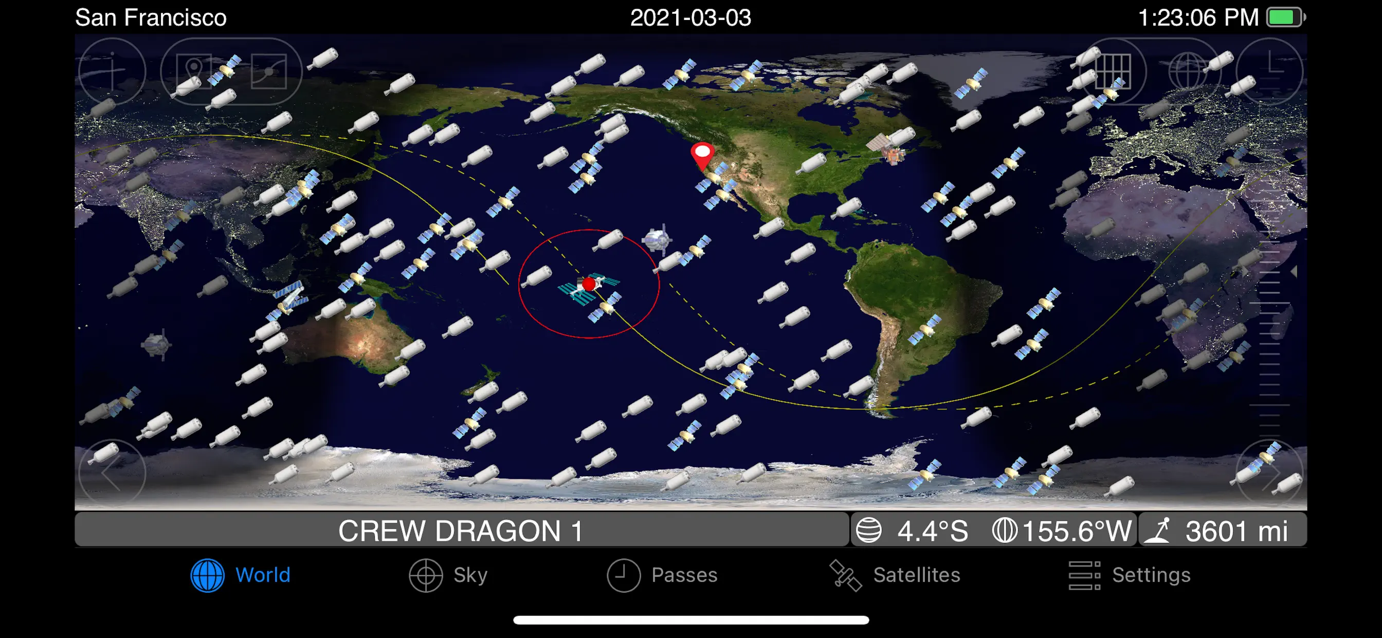
GoSatWatch Satellite Tracking
Real time satellite tracking on your iPhone, iPad or iPod touch. Find out when and where any satellite including the international space station can be seen from any location in the world. Easily identify satellites seen in the sky with real time tracking.
SpaceX spacecraft Crew Dragon, Dragon CRS and Starlink
Updated: 4 years ago
Released: 16 years ago

2.5
10 Ratings
$0.99
Navigation
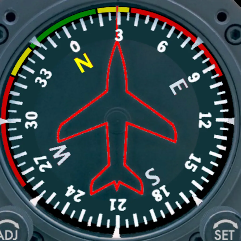
Aircraft Heading
Displays a photorealistic aircraft style heading indicator on your device. Modeled after analog instrumentation in general aviation aircraft. The meter movement is smooth and realistic.
New version includes
1. Improved Graphics
2. Rotation Lock
3. Bug Fixes
4. Supports Latest iOS version and Device
Displays both the analog instrument and
Updated: 7 years ago
Released: 16 years ago